

An Adventure in Ghale Gaun and Bhujung Gaun - Part II
The two villages of Ghale Gaun and Bhujung are one of the oldest settlements in this region. The native people, and the ethnic community of Gurung, feature a rich cultural history. They are the masters of this terrain and have lived sustainably in these mountains for centuries. This trek offers you the chance to not just indulge in the natural serenity but also witness the lifestyle of the people. Their smiles will strike your heart, and their humble hospitality shall make this trip a once-in-a-lifetime experience.
About the trip
Difficulty: Moderate
Average Duration: 4 Nights and 5 Days
Maximum Altitude: 2157 metres
Accommodation Type: Tea House
Route: Kathmandu- Besisahar- Khudi- Ghale Gaun- Ghanpokhara - Bhujung- Ghale Gaun- Khudi- Besisahar- Kathmandu
Day 1: Arrival at Kathmandu
Once you arrive at TIA (Tribhuvan International Airport), our staff shall receive you at the airport (if you've requested airport pick up). If you're staying at Hotel Shanker but didn't opt for pick up, you can take a taxi. You can use Google Maps if the driver doesn't know the exact location.
You can take the day to travel to the capital- Kathmandu. The city is a unique gem that boasts its unique cultural heritage and monuments. The valley of Kathmandu, with its three cities- Kathmandu, Lalitpur, and Bhaktapur combined features 7 of the 10 UNESCO world heritage sites of Nepal.
Read more on the heritage sites through the links mentioned below:
7. Changu Narayan Temple
Day 2: Depart to Khudi via Besisahar and trek to Ghale Gaun
After breakfast, we shall arrange your departure to Besishar- the district headquarters of Lamjung District. It is 173 kilometres from the capital. The bus ride averages 6-7 hours. You can read the first part of the article for further details.
Click on this link to read the first part of this blog
Once you arrive at Besisahar, you shall be switched to a private vehicle that shall take you to Khudi. The drive averages 30 - 40 minutes. Once you reach Khudi, you can relax before the trek begins. You shall then walk 4 to 5 hours to Ghale Gaun. The hike difficulty is moderate, with gradual inclines and declines. You shall witness numerous small villages which display the traditional lifestyle of the people of this region. In terms of mountain views, you shall be greeted by the panoramic vista of the Annapurna range and Manaslu.
Once you arrive at Ghale Gaun, you shall be received with great respect. The village elders shall offer you a flower garland, place a tika on your forehead and offer you a traditional beverage. The village has good cellular reception from the national carrier (NTC) and private carrier Ncell, with random latency caused by the weather. Wifi service is also good.
The toilet and bath are not attached to the main home in this region but are just a few steps away from the main compound of the house.
Day 3: Ghale Gaun - Ghan Pokhara - Bhujung Gaun - Ghale Gaun
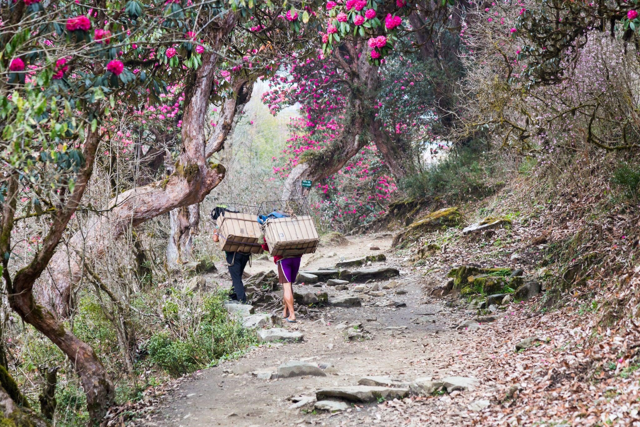
We recommend waking up before sunrise and heading to the local viewpoint to witness the beautiful sunrise. After a good breakfast featuring both traditional offerings, you shall travel to Ghan Pokhara. The hike averages about 40-45 minutes. The hike features a good number of uphill climbs. You shall see numerous Rhododendron forests and honey hunting sites.
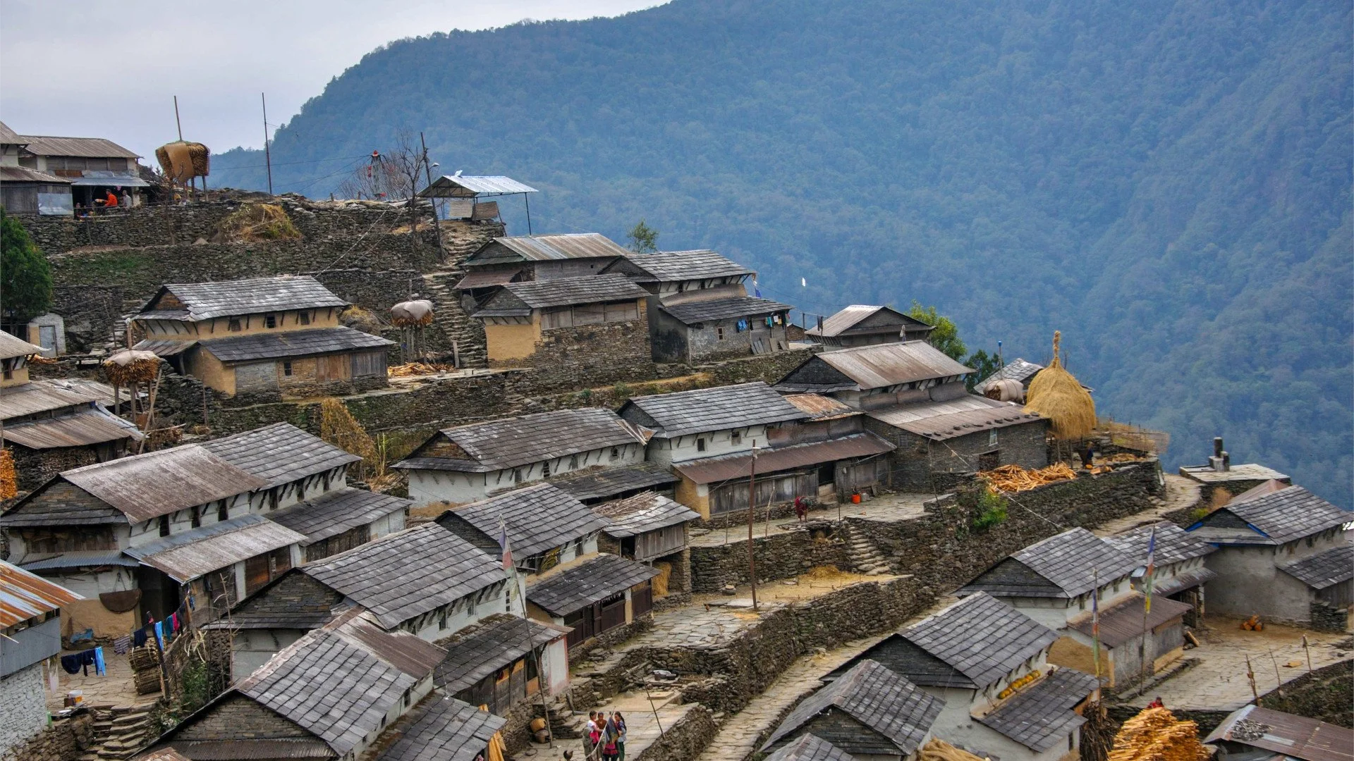
Once you reach Ghan Pokhara, refreshments will be provided. After a short break, you shall head towards Bhujung Gaun - the largest Gurung settlement in the Annapurna region. One of the most unique facets of this village is the arch terrace layout of houses.
The primary occupation of the people in this region is agriculture and animal husbandry. They practice a sustainable style of living. Your lunch for the day shall be at this village.
Things to do in Bhujung Gaun
Take par in the village tour
Visit the Bhujung Museum
Visit the tea garden
Visit the Kaiyo waterfall
Visit the local monastery
Visit the local hydro power site
Buy the handicraft as a souvenir
After exploration, you shall return to Ghale Gaun. The hike back to Ghale Gaun averages 2 hours. Once you reach Ghale Gaun, you can relax and take a shower before dinner.
POPULAR ITINERARIES
SIMILAR POSTS
Exploring The Unexplored - Part III
So much is yet to be explored! A humble nation, traversed by thousands over time, still has so many new places to be discovered? There are many facets of existing popular destinations that have never seen the light of day. Let us look at a few places to explore, shall we?
Panauti
Province: Bagmati
Distance from Kathmandu: 32 km
Accessibility: Land at TIA (Tribhuvan International Airport) and take a 1.5 hour bus ride along Araniko Highway
Attractions: Well preserved traditional Newar architecture, Indreshwar Mahadev Temple, Brahmayani Temple, Tindhare Waterfall, Old Bazzar
When we think of the Newar culture; and their dominion, the valley kingdoms of Lalitpur, Kathmandu (Kantipur) and Bhaktapur come to mind. But, they aren't the only cities that feature a sizeable population of this ethnic community that once dominated the landscape of this region. Cities such as Panauti, Bandipur, Kirtipur, Bhimphedi, Banepa, Nuwakot and Palpa also feature brilliant examples of Newari culture and lifestyle.
Panauti was once a flourishing kingdom. It was a trading hub in Tibet and India's ancient Salt Trade Route. Historically, this region was a small state. As per historical findings, the settlement was created by King Ananda Malla.
“This younger brother (Ananda Malla) being very generous and wise, gave up the sovereingty over the two cities, and having invoked Annapurna Devi from Kasi founded a city of 12,000 houses which he named Bhaktapur(Bhatgaon) and included sixty small village in his territory.After this, the Raja having obtained the favour and directions of Chandeswari, founded seven towns; viz. Banepur(Banepa) near Chandeswari Pitha, Panavati(Panauti), near the Pragaya TIrtha of Nepal, celebrated in the Shastras on the site where Panchala-des formely stood, Nala, near Nala Bhagavati, Dhaukhle near Narayana; Khapu near Dhaneswaril Chaukot near the residence of Chankora Rishi; Sanga near Nasika Pitha.”
Wright 1877: 163
Later, during the reign of King Bhupatindra Malla, the state was presented his passed on to his sister as dowry (offerings given by the bride's side during marriage). Panauti is a city of great historical significance. As per chronicles and historical findings, this region was where the Panchala-desh once stood. Panchala was one of sixteen mahajanapadas (states) of the Indian subcontinent. Characters of Mahabharata such as Draupadi, Drupada, Satyajit, and Sage Dhaumya are said to be natives of Panchala.
Panauti is an example of what the entire valley once looked like once. The city is stagnant today like many other once trading hubs of the ancient salt route. This stagnation helped preserve the historicity of the city and its architecture.
Koshi Tappu Wildlife Reserve
Provinces: 1 & 2 ( Madesh Province)
Distance from Kathmandu:
Accessibility
By Road: 8.5 hour bus ride (338.6km) via B.P Highway & East-West Highway, Daily buses (Day & Night) service from Kathmandu to Kakarbhitta and Biratnagar, visitors shpuld disembark at Jamuha and walk 2.5 km to the reserve head quarter.
By Air: 35 minute plain ride from Kathmandu to Biratnagar then a 1.5 hour bus ride
Attractions: Sapta Koshi River, last surviving population of wild buffalo, fauna species such as hog dee, wild deer, spotted deer, blue bull and rock python, panoramic views of Himalayan peaks including Makalu (8643m), 441 species of birds (14 endemic)
Koshi Tappu Wildlife Reserve KTWR) is a marvellous example of conservation at its finest. Originally this area was announced as a Hunting Reserve in 1969 with a total area of 12 km2. In 1976, the reserve area was enlarged to 65 km2. A third phase extension was conducted in 1980 to feature the present total area of 175 km2.
When we think of the conservation area projects in Nepal- the eastern flank is highly reclusive. Due to ineffective development of transportation and lack of adequate promotion compared to its western siblings are less traversed.
KTWR is the last habitat for Babalus arnee, also known as Wild Buffalo or Arna in the Nepalese language. It is also the habitat for 14 endemic species of birds that thrive in this wetland. This area has thee distinct seasons- Summer (February through May), which is very hot with minimal precipitation. The monsoon beings in late May/early June and lasts till September. The monsoon features intense flooding of the region. Winter beings in October and lasts till January. Even this season features moderate temperature, it can get cold sometimes.
The last time KTWR came into the spotlight was when Gangetic dolphin's were spotted in the lake system. The reserve is home to the endangered Gharial crocodile and is the perfect habitat for various migratory birds.
POPULAR ITINERARIES

SIMILAR POSTS
Exploring The Unexplored - Part II
We travel for various reasons. Some do it to recreate, while others to discover oneself and the world. It is a unique process that allows us to understand life and its multiple folds. Nepal’s potential as a great retreat is a fact known to all. But within the explored lies countless other places which await you.
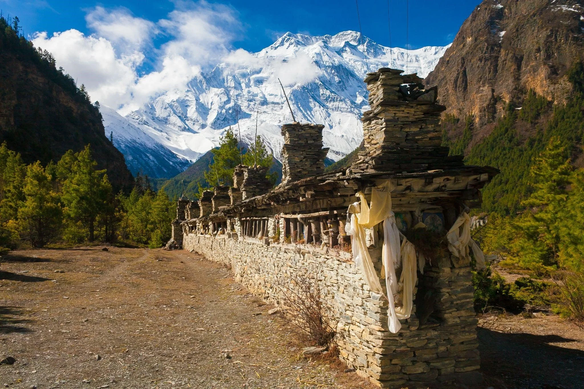
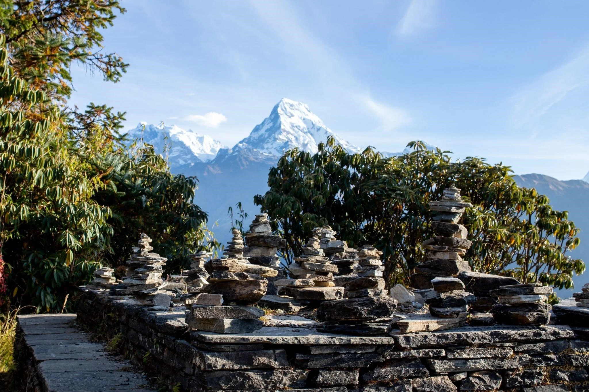
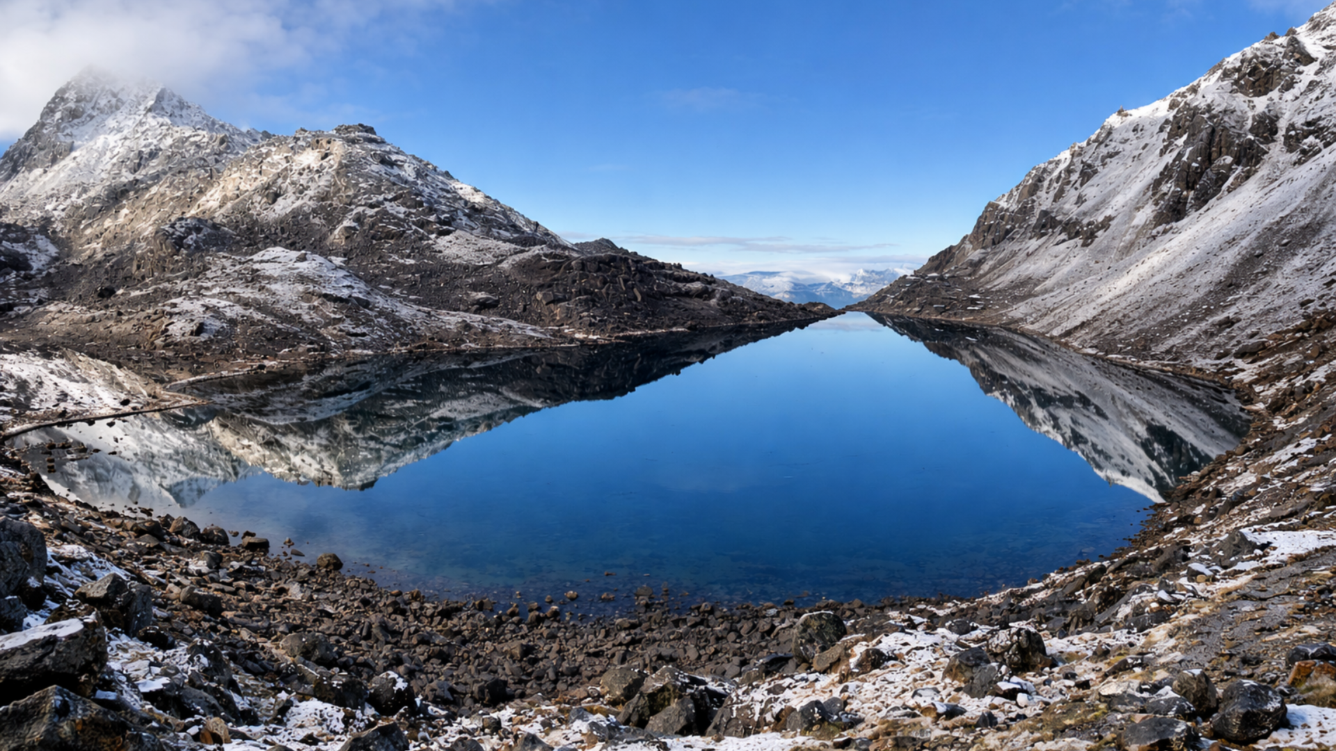
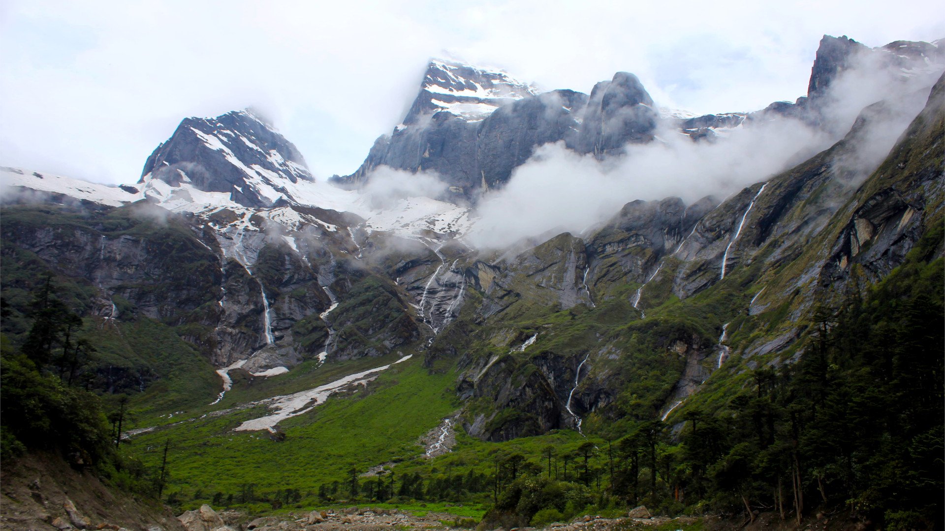
The Barun Valley
Province: Province 1
Distance from Kathmandu: 173 km
Accessibility
By Road: 12 hour bus ride to Tumlingtar
By Air: Land at Tumlingtar Airport- 2 hours then a 3 hour drive
Attractions: Panoramic vista of the Himalayas, Makalu Himal- 5th highest mountain in the world, Makalu Base Camp, Salpa Pokhari, Thulo Pokhari, Barun Pokhari, Dudh Pokhari, Shiva Dhara, Kirat culture and monuments, plethora of flora and fauna.
The great himalayan outback is pristine and unexplored. Much of this great space is unknown to travellers. This remoteness has helped preserve the regions authenticity but it has also hindered it from advancing and truly meeting its tourism potential. Amongst such destinations is the Barun Valley. This beautiful valley, something straight out of a sci-fi plot is magical. It features breathtaking views of the great panoramic vista, and exotic flora and fauna species. This valley is located at the base of Mt. Makalu in the Sankhuwasabha district of Nepal. It is a part of Makalu Barun National Park.
This valley was created by the Barun River. In terms of inhabitants, historians believe that it was previously inhabited by Yakkha and Limbu people centuries ago. This valley is also mentioned in the ancient Buddhist books- seven Beyul (Nghe- Beyul Khimpalung). This book mentions great mystical lands in the Himalayas where no one gets old. It is said that if a great cataclysm occurs, these seven areas of the world will only survive. One of the seven Beyul is said to be situated in the Makalu- Barun region. Historians state that it could well be this pristine valley.
Palpa
Province: Lumbini
Distance from Kathmandu: 273.7 km
Accessibility:
By Road: 8 hours and 14 minutes
By Air: Land at Gautam Buddha International Airport in Bhairahawa and drive 2 hours and 24 minutes to reach Palpa region
Attractions: Argeli Palace, Rambha Devi Temple, Ranighat Palace (Ranimahal), Rishikesh Complex, Tansen Bazzar, Bhairabsthan Temple (Tansen Bhairab), Shrinagar Hill, Tansen Durbar
Travel Season: Throughout the year
The region of Palpa has much to offer in multiple genres of tourism. The potential of this region as a religious site along with sightseeing and cultural tourism is strong. The central attraction of this place is the hill station of Tansen. In 2008 AD, UNESCO added this area to its tentative list for World Heritage in the cultural category.
The whole of Palpa has a strong note of Magar culture, but there is Newar influence in multiple locales. The souvenir of this region has always been Palpali Dhaka. It is a unique cloth produced by the local Newars. One of the most famous landmarks is the “Golghar”, an octagonal pavilion in the middle of Sitalpati, the main market square. Srinagar hill is a popular viewpoint that offers a beautiful panorama of the high Himalayas. Peaks such as Dhaulagiri, Tukuche, Nilgiri, Annapurna, Himchuli and others are visible on a clear day.
The unique fusion of Palpa makes it a great destination. It offers something for all genre of travellers, which has always been its greatest strength. Exploring the core settlements of Tansen at times makes you feel like you are in Kathmandu due to the strong influence of Newar culture.
POPULAR ITINERARIES
SIMILAR POSTS
Exploring the unexplored - Part I
We travel for various reasons. Some do it to recreate, while others to discover oneself and the world. It is a unique process that allows us to understand life and its multiple folds. Nepal’s potential as a great retreat is a fact known to all. But within the explored lies countless other places which await you.
We travel for various reasons. Some do it to recreate, while others to discover oneself and the world. It is a unique process that allows us to understand life and its multiple folds. Nepal’s potential as a great retreat is a fact known to all. But within the explored lies countless other places which await you.
In this article, we look into these prospective gems. They have so much to give in terms of natural yonder, cultural values and lifestyle experiences.
Therathum
Province: 1
Distance from Kathmandu: 493 km
Accessibility:
By Road: 13 hours and 3 minutes
By Air: Land at Tumlingtar Airport in Sankhuwasabha and drive 3 hours 46 minutes to reach Therathum region
Attractions: Deurali Dada, Hyatrung Waterfall, Tea Garden
Travel Season: Throughout the year
Therathum has for years been on the radar as a potential tourism goldmine. It has a unique cultural setting with ethnic and natural diversity. These are great lures to draw in both domestic and foreign tourists. In ancient times this region was part of Pallo Kiraat province. One of many footholds of the Kirat dynasty.
Amongst the numerous locations suited for tourism, Deurali Dada (Deurali Hill) is a great rendezvous. Also known as the capital of lali guras (rhododendrons), this hilltop during spring is a sight to behold. It also has a charming lake known as Chichilung. The longest waterfall of Nepal, known as Hyatrung, is located at Ishibu. This waterfall ranks as the second-highest in the whole of Asia. Apart from these, Solma is also popular due to its robust tea gardens, which create a picturesque landscape.
Shey Phoksundo Lake
Province: 6
Distance From Kathmandu: 315 km
Accessibility:
By air: Shey Phoksundo can be only accessed through Nepalgunj or which has to take a flight to Nepalgunj and from there to Juphal in Dolpa and 4 days trek to Ringmo
By road: 24-25 hour bus ride from Kathmandu- Radi Bazar and 4 days trek to Ringmo
Route by road & return by air: Kathmandu- Radi Bazzar- Tallo Bagar - Supani - Suligad - Kagani - Chhepka - Rachhi - Samjhana Hotel - Jharna Hotel - Ringmo (Shey Phoksundo Lake) - Chhepka - Kagani - Suligad - Juphal Airport - Nepalgunj - Kathmandu
Attraction: Tshwo Gompa, Highest Waterfall in Nepal, Himalayan Panaroma
Travel Season: Spring (March-May) and Autumn (Sep-Nov)
The sea-green water of this magnificent lake at golden hours is hard to describe. Sitting by it with the distant sound of a waterfall under an open blue sky is an experience straight out of heaven. The Phoksundo lake is within Shey Phoksundo National Park, the largest and only trans-Himalayan protected area of Nepal. On the southern end of the lake lies the village of Ringmo on top of a landslide dam created 30-40,000 years ago.
This body of water lies at an elevation of 3,660 m (12,010 ft). Surrounded by glaciers in its upper range, it is famous for its magnificent turquoise colour. Near the lake’s outlet is the country’s highest waterfall. The trek to this part of Nepal is strenuous, but the reward is an experience worth multiple lifetimes. The trip offers landscapes beyond words. Getting to experience the lifestyle of the ethnic community is a bonus.
Tsho Rolpa Glacial Lake
Province: 3
Distance From Kathmandu: 114 km
Accessibility:
8 hour drive from Kathmandu to Singati Bazzar, trekking itinerary can be anywhere between 7-9 days
Route: Kathmandu - Singati Bazaar - Chhetchhet - Simigaun - Dongang - Beding- Na - Tsho Rolpa- Beding - Kyalche - Chhetchhet- Singati Bazaar
Attractions: Gaurishankar Himal (7134m), Glacial Lake, Sherpa Culture of Rolwaling Valley
Travel Season: Spring, Autumn
The Rolwaling valley of central Nepal for years has laid under the shadow of its neighbouring Everest region. Its possibility as a tourism destination has for years been talked about by tourism specialists. But lack of interest made this valley a hidden gem.
Its crown jewel is the Tsho Rolpa (Cho Rolpa) glacial lake situated at 4,580 m (15,030ft). In recent years, it garnered attention due to the accelerated melting of the glacier.
Reaching Tsho Rolpa is a challenging trek, but the tranquil glacial water is worth the hardship. This area is home to the Sherpa community, dispersed in beautiful villages. This trek also allows one to experience their traditional culture and lifestyle. An extended itinerary to explore the Daldlung Pass features splendid views of the high Himalayas.
POPULAR ITINERARIES
SIMILAR POSTS
An Adventure In Ghale Gaun and Bhujung Gaun - Part I
The Annapurna region for years has fascinated travellers and wanderers. One of the most popular destination is the scenic village of Ghale Gaun. It is located in Lamjung District at an elevation of 2100 meters above sea level. It boasts views of popular mountains such as Mount Machhapuchre, Annapurna Mastiffs, Lamjung Himal and more
For years, travellers and trekkers have flocked to the the beautiful villages of Ghale Gaun and its neighbouring village of Bhujung. The hill station village of Asia’s model tourism village. The village is situated approximately 108 km north west of Nepal’s capital- Kathmandu. Whereas, it is 12.5 km north-east of Pokhara- the popular lake city of Nepal.
Highlights of Ghale Gaun Trek
Stunning panoramic views of mountains such as
Mount Machhapuchre (6693m)
Mount Annapurna (8091m)
Mount Annapurna II (7939m)
Mount Annapurna IV (7525m)
Mount Lamjung (6932m)
Mount Bouddha (6974m)
Himal Chuli (6747m)
Witness the traditional lifestyle of the Gurung community
Savour traditional delicacies and drinks of the Gurung Community
Rejoice in the traditional dance and music of the Gurung Community
Rekindle with yourself in the peaceful mountainous setting and rejuvenate in nature.
Where do I get the permit and card? How much does it cost?
A trekker needs to pay the ACAP Permit, $20 per person. You need to acquire the TIMS (Trekkers Information Management System) card from Nepal Tourism Board. It’s offices are located in Kathmandu and Pokhara.
Can I trek to Ghale Gaun alone?
Yes! You can perform a solo trek to Ghale Gaun. There are no restrictions placed on solo trekking in this region by the government of Nepal. As the route is well mapped and features plenty of local and international travellers especially during the main season, you shall not have much difficulty in maintaining our route.
How do I start?
Once you have landed at TIA (Tribhuvan International Airport), you can either experience a bit of the capital (Kathmandu) for a few days or get a connecting flight to Pokhara. The distance between Pokhara and Kathmandu is 200 KM. You can opt to take a bus instead of a flight as well. Your available options are either local or deluxe buses.
Deluxe buses leave at 7 AM from Sorakhute Bus Station in Kathmandu. You may either book a ticket beforehand or arrive an hour early, pay and embark directly at the terminal. We recommend these buses as they have air conditioning. The travel time ranges between 7-8 hours, with stops for lunch and snacks at good quality rest stops.
Once you explore Pokhara, you can catch a bus to Besisahar from Pokhara Bus Stop. The drive time is a total of 3-4 hours.
You can skip all of the hassles by contacting the front desk officer at the hotel. S/he shall do their best to arrange these services for you. They can also develop a proper itinerary to experience Lower Mustang at a reasonable rate.
If you do not want to visit Pokhara then you can take a bus to Besisahar from Kathmandu. The bus is available at Gongobu Bus Park. We recommend reporting half an hour earlier. The drive time is 6 to 7 hours with a total distance of 173 km.
Normally the buses leave at 8:30 in the morning.
When is the right time to trek?
In Nepal, Spring and Autumn is prime trekking season. The skies are clear with light to minimal rainfall. Autumn (Mid-September to Mid-November) is best for Lower Mustang Trek.
During other months such as December - February, the climate is colder and potential high snowfall may not allow you to trek above High Camp. Whereas during pre-monsoon ( Mid-May to Mid-July) and monsoon (Mid-July to Mid-September), chances of rain and clouding are high. The forest area shall be full of leeches and mosquito's.
Spring (Mid-March to Mid-May) is also a great time to trek this region. Temperature is nominal, and winds are light, allowing you to have a beautiful walk. The plant life will be blossoming: amplifying the atmosphere.
What should I wear and carry?
Proper clothing is vital while trekking to remote areas. In Spring and Autumn, you need summer/light clothing for the day hours and warmers for the night. If you’re travelling during the pre-winter and winter months, you need to wear your heavy jacket. During pre-winter and winter, warm clothes are essential. A heavily padded jacket, full sleeve t-shirt and fleece-lined pants are essential. During spring and autumn, a parka is mandatory. An umbrella and a raincoat should be carried as well.
Does the trek cost the same around the year?
No, the cost presented to you by your tour agent varies as per the season. The cost of accommodation is higher during peak season. Food costs rise during winter as transportation of goods becomes difficult. During peak season, you are bound to be over-charged. Off-season treks are usually less expensive due to slow business. You’ll get a sweet deal if you time your adventure off-season.
In the next part of this article we shall discuss the itinerary of Ghale Gaun.
POPULAR ITINERARIES
SIMILAR POSTS
Exploring Dhampus
The region of Annapurna is a plethora of adventure. Amongst the numerous picture-perfect villages of this region, Dhampus is one of them. A trek to this scenic village is short but filled with great opportunities to witness the greatness of the area of Annapurna
The shire of Dhampus is located approximately 25KM from Pokhara. The population of this village is mostly Gurung. The trek to this tranquil village is easy. In a short period, you get a glimpse of the culture, natural beauty and wonders of the Annapurna region.
Highlights of Dhampus
A chance to witness the ethnic lifestyle of the Gurung community.
Opportunity to observe and participate in traditional Gurung dances and songs
Explore the natural beauty of the Dhampus village
Watch the sun rise and set across the panoramic vista of the Annapurna ranges, Mt.Fishtail, Nilgiri, Pokhara and Phewa Lake.
Savour the ethnic cuisine of the Gurung community.
Tour the city of Pokhara Valley, Lakeside, Tal- Barahi Temple and Phewa Lake.
When is the right time to trek?
In Nepal, Spring and Autumn is prime trekking season. The skies are clear with light to minimal rainfall. Autumn (Mid-September to Mid-November) is best for Dhampus Trek.
During other months such as December - February, the climate is colder. Whereas during pre-monsoon ( Mid-May to Mid-July) and monsoon (Mid-July to Mid-September), chances of rain and clouding are high. The forest area shall be full of leeches and mosquito's.
Spring (Mid-March to Mid-May) is also a great time to trek this region. Temperature is nominal, and winds are light, allowing you to have a beautiful walk. The plant life will be blossoming: amplifying the atmosphere.
What should I wear and carry?
Proper clothing is vital while trekking to remote areas. In Spring and Autumn, you need summer/light clothing for the day hours and warmers for the night. If you’re travelling during the pre-winter and winter months, you need to wear your heavy jacket. During pre-winter and winter, warm clothes are essential. A heavily padded jacket, full sleeve t-shirt and fleece-lined pants are essential. During spring and autumn, a parka is mandatory. An umbrella and a raincoat should be carried as well.
Itinerary To Dhampus Village
Once you arrive at the TIA, our representative shall be waiting for you at the arrival hall (if you’ve signed up for pick-up). When you reach our hotel, our staff shall help you with the check-in process and escort you to your room. If you wish to explore the beautiful cultural valley of Kathmandu, we can arrange a sightseeing package for you.
To start our official journey to Dhampus, we must first reach the scenic lake city of Pokhara. A flight to Pokhara from Kathmandu is approximately 15 minutes. Deluxe buses leave at 7 AM from Sorakhute Bus Station in Kathmandu. You may either book a ticket or arrive an hour early, pay and embark directly at the terminal. We recommend these buses as they have air conditioning. The travel time ranges between 7-8 hours, with stops for lunch and snacks at good quality rest stops.
Once you are at Pokhara, settle into your hotel and make sure to explore the beautiful lake. The next day, after breakfast, we drive to Phedi. The drive takes 30 minutes. You make your way from Pokhara to Baglung to Phedi via the Rahmarg Road.
Once you reach Phedi, you make your way to Dhampus on foot. The trail is steep that passes through beautiful sub-tropical forests. Depending upon your physical fitness, the trek takes anywhere between 2-3 hours.
An alternate route is to drive to Kande and trek to Dhampus. It shall take you 2 hours to reach the Dhampus Australian Camp. You can spend the night at teahouses in the camp and hike to Dhampus village the next day. The walk ranges from 1-2 hours. Once at Dhampus, you can explore the scenic shire and the ethnic lifestyle of the Gurung community.
POPULAR ITINERARIES
SIMILAR POSTS
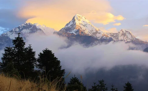
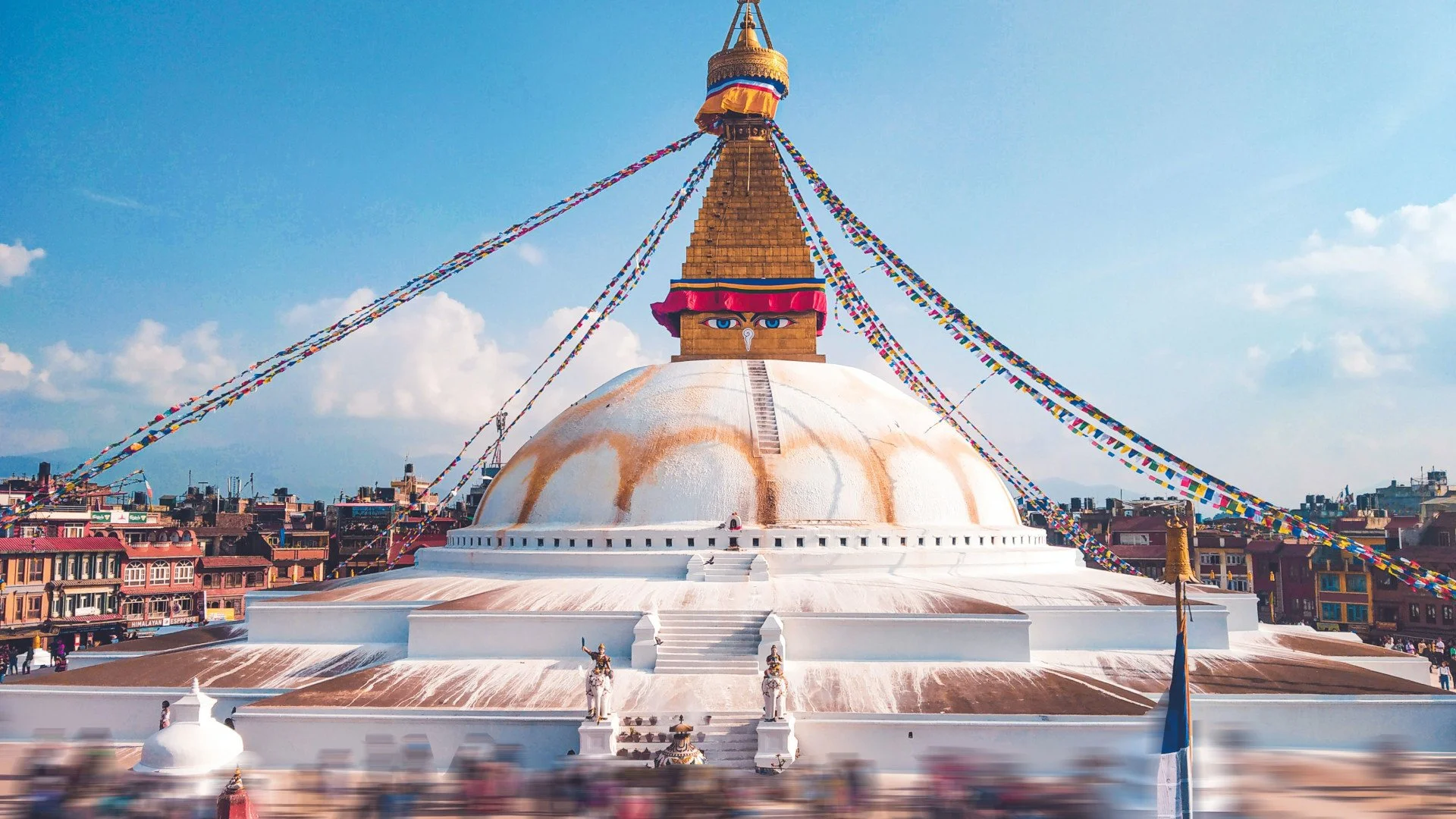
The Jewels of Bagmati Province
Province 3, also known as Bagmati Province, is the biggest gem in the crown of Nepalese Tourism. This province proudly boasts 80% of the UNESCO World Heritage Sites and new countless majestic sites that showcase the beauty of this nation
Bagmati Province has a lot to offer. For years had been the first step for travellers due to the only international airport in Nepal- Tribhuvan International Airport (TIA). Many great adventure stories have begun in this region. It is almost like this province was the beating heart of the nation's tourism economy.
This province is the second most populous in Nepal. It borders the Tibet Autonomous Region of China in the north, Gandaki Province to the west, Province 1 in the east and the state of Bihar and Madesh Province in the south. It is also home to the capital of Nepal- Kathmandu, and the ancient kingdoms of Kathmandu, Bhaktapur and Lalitpur- the birthplace of the Newar culture. In terms of culture, it includes Newar, Tamang, Madhesis, Sherpa, Tharu, Chepang, Jirel, Brahmin, Chhetri and more. Due to the region's natural abundance, liveability and acceptance, it became a melting pot of cultures.
There are numerous sites of great interest in this region. But amongst the best, these are the few that cannot be missed:
1. Swayambhunath Stupa
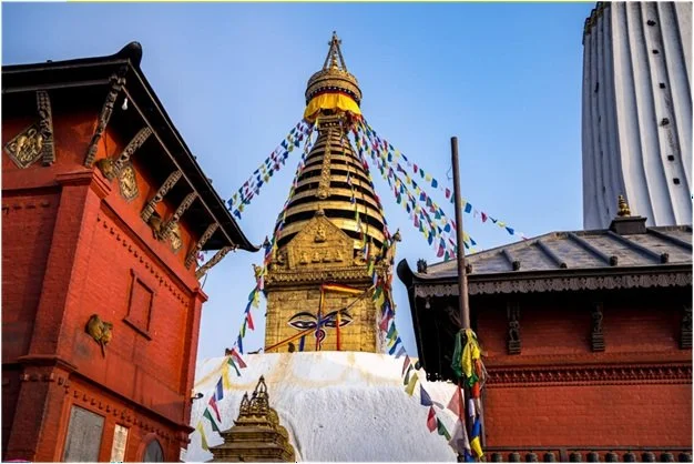
The shrine of Swayambhu is known as Swayambhu-Nath or The Monkey Temple and is a major tourist attraction of Kathmandu Valley. Riddled with numerous shrines of Bodhistva's, Lichavi chaitya and stupas, mists of incents and chants of prayer. The Padma-Giri is a hill of spiritual awakening, the light of Swayambhu ever since history began has been a beacon of enlightenment attracting its seekers to the valley, even till this date many take great journeys to find sanctum in its light.
As per chronology, Bipaswi Buddha came from a city named Bandhumati: and took abode on a mountain west of Nag Hrad (Ancient name of the valley when it was a lake). He sowed a lotus-seed in the Hrad on the full moon in the month of Chaitya. In honor of this a Mela is held on the mountain on the full moon on the month. Today its known as Gunla Festival where it is believed one must visit the chaitya at least once. “Gunla Baja” is played every morning by the various tole’s(communities) around Swayabhu, People ascend the 365 and venerate shrine before returning home.
The legend continues as the same lotus -seed brought forth a lotus-flower and in the center was Swayambhu, who came from Aknisht Bhuban ( Sacred Land) appeared in the form of light. In Treta Yuga, Manjusri came from Mahachin(China) and saw the light of Swayabhu, he then cut a passage through a mountain that drained this ancient lake and thus emerged the valley of Kathmandu.
2. Chitwan National Park
Among the two national parks listed in the UNESCO World Heritage list from Nepal. The Chitwan National Park is a protected area for conservation of the natural habitat, flora and fauna of the subtropical scape of Nepal. The park is home to 68 species of mammals, 544 species of birds, 56 species of herpetofauna(amphibians) and 126 species of fish. The park is home to the One Horned Rhinoceros, Royal Bengal Tiger and Gharial Crocodiles. Through in-situ conservation methods, translocation programs, patrol guarding and monitoring the park has reduced the illegial activities such as poaching, unauthorized deforestation and also increased the social wellbeing of the individuals surrounding the buffer zone.
The national park has grown into a prime tourism hub for enthusiasts of wildlife, photography, bird watching and sight seeing. Through private and governmental efforts the park has seen numerous progressions.
3. Pashupatinath Temple
Legend has it, after Majusri after draining the Nagardha (Kathmandu Valley) established a beautiful Slesamantaka Forest near Guhyesvari for the services of Swayambhu and Guhyesvari. As the forest grew dense and beings began populating the great forest. It was then Krakucchanda Buddha visited the valley. One fine day he was near the Slesamantaka forest and saw Brahma, Visnu and Mahesvara who had manifested themselves in the form of a deer and lived in the forest. The place was since then called Mrgasthali from that day on.
In time Brahma, Visnu and Mahesvara agreed to leave their deer from in the forest and go back to abodes. During when, Mahesvara (Shiva) left his deer form at the bank of the Vagmati(Bagmati), as he manifested as a light that pervaded through seven worlds upwards from Earth and seven worlds downwards from hell. Lord Brahma went upwards to cross the light of Mahadeva, which had extended beyond seven worlds from the earth whereas Lord Visnu did the same in the downward direction. The place from where Visnu departed towards hell is known as Visnugupta. Similarly, the place from which Mahadeva left his deer from into light is known as Pashupati.
The site was inscribed into the list of UNESCO World Heritage in 1979 AD. It span’s a total area of 246 hectors which encompass, the temples, ghats and monuments. The site is one to hundreds of sacred rituals performed by the priests every day.
POPULAR ITINERARIES
SIMILAR POSTS
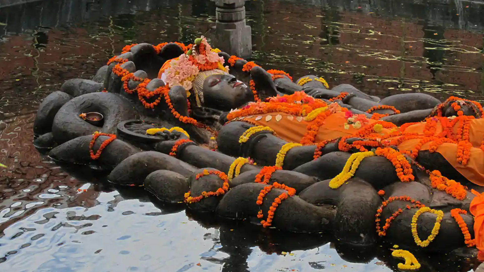
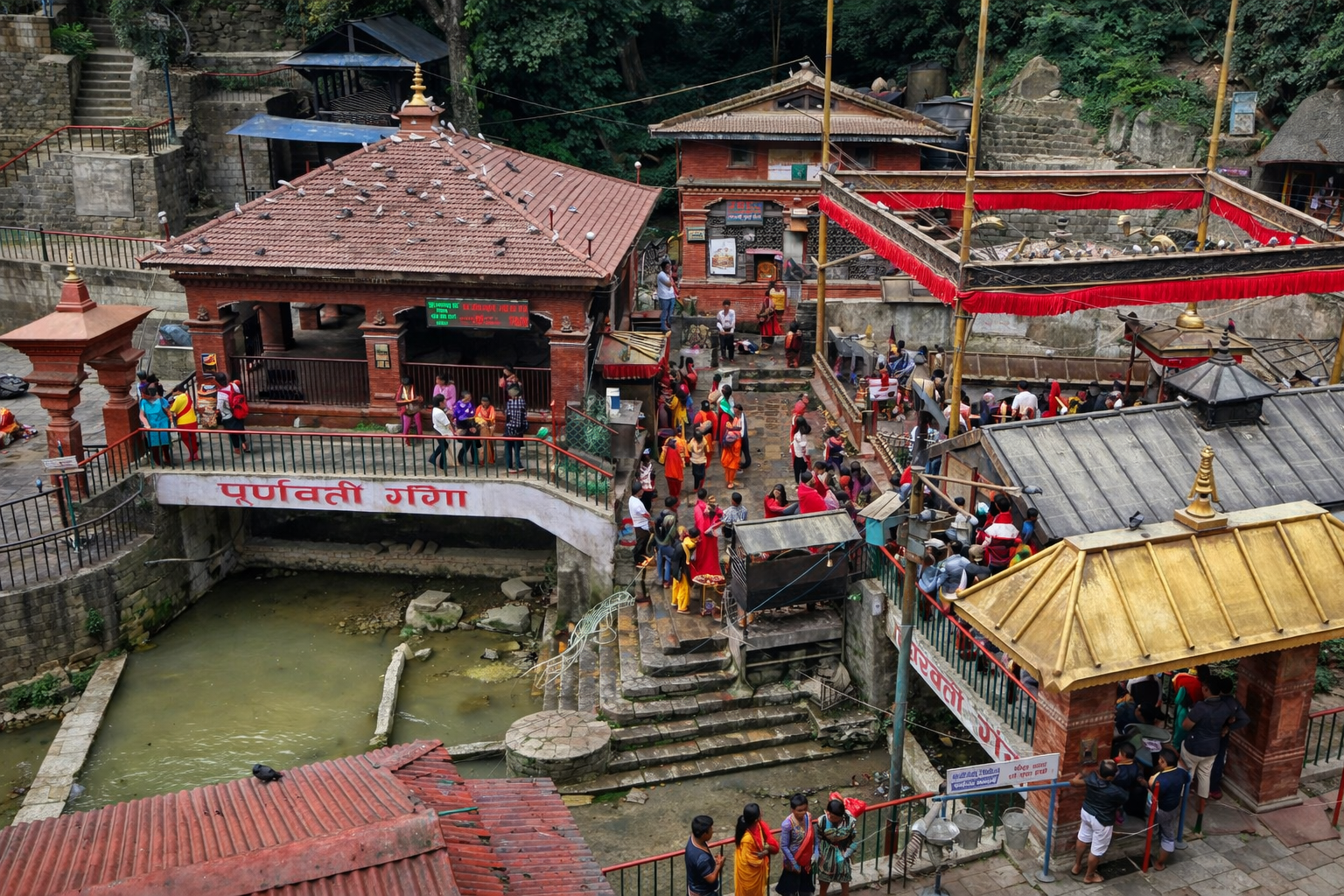
A World Within A World
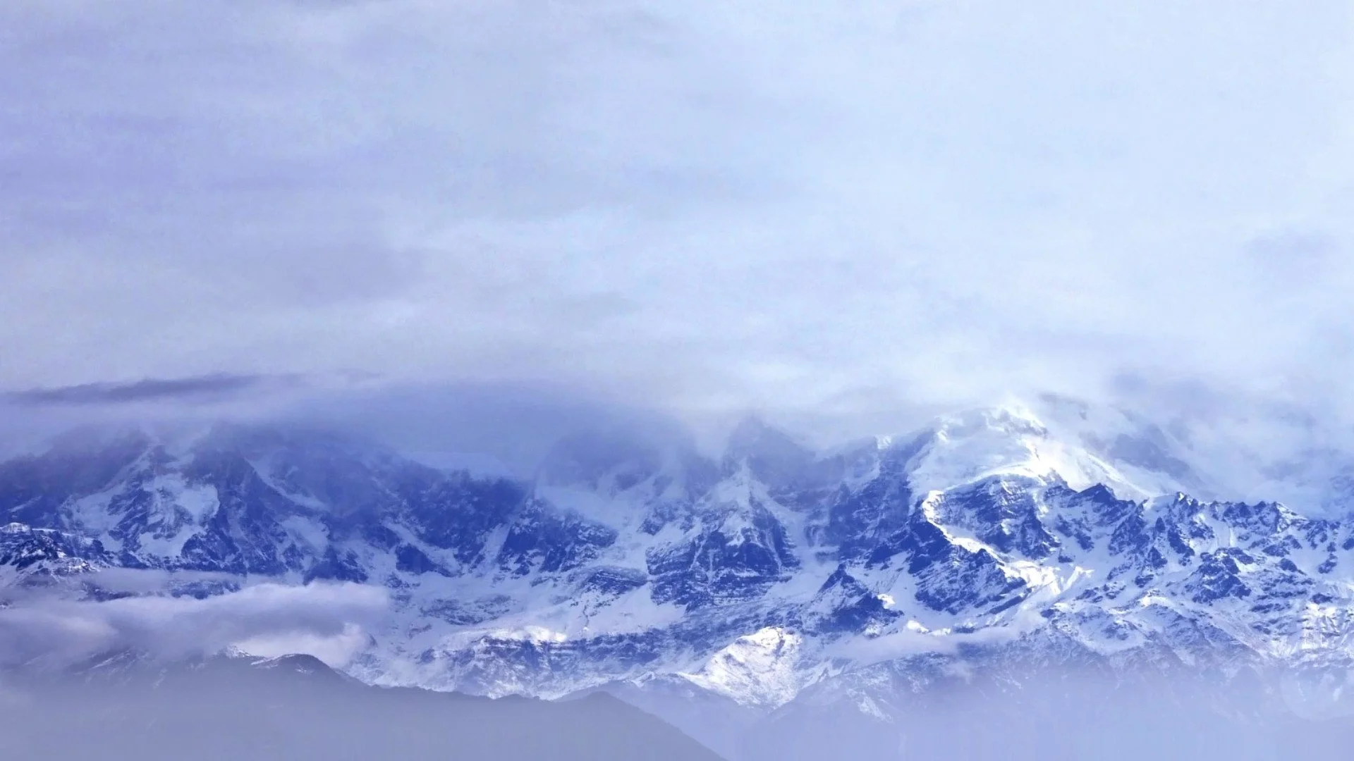
Even though Nepal occupies only a tiny portion of the world, it is a world within a world. The diversity of Nepal's terrain and climates gives you- the traveller, an opportunity to explore what the world offers within our nation's small boundary.
Those familiar with the geography of Nepal know that it is a miraculous haven. Within the area of 143,350 sq km that stretches 241 km west to east and 193 km north to the south lies countless opportunities to reconnect with nature. To the south are tropical alluvial plains at 60m above sea level. To the north is the forehead of the world- Mt. Everest at 8,848.86m. The Himalayan mountains are rugged and permanently covered with snow and ice.
Unearthing the wonders of Nepal, researchers have identified a total of 118 ecosystems in Nepal. Amongst them are 112 forest ecosystems, four cultivation ecosystems, one water body ecosystem and one glacier ecosystem. Such is the diversity of this small but humble nation. In terms of fauna, Nepal is home to 175 species of mammals, 836 bird species, 147 reptile and amphibian species, 180 species of fish, 640 species of butterflies and a staggering 6000+ species of moths.
Facts aside, Nepal truly is heaven on earth! Our natural beauty is our greatest strength. We must take great strides to balance our need for modernization to maintain this pristine beauty. It isn't just for our environment but our livelihood as well. Our economy is heavily reliant on our natural resources. Agriculture and tourism greatly rely on the presence of our natural wonders.
As we expand our cities and footprints around the nation, we must remember- we are the guests! We must think creatively and develop sustainable measures to reduce encroach and push more species into extinction. The theme of this year, World Environment Day, captures this very thought at best, 'Only One Earth'. The time is now, and every second that we fail to understand the importance of harmony with nature, we come close to disastrous encounters. From climate change to wildlife attacks, they're all interlinked.
The celebration of World Environment Day isn't just about parading and increasing awareness. The thoughts must come into action. As famously said, change begins from one, and it's up to all of us to take greener measures in our daily lives to shorten the production and consumption cycles that are deteriorating our environment.
Every year post the climbing season, we see pictures of camps just filled with waste. Yes, waste occurs, but if you analyse it in a calm setting, even you wonder, Why? You can say no to single-use plastic and make sure to not litter during your escapade in the Himalayas. During your adventure in the Himalayas, you can rent your equipment instead of buying them. It reduces the chance of them becoming baggage after your trip is over. A diverse scape always means diverse cuisine! On your next adventure, try and tingle your taste buds with native flavours.
The list of sustainable activities is plentiful. While on your journey, think of the most sustainable actions to reduce your carbon footprint.
POPULAR ITINERARIES
SIMILAR POSTS
An Adventure In Upper Mustang | Part III
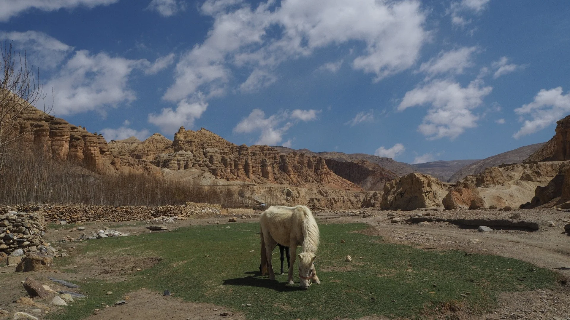
Upper Mustang is the picturesque pride of Nepal, life in this highland is tough, but this toughness brings about a smile that stays with you for the rest of your life. As you witness the Himalayas standing tall, all you wish to do is freeze this moment to cherish it for the rest of your life.
Day 6: Ghami to Charang
Altitude: 3560m
Trek Time: 4 hours
After a good night's rest at Ghami and breakfast, you shall head out to Charang. We advise you to walk cautiously. The trail is very rough and slippery right before the descent of Ghami Khola. During the hike, your hall comes across mani walls. Next up, you shall cross the Charang La pass at 3870m. You shall witness the majestic Charang Chu canyon during your journey. Atop it lies the beautiful village of Charang. The highlight of this village is its ancient fortress and red gompa (monastery) towards its east. As the trek time is approximately 4-5 hours, you shall have plenty of time to explore the village after lunch.
Day 7: Charang to Lo Manthang
Altitude: 3770m
Trek Time: 5 hours
The next day after breakfast, you shall make your descent down the canyon. You need to cross a river and ascend the Lo La pass at 3950m. At the end of the pass, you shall be greeted with your first view of the historic village of Lo Manthang.
This village historically was the capital of the Kingdom of Lo and is home to the royal palace of its king. Unlike the previous hamlets, you shall see a lot of Buddhist elements. The surrounding peaks of Nilgiri, Tilicho, Annapurna and Bhrikuti Peak liven up the vibe of this ancient setting.
Day 8: Outing to Chhoser Cave
Trek Time: 6 hours
This day is fully dedicated to exploring the Chhoser Caves. Also known as sky caves, these are ancient dwelling spaces dug into the side of valleys. These caves are 155 feet or more from the ground. They are thought to be more than 1000 years old. The purpose, origin and creator of these caves are still unknown.
The cave society is equipped with burial chambers, monasteries, hidden rooms and living quarters. Researchers assume native inhabitants built these caves to escape predators and dacoits.
Day 9: Lo Manthang to Dhakmar
Altitude: 3800m
Trek Time: 7 hours
The trek to Dhakmar is more challenging than previous legs, but it features beautiful sights and sounds. En route, you should stop at Gyakar Village. It is home to the ancient Ghar Gompa. This monastery is home to some of the most exquisite rock paintings in the region. A tradition in this region is you must make a wish. Stange right? Once your prayers and wishes are conveyed, you head towards Dhakmar.
Day 10: Dhakmar to Ghiling
Altitude: 3860m
Trek Time: 6 hours
The trek to Dhakmar is more challenging than previous legs, but it features beautiful sights and sounds. En route, you should stop at Gyakar Village. It is home to the ancient Ghar Gompa. This monastery is home to some of the most exquisite rock paintings in the region. A tradition in this region is you must make a wish. Stange right? Once your prayers and wishes are conveyed, you head towards Dhakmar.
After a splendid night at Dhakmar, you are requested to hit the trail early as the winds are powerful in this part of the trail. You shall cross a dry plateau and notice patches of agricultural fields along the road to Ghiling. The winds are a nuisance, but the views of Dhaulagiri and Nilgiri are worth the difficulty.
Day 11: Ghiling to Chuksang
Altitude: 3050m
Trek Time: 6 hours
This leg of the trek is perfect for understanding the lifestyle of this region because you pass through numerous villages. You can engage with the locals and make cherishable memories.
Day 12: Chuksang to Jomsom
Altitude: 2715m
Trek Time: 5 hours
This is the last leg of your trek in the Upper Mustang. The whole you approach Jomsom, you are officially exiting the restricted region. Your lunch stop for the day is at Kagbeni. As the total trek time is an average of five hours, it gives you enough time to veer a bit off course and explore. Once you arrive at Jomsom, please don't forget to grab a few souvenirs and confirm your flight to Pokhara.
Day 13: Flight from Jomsom to Pokhara
Flight Time: 15 minutes
This is your last night in the beautiful high region of Nepal. Before boarding your flight, don't forget to get one last glimpse of the beautiful scenes around you. Once you arrive in Pokhara, please relax and hit your favourite eateries and bars. Upper Mustang is a challenge, and you've done it.
POPULAR ITINERARIES
SIMILAR POSTS
An Adventure In Upper Mustang | Part II
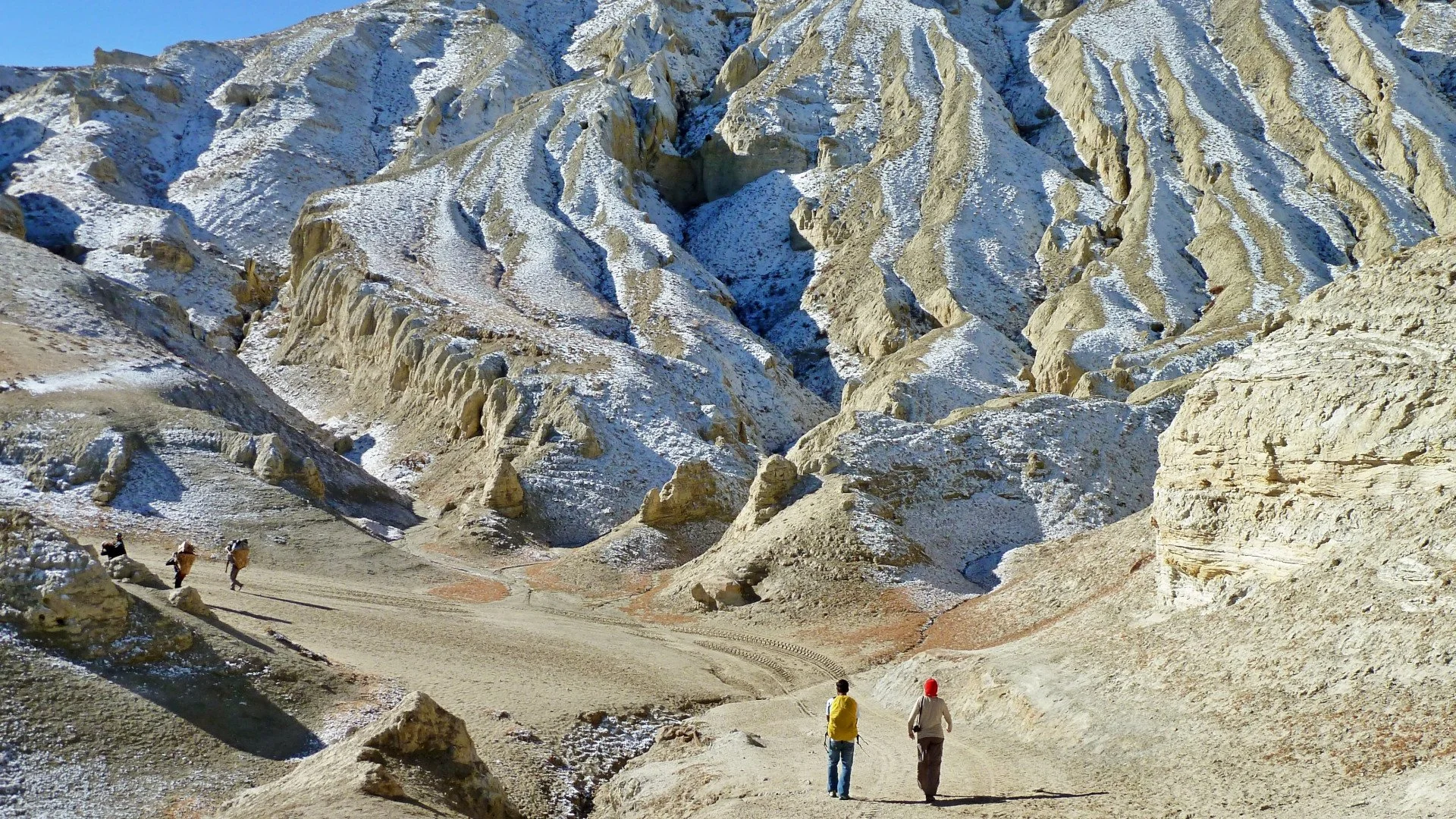
The Himalayas are a cure for every spiritual turmoil. The trails of upper mustang offer you an opportunity to experience the dessert terrain, scattered green pastures and the majesty of the stunning peaks such as Nilgiri, Annapurna and Dhaulagiri.
Trek Itinerary
Day 1: Arrival in Kathmandu and Flight/ Drive to Pokhara
Once you land in Kathmandu, our team shall transport you to our hotel. After checking in, you can rest for a while before pursuing further. A flight to Pokhara is at an average of 15 minutes, whereas a drive ranges between 6-8 hours. A flight to Pokhara allows you to visit a few sights in Kathmandu. It also exempts you from a long bus journey.
Day 2: Flight to Jomsom and Trek to Kagbeni
Trek time: 3 to 4 hours
The flight to Jomsom from Pokhara is approximately 20 minutes. The real journey begins here. After you land at the airport, you are greeted with a teaser of the trek and views ahead. Your first destination is the mystical town known as Kagbeni. Firstly, you shall cross a small bridge. After that, the trail is well marked and relatively easy compared to the road ahead. When at Kagbeni, walled passages greet you with an archaic feel. The walls feature clay effigies and decorations. The stone houses transport you to a different realm altogether.
Day 3: Kagbeni to Chele
Altitude: 3050m
Trek Time: 6 hours
After spending a beautiful night at Kagbeni, the trek to Chele begins after a hearty breakfast. The trail follows the winding Kali Gandaki river. You get to witness the absolute depth of the valley gorges during this hike. The village of Tanbe is an oasis on the trail. You can stop here to catch your breath and admire the white-washed houses and the beautiful fields of buckwheat and barley. This landscape also features splendid apple orchards.
Did you know the apples of this region are prized for their rich taste? The locals also create various drinks and snacks with the apples. You should definitely grab a few to indulge during your trip. Further in the hike, you follow a ridgeline which takes you to Chele village.
Day 4: Chele to Syangmoche
Altitude: 3475m
Trek Time: 6 hours
The previous hikes seem easy compared to the trail ahead. During your journey to Syangmoche, you shall cross your first big pass- Taklam pass. The pass stands tall at an altitude of 3624m. As soon as you’re done with Taklam La pass, you are greeted with Darjori La pass at 3737m. Every risk comes with its reward. The trail offers breathtaking mountain views and glimpses of peculiar caves. As you walk further, you decend into Samar Village. You need to follow a ridge and cross a narrow steep trail during the final mile of Syangmoche.
Day 5: Synagmoche to Ghami
Altitude: 3500m
Trek Time: 5 hours
After a hearty breakfast, you shall embark on another challenging trail. You shall cross two passes in this leg Yamada La at 3850m and Nyi Pass at 4010m. As you embark further stunning landscape views of stone villages with lush barley fields greet you. Before you descend down to Ghami, you need to cross the second pass- Nyi Pass at 4010m. The village of Ghami is a picture perfect village. After refreshing yourself, you can indulge in a brisk village walk.
To be continued in the next blog…
POPULAR ITINERARIES
SIMILAR POSTS
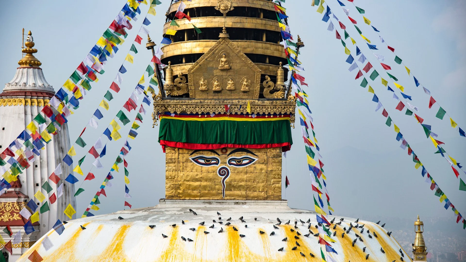
Major Buddhist Sites of Kathmandu Valley
Buddha Jayanti is an auspicious occasion. This day celebrates the death and enlightenment of the most recent Buddha, Shakyamuni, Gautam Buddha. The valley of Kathmandu holds numerous great Buddhist shrines that pay tribute to the Buddha and his teachings.
This valley and enlightenment have an entangled history. As per local lore, the first seeds sown were by Tathagata Vipasvin (Vipasyi Buddha). From it grew a lotus in the shape of a chaitya. It was called jyotirupa, a jewel in the form of light. Bodhisattva Manjushree learnt of it during meditation and embarked on a pilgrimage. He drained the valley, giving the world access to jyotirupa.
The first township in the valley was Manjupattana, a beautiful city created by Manjushree. Buddhism flourished in this vale, a sacred haven built by Bodhisattva Manjushree.
The greatness of this valley kingdom was known far and wide, attracting refugees, sages, bodhisattvas and more.
Many great shrines symbolise the Buddha's journey and his teachings. These sites bustle with devotees during Buddha Jayanti. They present various offerings and pray for peace and well-being.
Swayambhu
For the Newars of this valley, the hill is as sacred as the stupa. "Especially among the Newar, it has a great popularity since mythical times not as a stupa-building but as a holy place and even as a god.", wrote Wolfgang Korn in his book the "The Traditional Newar Architecture Of The Kathmandu Valley".
In Newari, the hill is known as sahyengu. Sa denotes cow and hyen tail, whereas gu means hill. The short version of this name is still used by elders, singum. As per research by Rospatt, it was only during the 15th century that the hill became Svayambhu. This correlates with Svayambhu Purnana being written in the same century. The hill gained an association with Adi Buddha, self-existent, through this writing because researchers did not discover any mention of Adi Buddha in the 14th-century chronicle The Gopalarajvamsavali.
Travelling forward in time, Svayambhu today is the crown jewel of this valley. Over the years, various elements have been added to this site, such as mani-walls, statues of Buddha, Manjushree, Padmasambhava and others. It is known as Svayambhu Stupa and Svayambhunath. It is a symbol of Buddhism, which receives numerous devotees. It was indoctrinated into UNESCO's World Heritage Sites in 1979.
Boudha
The stupa of Boudha is yet another stellar representation of Buddhism in Kathmandu Valley. As per Tibetian belief, the stupa is a tomb holding the remains of Kasyapa Buddha, the predecessor of Shakyamuni (Gautam Buddha).
As per Newar chronicles (Vamsavali), Manadeva I built the chaitya in the 5th century. Devotees regard the eyes of this stupa as the guardian of the whole world. For a long period of history, the local Newar population disregarded the stupa. Author Wolfgang Korn writes, "It is obvious that this stupa was not integrated into the religious calendar and life of the Valley Buddhist population, the Newars, as it was not mentioned for about 600 years."
Today, Boudha is a sacred space highly revered by the national and international population. It sees thousands of pilgrims and visitors very year.
The four Ashokan Stupas of Patan
In the ancient city of Patan, which today lies in the larger town of Lalitpur, exists four mysterious stupas. The four stupas are collectively called the Ashokan Stupas of Patan. Their origin is widely debated in the cultural community. One sect believes that the Mauryan emperor Ashoka erected the stupas in the 3rd century BCE. The second sect counters the claim stating that it isn't Ashoka but his daughter Charumati, who was married to the prince of Nepal Devapala Khastriya.
The names of the stupas are as follows:
A. Tetas (East)
B. Lagan (South)
C. Pucho (West)
D. Yampo (North)
These stupas were regarded as the boundary of the inner city of Patan. Newars identity them as thur rather than stupa. For a long period of history, these stupa/thur were only viewed as landmarks. It was only later that they were incorporated into the religious rituals by the Newar population.
POPULAR ITINERARIES
SIMILAR POSTS
An Adventure In Upper Mustang | Part I
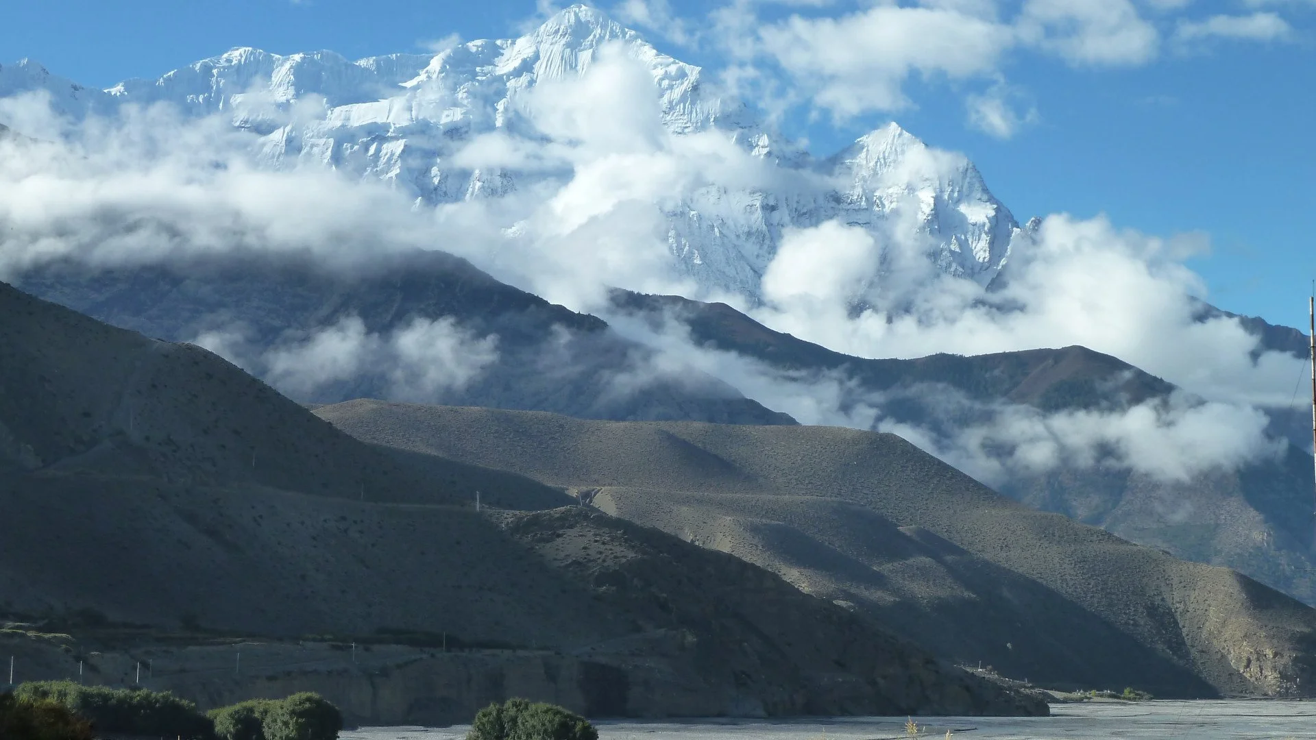
The allure of the vast yonder of Upper Mustang has been a true calling for numerous adventurers. Formerly known as the Kingdom of Lo, the reminiscences of a bygone era are still visible in the region. An adventure to this land is a lifetime of memories.
Up until 2008, the Government of Nepal officially recognised the Kingdom of Lo as a Kingdom. The last recorded king (raja or gyelpo) was Jigme Dorje Palbar Bista. His lineage is traced back to 1380 AD. He is a descendant of Ame Pal, the king who oversaw the foundation and construction of Lo Manthang, the walled capital of Lo and Mustang.
In terms of geography, Traditional Mustang ( Lo Kingdom) ranges from 2750m (9020ft) above sea level at its lowest point. The highest point is 7600m (22,00 ft) at Khamjung Himal, north of Kagbeni. Hydrographically, the main feature is Gandaki River. It runs southwards to the Terai bisecting Mustang. Traders used the route to travel between Tibet and India. The Kali Gandaki Gorge is regarded as the deepest gorge in the world.
Where do I get the permit and card? How much does it cost?
As per the department of immigration, a fee of USD 500 is charged for the first 10 days. Beyond which USD 50 is levied per person/day. A trekker needs to pay the ACAP Permit, $20 per person. The TIMS (Trekkers Information Management System) card is not required in Upper Mustang. Trekkers are required to present the RAP (Restricted Area Permit).
Can I trek to Upper Mustang alone?
No! You are not allowed to trek the Upper Mustang region alone. Neither you nor an individual guide can obtain the RAP. The permit can only be requested by a registered trekking company. However, you can acquire the TIMS and ACAP Permit at Nepal Tourism Board in Kathmandu and the Tourist Office in Pokhara.
How do I start?
Once you have landed at TIA (Tribhuvan International Airport), you can either experience a bit of the capital (Kathmandu) for a few days or get a connecting flight to Pokhara. The distance between Pokhara and Kathmandu is 200 KM. You can opt to take a bus instead of a flight as well. Your available options are either local or deluxe buses.
Deluxe buses leave at 7 AM from Sorakhute Bus Station in Kathmandu. You may either book a ticket beforehand or arrive an hour early, pay and embark directly at the terminal. We recommend these buses as they have air conditioning. The travel time ranges between 7-8 hours, with stops for lunch and snacks at good quality rest stops.
You can skip all of the hassles by contacting the front desk officer at the hotel. S/he shall do their best to arrange these services for you. They can also develop a proper itinerary to experience Lower Mustang at a reasonable rate.
When is the right time to trek?
In Nepal, Spring and Autumn is prime trekking season. The skies are clear with light to minimal rainfall. Autumn (Mid-September to Mid-November) is best for Lower Mustang Trek.
During other months such as December - February, the climate is colder and potential high snowfall may not allow you to trek above High Camp. Whereas during pre-monsoon ( Mid-May to Mid-July) and monsoon (Mid-July to Mid-September), chances of rain and clouding are high. The forest area shall be full of leeches and mosquito's.
Spring (Mid-March to Mid-May) is also a great time to trek this region. Temperature is nominal, and winds are light, allowing you to have a beautiful walk. The plant life will be blossoming: amplifying the atmosphere.
What should I wear and carry?
Proper clothing is vital while trekking to remote areas. In Spring and Autumn, you need summer/light clothing for the day hours and warmers for the night. If you’re travelling during the pre-winter and winter months, you need to wear your heavy jacket. During pre-winter and winter, warm clothes are essential. A heavily padded jacket, full sleeve t-shirt and fleece-lined pants are essential. During spring and autumn, a parka is mandatory. An umbrella and a raincoat should be carried as well.
Does the trek cost the same around the year?
No, the cost presented to you by your tour agent varies as per the season. The cost of accommodation is higher during peak season. Food costs rise during winter as transportation of goods becomes difficult. During peak season, you are bound to be over-charged. Off-season treks are usually less expensive due to slow business. You’ll get a sweet deal if you time your adventure off-season.