
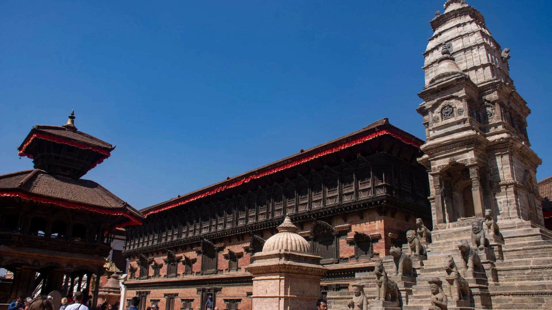
UNESCO Heritage Edition: Bhaktapur Durbar Square
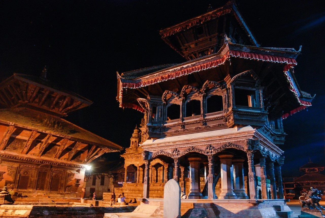
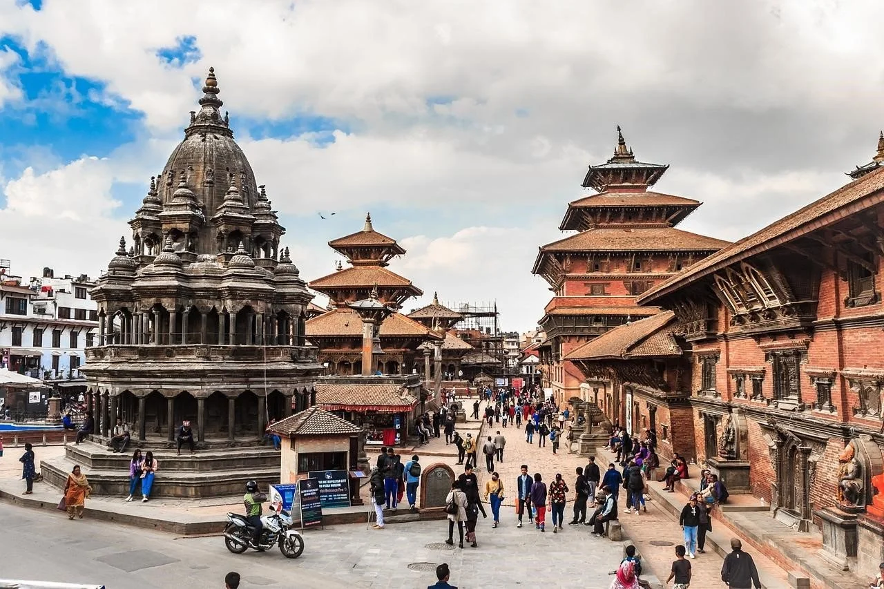
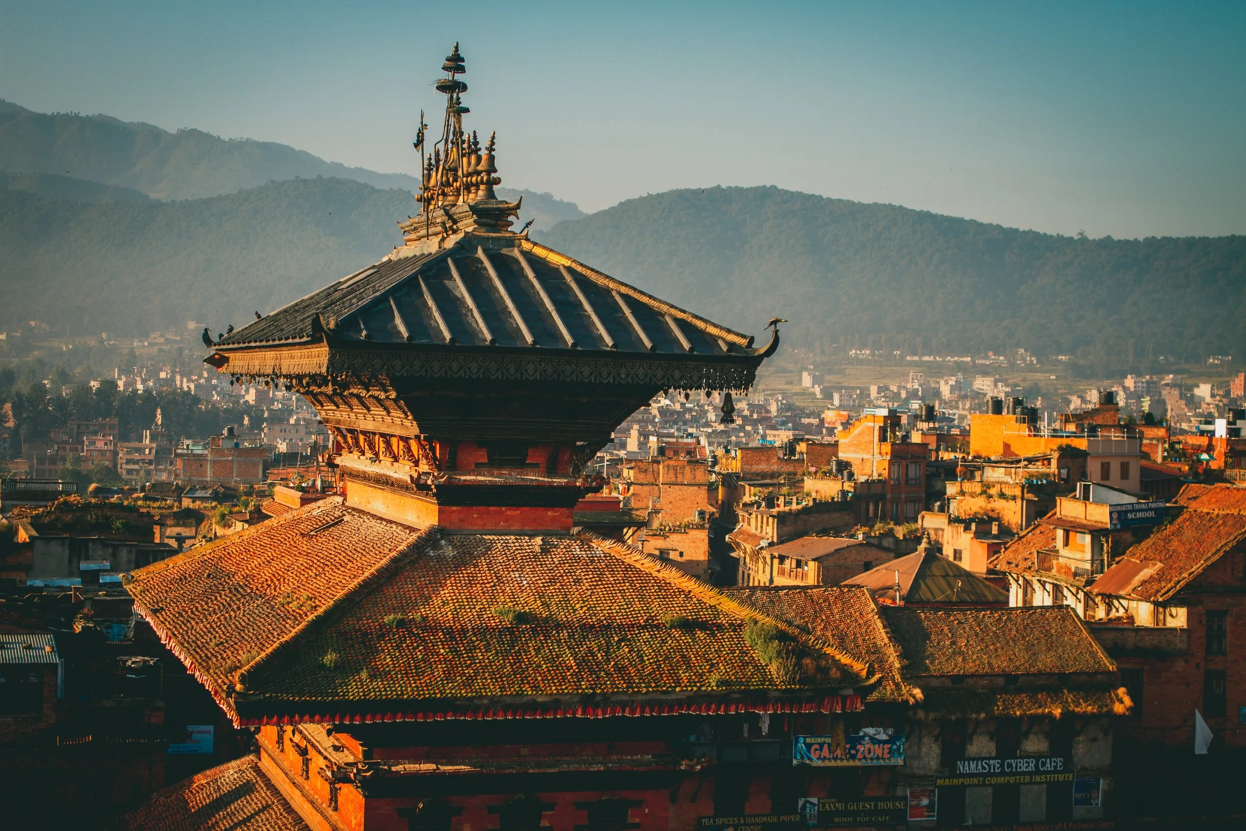
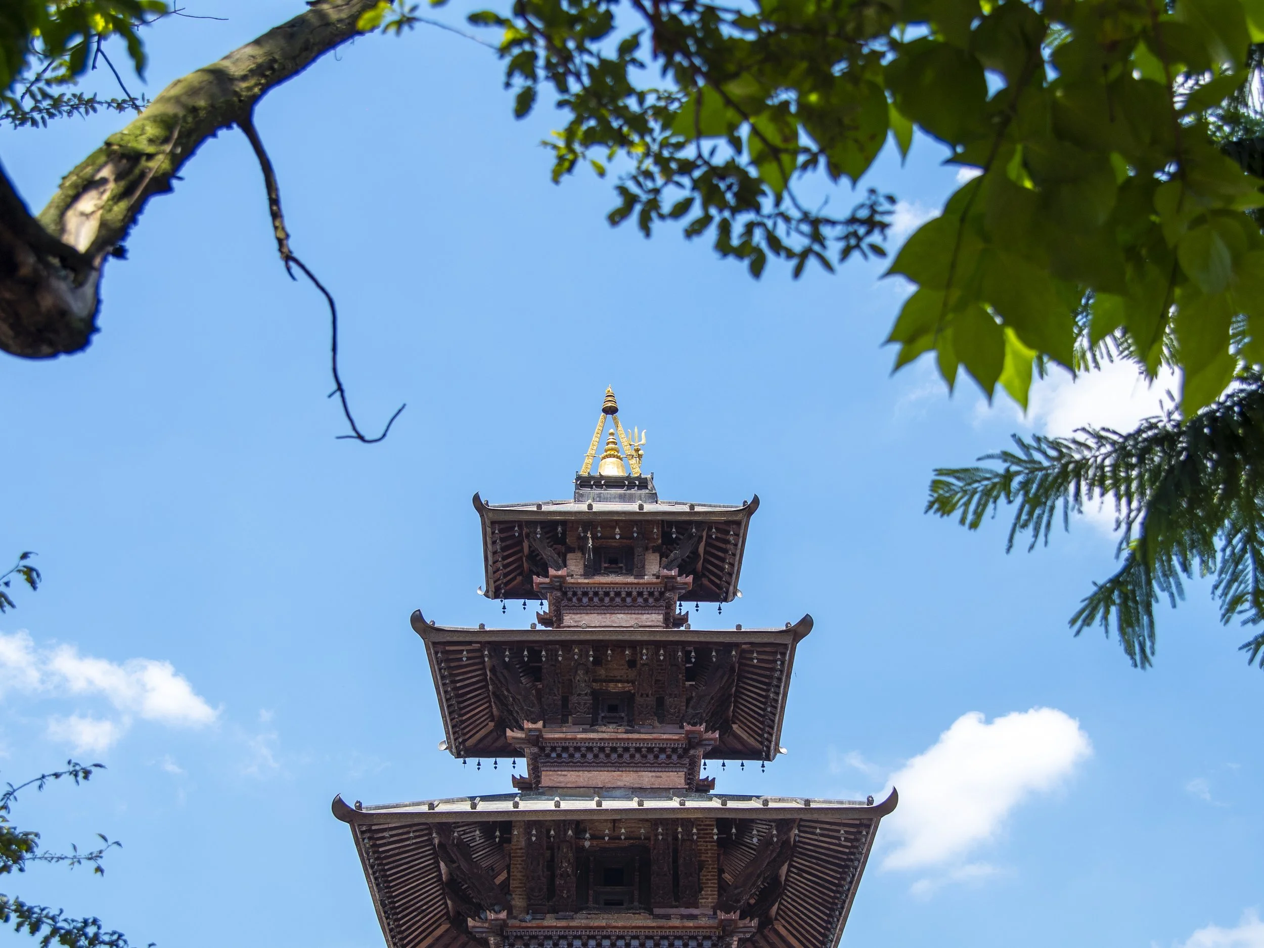
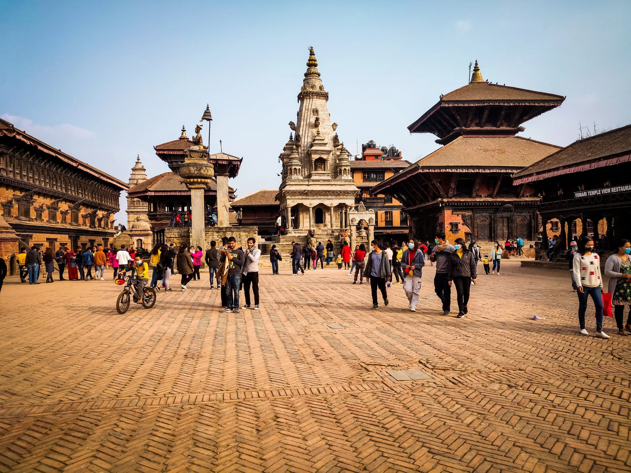
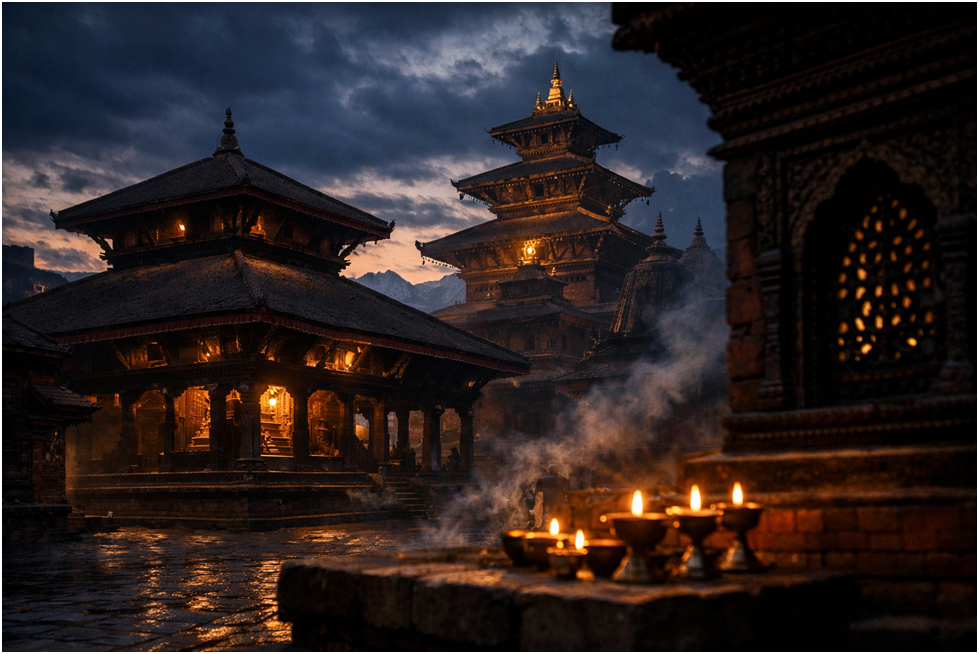
The youngest of the three sister Durbar’s of the valley. Bhaktapur Durbar Square is a marvel of wooden and stone architecture. It features a unique blend of ingenuity and fusion of the architecture of its older sisters. In comparison with its sister durbars the architectural layout is more organized with large squares and equal divisions around the city. The city diffuses from the centre(Taleju) outwards into the numerous vicinities of Bhaktapur.
“The city of Bhaktapur can be neatly divided into nine sectors corresponding to the Eight Mother Goddesses plus a ninth, central goddess, that are situated at Power-Places amount its perimeter.” CNAS Journal, Vol 32, No.2 (Pickett,2005:247)
Built by Ananda Malla the younger son of Abhaya Malla, Bhaktapur originally called Bhatgaon is a city protected by the Navadurga and is a symbol of prime Malla architecture.
Inception of the Kingdom of Bhaktapur
“This younger brother (Ananda Malla,) being very generous and wise, gave up the sovereingty over the two cities, and having invoked Annapurna Devi from Kasi founded a city of 12,000 houses which he named Bhaktapur(Bhatgaon) and included sixty small village in his territory.After this, the Raja having obtained the favour and directions of Chanfeswari, founded seven towns; viz. Banepur(Banepa) near Chandeswari Pitha, Panavati(Panauti), near the Pragaga TIrtha of Nepal, celebrated in the Shastras on the site where Panchala-des formely stood, Nala, near Nala Bhagavati, Dhaukhle near Narayana; Khapu near Dhaneswaril Chaukot near the residence of Chankora Rishi; Sanga near Nasika Pitha.”
Wright 1877: 163
Establishment of Bhaktapur Durbar Square
“ He established his court at Bhaktapur, where he built a Durbar; and having one night seen and received instructions from the Navadurga, he set up their images in proper places, to ensure the security and protection of the town both internally and externally.”
Wright 1877: 163
Bhaktapur Durbar Square Today
The Durbar square is as magnificent it was when it was incepted. The squares are always bustling with tourists admiring the architecture and heritage along with locals busy in their daily essentials. The gullies are filled with souvenir stores selling diverse range from Thanka art, metal statues and sculptures, merchandise and traditional and international cuisine.
The 2015 Earthquake and its impact on Bhaktapur Durbar Square
During the 2015 earthquake, the city of Bhaktapur faced severe damage in terms of monuments and houses. The traditional houses have stood in their original archtitcure for more than 40 year, but not anymore. The Vatsal Devi Temple was turned to rubble allong with many other temples. Many heritages such as the temple of Rameshwor, Batsala, Narayan, Siddi Lakshmi, Biswaroopa,Siddi Ganesh, Swetbhairav, Sij Mahadev, Degaina, Satall were damaged along with premises of Taleju Chowk and the 55 windowed palace. 4 out of 11 heritages have been restored and the others are in the process of restoration. The events of the earthquake of 2015 left allot of the inhabitants without a home and had to live in temporary shelters and MRE’s. But slowly but steadily till today, life moved on as the people of Bhaktapur persevered what was lost cannot be regained but lessons can be learnt and heritages can be rebuilt.
SIMILAR POSTS




Mardi Calling.
Trekking is never just about the climb or the view from a high point. It is far more than that - it is an experience, an opportunity to build relationships and forge memories you thought you could only dream of. You can have your definitions and this is mine.
Nepal was never on the forefront of my mind when I thought of travel, I imagined skyscrapers, oceans and deserts and all things you cannot see or experience in Nepal. But one trekking trip from my college changed it all. The sun shining over the mountains, the fresh morning air and the excitement within never gets old when I see the mountains.
This was the third trek of my life and I was as excited as it was my first time walking towards the mountains. The planning—pre-packing and pre-excitement, was pretty stressful but a lot of YouTube videos and discussions later we were ready. I was pretty nervous too because unlike the last time we were doing everything on our own. I was walking with four friends - Ganga, Parakram, Subit, and Ishwor.
If I had to rate the difficulty of the trip I would say it was a tiny bit difficult due to the rain but overall the trek was a moderate one. So we decided to take the trip in late April— from April 28th to May 3rd. For most parts, it was good because the month April lies smack in the peak season, but it rained which dampened our spirits a tiny bit.
Here is an overlook of the itinerary:
- Day 1: Bus Ride from Kathmandu to Dhampus
- Day 2: Trek from Dhampus to Forest Camp
- Day 3: Trek from Forest Camp to High Camp
- Day 4: Uphill from High to viewpoint and back. Downhill to Sidhing. Jeep to Pokhara.
- Day 5: Stay at Pokhara
- Day 6: Bus to Kathmandu
So the very first day was filled entirely with bus rides. We took the 7 am tourist bus to Pokhara. Got down at Pokhara Bus Park and hopped on a local bus to Dhampus. A comfortable night at the Hotel Paradise View & Restaurant ended our day.
The next day brought rain in the morning, so we started our trek at 9 am with excitement and hope that it wouldn’t rain. The woods were a blessing and a curse at the same time; while it kept us cool from the sun it also kept us from the mountain views. Three and a half hours later, we reached Deurali where we had our lunch. And guess what? We did run into rain and out came our raincoats. The rain left us with wet and with zeal to walk like never before. That’s when we came up with the motto of the trek “Raincoat power 24 hours”. We walked like crazy and reached Forest Camp at around 6:30 pm. We stayed in the Mardi Guest House & Restaurant for the night.
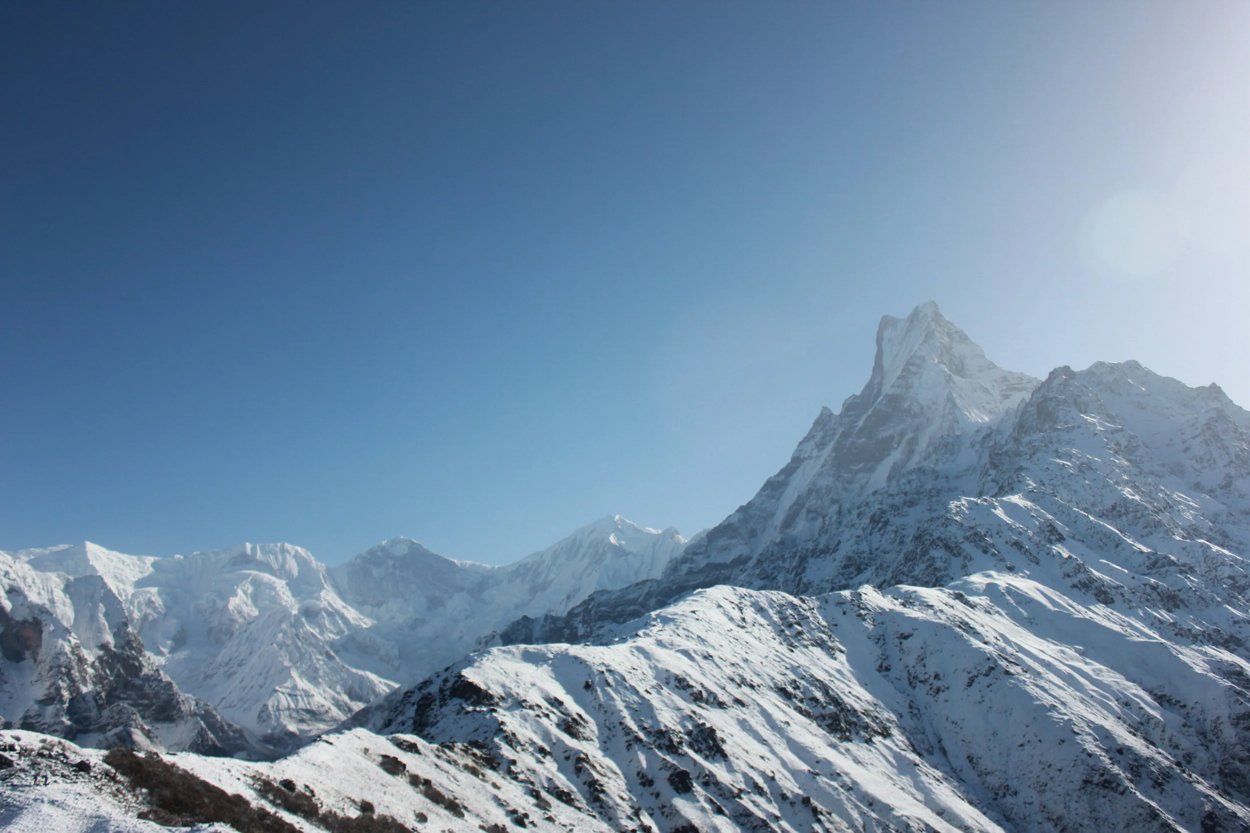
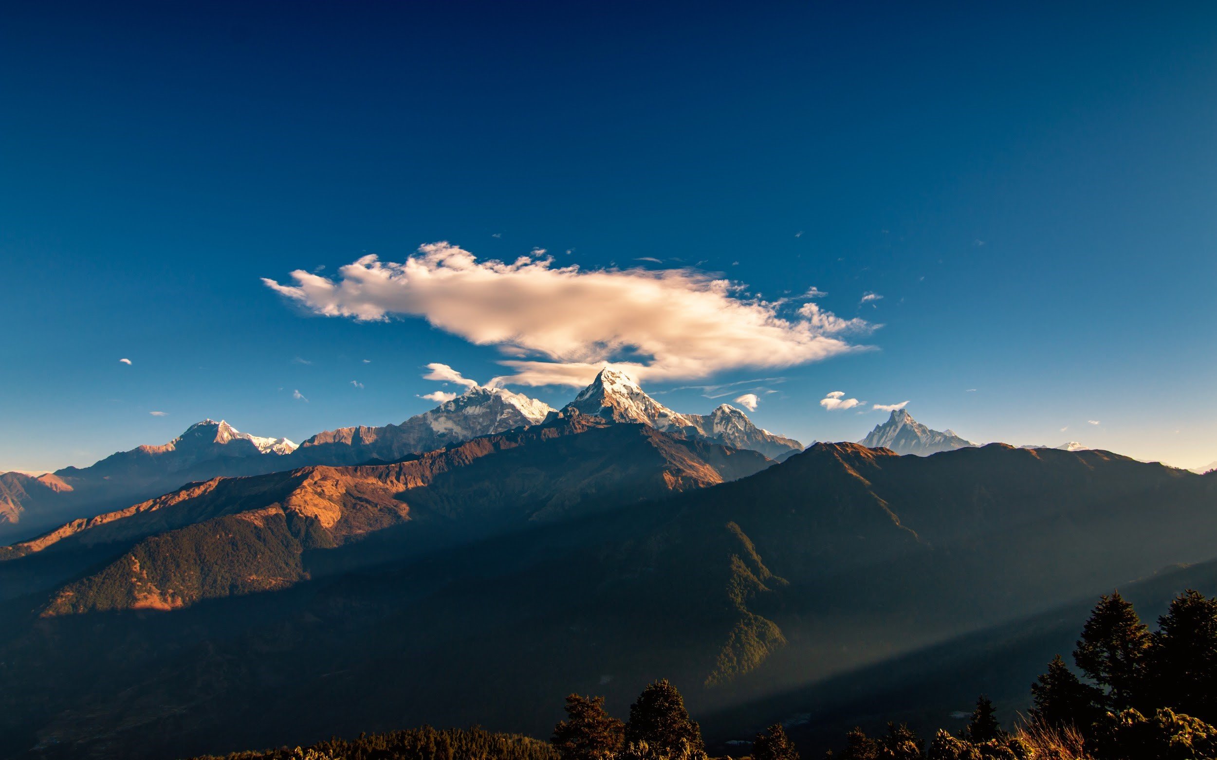
After a hefty brunch, we started our walk to High Camp. The day’s views were more woods, break at Low Camp, more rain followed by fog and cold as we reached Badal Danda aka Middle Camp. The sneak peak by Mount Machhapuchhre was what we needed to keep us moving to reach our destination—the High Camp.
“Besides the fog, the views and the path from Badal Danda were spectacular”, says Ishwor.
The despair until we reached High Camp was so real, mostly due to the fog but the view of the mountains was worth it. High Camp Guest House & Restaurant welcomed us well with gorgeous views and hot delicious food.
Cold as it could only be in the mountains, the 4 AM walk to the Viewpoint on the final day of the trek was the scariest and the most difficult thing for me. We gained about 600 to 700 meters in altitude in a few hours and it nearly had me give up, but that was mostly because the path was built with a cliff to the side. I finally managed to crawl my way up thanks to my friends. Having Mt. Machhapuchhre so close was unreal. The golden rays of the sun on the mountains were unreal and any picture I have from the trip doesn’t do the view justice.
“I felt like I could actually touch Mt. Machhapuchhre but I had expected to see more mountain ranges even if they were on the sidelines apart from Mt. Machhapuchhre and the Annapurna Range from the Viewpoint”, says Subit who is a seasonal trekker.
We spent a good 1.5 hours with the mountains, then the clouds took over our view so we got down. Getting down was a tiny bit less scary and I still was crawling all the way through. After breakfast, we started our way down. I would call us ambitious for making our way down to Sidhing the same day. Slipping, sliding and jumping through several hills we made it to Sidhing in 8 hours. From there we took around a 2 hour jeep ride to Pokhara and were we tired! We got to our room took a long hot shower and had a round of Thakali.
The following day we wandered around Pokhara relaxing and took the bus to Kathmandu the next day. It might have been the end of Mardi, but we still don’t stop talking about it until the next trek.
Heritage Weekly: Patan Durbar Square
Heritage Weekly: Patan Durbar Square
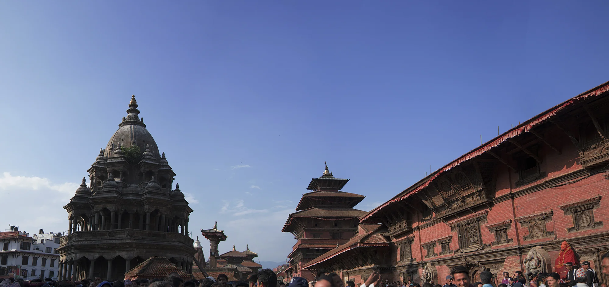
Patan, Yala, Lalitpatanna and Lalitpur,all these names are used to describe a magnificent city which was founded on Buddhist Principles during the era of the Licchavi Era. Today the Patan Durbar Square is known for its magnificent wooden architecture and the harmonious entanglement of Buddhism and Hinduism. Patan Durbar Square is the centre of the Sri Yantra Mandala of the city of Lalitpur. It was enlisted along with its sisters Kathmandu Durbar Square and Bhaktapur Durbar Square in the UNESCO World Heritage list under the criteria of culture in 1979 AD.
Origins Gellner 1996:126
Bir-deva son of Nand-Deva and 5th King of the Vikramaditya Dynasty( Lichhavi)
The king used to sit at the window of his palace, and he regularly saw a leprous grass cutter going to cut grass. One day he was astonished to see that very grass cutter going by with his leprosy all cured and looking very handsome. So he asked him how it was that he now looked so well, and the grass cutter, who was called Lalita replied: “Great King! Yesterday I went to the southern side of the Bagamati river into the Lalita wood in order to cut grass. I became hot and went to a place where there was a pind(pond), took off my clothes, stick my carrying pole into the ground, went to bathe. When I came out of the water my leprosy was all gone. The carrying pole was stick and I could not pull it out. I thought it must be siddha.” Being A devoted to Sarveswara, the king had it in mind to establish a city, some time later Sarveswara appeared to him in a dream. He said: “ Oh King! To make the city, cut down Lalita wood in accordance with the 24 element and in the shape of a Sri Yantra and make your minister Lalita the architect.
The Creation of Mangal Bazar
He built a chaitya (stupa) and a dhara (spout) and erected a Shivaling, a Ganesha, a Mahakala and a Mandap and built a Durbar for the Raja, all of these after the goddess as follows: Mani-Talava[I.e, Taleju in the royal palace], Man i-Chaitya, Mani-Dhara, Mani-Linga, Mani- Ganesha, Mani-Kumara, Mani-Mahakala, Mani-Mandapa and Mani-gal bhatta.
Wright 1972:136
The Square that we are familiar with today, is the result of diverse architecture founded in various era’s and and a harmonious entanglement of Buddhism, Vajrayana Buddhism, Vaishnavism, Shaktism and Hinduism.
From the first Kirat Settlement to Lichavi’s Mangal Bhatta Durbar, the glory of today’s Patan Durbar comes from the architecture and monuments built by all dynasties. The Malla’s have a special role as they have many additions. The Temples such as Bhimsensena, Hari Shankar, Taleju Temple, Degutale, Vishwananth Temple, Bhai Dega Temple, Chyasing Dewal and the crown jewel Krishna Mandir. The addition of palace squares such as Mulchowk and Sundari Chowk with the Agama Devata and the beautiful Tsuhiti. The endless amount of beautifully carved tudals (struts) and stone sculptures .
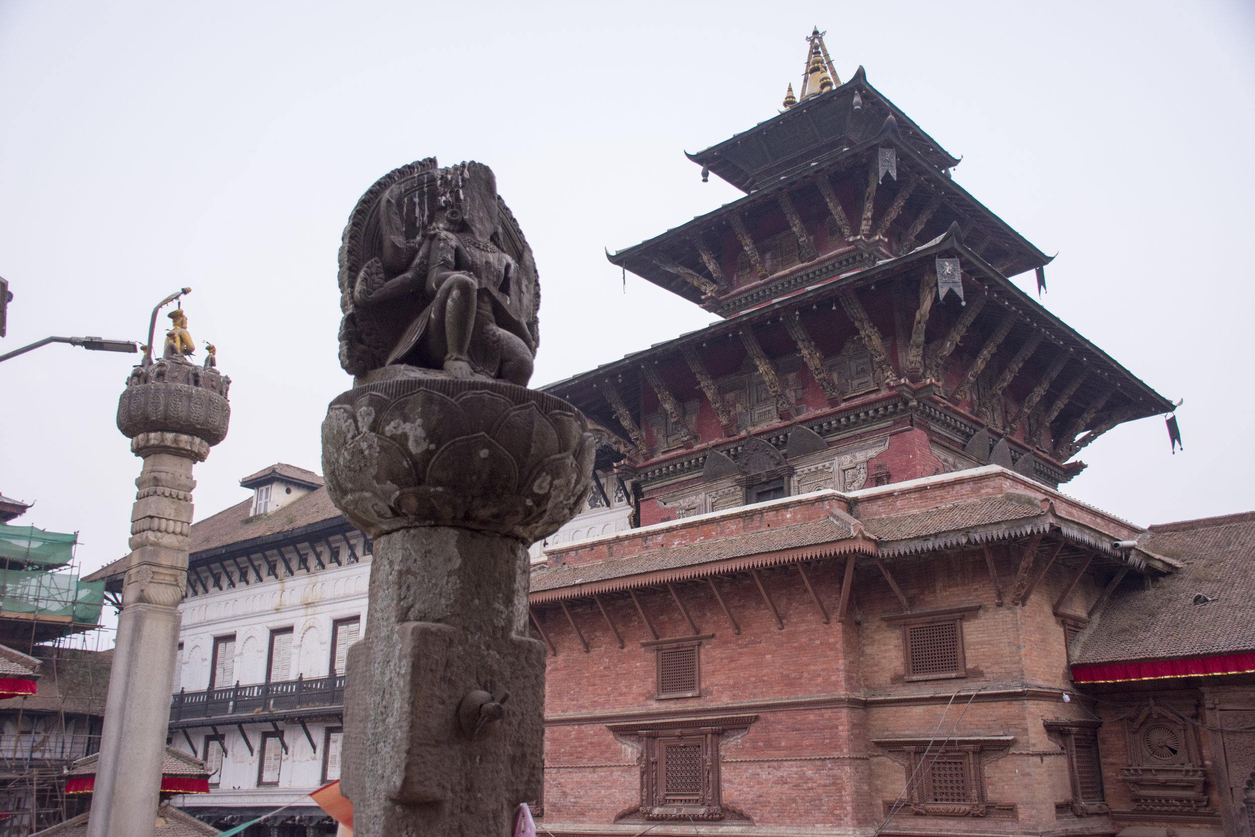
UNESCO Heritage Edition: Kathmandu Durbar Square
Nepal is a country known for many things, be it the rich culture and colorful traditions, the diverse harmony of all religions and beliefs, the abundant natural sceneries, and the unique story of its history. Within the heart of all these features is the diverse love of art and architecture mixed thoroughly with religious beliefs and imagery. Filled with immense architectural beauty that have stood the test of time, the prime examples of the brilliance of such creations lie within three places around Nepal valley.
Nepal is a country known for many things, be it the rich culture and colorful traditions, the diverse harmony of all religions and beliefs, the abundant natural sceneries, and the unique story of its history. Within the heart of all these features is the diverse love of art and architecture mixed thoroughly with religious beliefs and imagery. Filled with immense architectural beauty that have stood the test of time, the prime examples of the brilliance of such creations lie within three places around Nepal valley.
Nepal has a rich cultural history that is tangible in the country’s architecture, traditions and festivals. The UNESCO World Heritage enlists 10 sites from Nepal, due to the history, architecture, global importance and need for conservation.
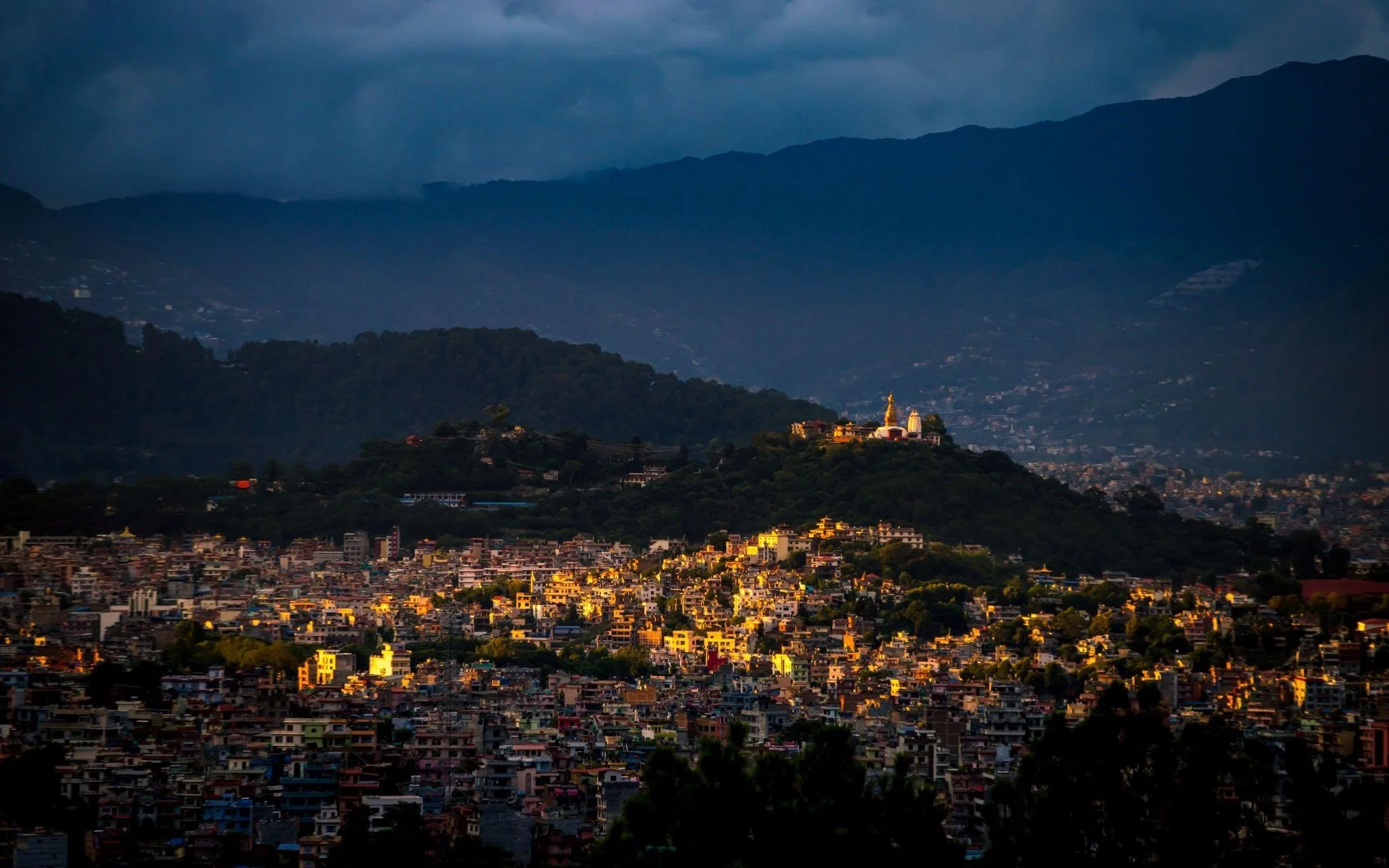
Divided into three squares in three corners of the valley, Patan Durbar Square, Bhaktapur Durbar Square and Kathmandu Durbar Square portray the unique blend of art, architecture and tradition all at once. Kathmandu Durbar Square lies in the heart of the capital, and despite the earthquake that shook Nepal in 2015, it is still as lively as ever.
Kathmandu Durbar Square was originally formed from the palaces and courtyards of the old Malla and Shah kings. Durbar Square literally means "Place of Palaces." The oldest temples were built in 1560-1574 by King Mahendra Malla, though the oldest palaces date back to the 3rd century. The square was still used for royal ceremonies up until 2001. Today Kathmandu durbar square is still used for official religious ceremonies including that of the Kathmandu Kumari (living goddess) whose residence is located there. Many of the intricate temple carvings on the roof struts in durbar square depict scenes of erotic art.
Entrance fees for Non-Nationals are set at Rs.1000 and Rs.150 for SAARC Nations. The square is riddled with tiny gullies and souvenir shops. Non-Nationals should be aware of hustlers and possibilities of being scammed, so before buying something just ask around a lot of stores best stores at opposite ends of the squares.
An unbelievable 50 temples lie within the vicinity including the temple of the titular deity, Taleju Bhawani. The Durbar is divided into two courtyards, the outer Kasthamandap, Kumari Ghar, and Shiva-Parvati Temple, and the inner section consisting of Hanuman Dhoka and the main palace. Some floors have been converted to museums dedicated to three generations of Shah kings. Most parts of the palace premises are open to tourists throughout the week.
Some important monuments to see in this area are: The Taleju Temple is the tallest of all structures, built by King Mahendra Malla in 1549 AD. This temple is open to the public for one day each year during the Dashain festival.
The Jagannath Temple, built in the 16th century is known for the fascinating erotic figures carved on the wooden struts.
The Kal Bhairav, one of the largest 17th century stone statues in Kathmandu, representing the terrifying aspect of Lord Shiva.
Swet-Bhairav - the temple is open to the public once in year during Indra Jatra Festival. The 17th century Kumari Temple (the temple of Living Goddess) is an example of highly developed Nepali craftsmanship.
Kaandasthamp, from which Kathmandu derives its name, is said to have been built from the timber of a single tree.
Nau-Talle Durbar (the nine storied palace).
Mul Chowk, as the occasional abode of the goddess Taleju, is opened to Hindus once a year when, on the ninth day of the Dashain Festival, hundreds of buffaloes and goats are sacrificed to the goddess. Bhandarkal is a botanical garden created by King Pratap Mall in the mid 17th century. With its diverse flora, Bhandarkal is a treat for nature lovers and ecologists. The garden has been named after a seven-storied palace that possesses a statue of the Sleeping Vishnu, Jalashayana Narayan.
The Chepang Trek Part 2
Why Nepal is a Trekker’s Paradise
The Everest Base Camp and Annapurna Base Camp treks are so well-known that they are often referred to as simply, EBS and ABC. Nevertheless, Nepal is a trekkers’ paradise not only for these two popular treks; there are many other trails that are exciting and challenging. Here’s a series of treks that are becoming more popular by the season.
On the last day of your excursion, you have an easy time ambling downhill for five to six hours to Shaktikhor (355 m), and here you’ll find small Chepang museum, as well as the Sinti waterfall and Sinti cave nearby. Now, having ended your trek in the Chepang heartland, it wouldn’t be a bad idea to take the time to visit Chitwan National Park, since it’s only one hour away. As you may know, this is the first such national park of the country, and was inscribed as a World Heritage Site in the “natural” category by UNESCO some decades ago (around the 1990s). This beautiful park attracts a lot of visitors, and is home to a diverse variety of interesting wildlife, and an equally interesting variety of flora.
It is especially famous for its inhabitants like the greater one-horned rhinoceros and the Royal Bengal tiger, which are on the endangered list of animals in the world. The high importance of this national park can be gauged by the fact that, out of the remaining population of 2,000 greater one-horned rhinos in the world, 600 are to be found here. Similarly, out of about 2,500 of the remaining Royal Bengal tigers around the world, 120 live in Chitwan National Park. During the years of the ten-year Maoist insurgency (1996-2006), it had been difficult to secure the safety of these magnificent animals, and many were killed by poachers, taking advantage of the uncertain circumstances then. However, it is indeed good news that, since then, extensive efforts by the government, and its “Zero Poaching” campaigns, has yielded good results, with the tiger population alone increasing to 120 from just about 90 in 2009, and a similar rise in rhino numbers.
There are quite a few renowned resorts around the park, all offering great facilities. Till a few decades ago, there were some very famous resorts inside the park itself, such as Tiger Tops and Gainda Wildlife Camp, to name just two. However, with a view of safeguarding the heritage all the more, all such resorts were made to close down, and most of them now have their establishments on the perimeter of the park. However, they conduct very exciting forays into the park, giving you the option of elephant rides, driving on four-wheelers, or just plain hiking through the dense jungle, including a ride down the crocodile infested river in dug-out canoes. There’s also a gharial breeding farm inside the park that should interest you, since this alligator-like snout-nosed animal too is in the endangered list. Back in Shaktikhor, you’ll be treated to an entertaining cultural program that will make your mood for the six-seven hour drive back to Kathmandu the next day.
The Chepang Trek Part 1
Why Nepal is a Trekker’s Paradise
The Everest Base Camp and Annapurna Base Camp treks are so well-known that they are often referred to as simply, EBS and ABC. Nevertheless, Nepal is a trekkers’ paradise not only for these two popular treks; there are many other trails that are exciting and challenging. Here’s a series of treks that are becoming more popular by the season.
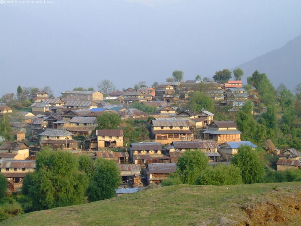
In central Nepal, on the hillsides of the great Mahabharata range of mountains, live people of the Chepang clan. It is a small community relative to the general Nepali population, just over fifty-two thousand or thereabouts, which means less than one percent of the whole. For comparison’s sake, the Chettris number over four million, the Bahuns, over three million, the Magars, almost two million, the Newars, more than one million, and so on. Thus, that makes the Chepang people a small minority.
Their place of inhabitance is west of Makwanpur, south of Dhading, and east of Chitwan, which means, right in the center of central Nepal. They are an aboriginal community that has for a long time lived on tubers and wild yams, and birds and deer and bats and fish for their subsistence. And, although they also are involved in agricultural pursuits, the topography of their land does not really support extensive agriculture. As is the case with many aborigines, they were in olden days followers of animism, but now many have been influenced by other religions like Hinduism and Buddhism, the two prevailing national religions, as well as by Christianity, which has made rapid inroads into their communities.
All of these make them an intriguing ethnic group, and so a trek into their region could be very rewarding, indeed. This trek begins at a small village called Hungdi, which is about eighty kilometers from the capital, in the west-southerly direction, and situated between Mugling and Krishna Bhir in Dhading district. There are two ways of reaching this village. The more sedate way is by traveling on a bus from Kathmandu, which should take around only four to five hours. The other way is much more adventurous. You drive down to Charaudi, forty-five minutes away, and getting down to the bank of the Trishuli River, hop on a raft and ride it through the rapids, especially in the stretch following a place called Manjitar that has a high rating as far as rapids are concerned, and there’s even one stretch of rapid that is nicknamed “Surprise”! You don’t need to hurry, and so can settle down for the night at Kuringhat Camp, and come morning, you again start off on your wet journey. On the way you will encounter some interesting stretches like the Mugling and Simaltal rapids. At Simaltal, you park your raft on the bank, get atop a four-wheel jeep, and drive to Hungdi, which is now an hour away. Next, you begin your real trek, hiking to Hattibang village (1,415 m) for some five hours or so. Here, you spend the night in a homestay or a guest house. Living in the former is of course more rewarding, since you’ll have more of an experience of the Chepang culture and lifestyle. Since it is all hilly country, the landscape is splendid. Having shared meals with one Chepang family or the other, the next day you trek for about six hours to the village of Jyandala (1,610 m), and along the way, you will be passing small villages of the Chepangs, such as Changa, Jautesh, and Dinglang. Jyandal is where you’ll be spending another night in Chepang territory, and you again have the opportunity of imbibing more of the local culture. You start off early next morning and walk for five to six hours to arrive at a place called Upperdan Gadhi (1, 278 m). “Gadhi” means a fort, so naturally a fort must have stood there once, and looking around, you’ll see that there are indeed remnants of one. It is worth keeping in mind that once upon a time, the Kathmandu valley was protected from outside invasion by many such forts in and around the valley, Makwanpur being a major site. You walk on, and it’s all uphill now, and you’ll reach Siraichuli, which at 1.945 m is the highest point of the Chepang trek. As a matter of interest, “chuli” means the peak. From this high point, the views of the Himalayan peaks like Dhaulagiri, Annapurna range, Langtang, Rolwaling, Manaslu, Gorkha Himal, Gaurishankar, and Peak 29 are pretty awesome. In addition, you get a good view of the Chitwan National Park far below, as well. For those who love to watch birds, it is a paradise, with over 255 species flying around the area.

Tamang Heritage Trail Trek
Why Nepal is a Trekker’s Paradise
The Everest Base Camp and Annapurna Base Camp treks are so well-known around the world that they are often referred to as simply, EBS and ABC. However, Nepal is called a trekkers’ paradise not only for these two famous treks; there are numerous other trails that are as exciting. Here’s a series of lesser-known trails that are becoming more popular by the season.
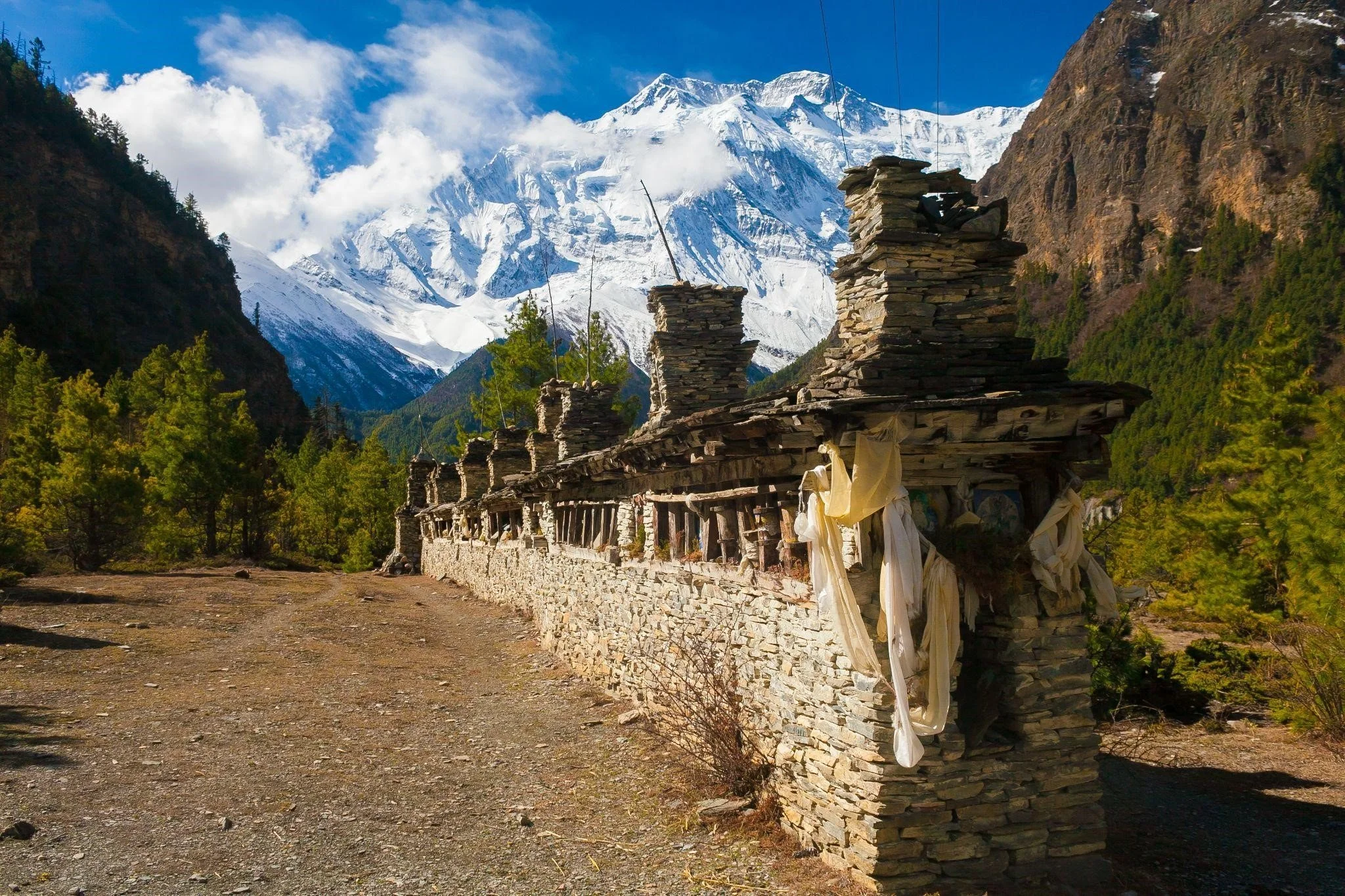
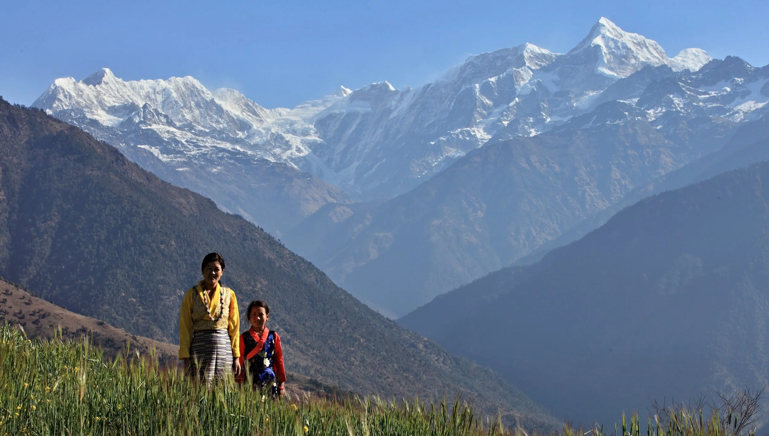
There is an interesting village called Gatlang in Rasuwa district, to the north of Kathmandu, which is inhabited by people of the Tamang community, and which suffered great devastation during the 2015 quake. To reach there, you have to first travel by bus for an entire day, a distance of about 130 km, from the capital to Syabrubesi. This is the starting point of your trek to Gatlang. The narrow trail goes quite steeply uphill, reaching 2,300 meters in height, and this is when you get good views of Langtang Himal, Ganesh Himal, and the Gosaikunda range, as also the Kerung range in far off Tibet. The landscape is enchanting. From Gatlang, you get to have panoramic views of Langtang Lirung (7,256 m) and Langtang II (6,561 m). The sunsets over distant mountain peaks are truly spellbinding. If simplicity is what you are looking for, then Gatlang is just the place for you. A warm welcome awaits every visitor, the Tamang people are as hospitable as they are simple, and you can also enjoy intermingling with them all the more by staying at a homestay. Other options include a community lodge also assured of comfortable lodgings at one facility or the other, be it a homestay, a community lodge and a private boarding house. The people here, despite the substantial number of tourists going their way, have managed to hold on to their traditional way of life, which includes a unique culture and distinctive identity. All the houses in this village are built of stacked stones and the roofs are of wood. The dresses worn by the local are of Tibetan style, and one of the most distinctive features of the women’s accoutrement are the large round gold plated earrings that adorn their ears. Similarly, a unique part of their culture is the custom of making mits and mitnis (best friends for life) by boys and girls, respectively, at a communal ceremony. Religion plays a big part of life here, the Tamangs being predominantly followers of Tibetan Buddhism. The Tamangs also have their own dances, some of which are popular all over the country. Shamans are also a part of life for them, and watching them exorcise evil spirits is pretty spellbinding, what with the jingling of many bells worn on a belt over the shoulders, the hypnotic beat of one-sided hand held drums, rhythmic chants, and so on. All this points towards a rich and ancient heritage, which is what you experience on a trek on the Tamang Heritage Trail. The trail goes through numerous villages like Langtang village, Thang Shyap, Ghore Tabela (about 3,000 m), and Kyangjin (3,900 m), besides Gatlang. As you hike uphill from Ghore Tabela to Langtang, the Langtang Himals to the north offer themselves as a splendid sight, and when on the way to Kyangjin, you’ll be crossing the outer margins of the Ledrup Lirung glacier. Some interesting and lesser known Himalayan peaks to be viewed from Kyangjin are Kyangjin Ri (4,770 m), Brana Chumso (4,350 m), and Menchmasu (4,650 m). In case you have enough stamina, and the interest, you can also hike up to Tsergo Ri (4,984 m), a four-five hour trek. Langtang, naturally the biggest village in the valley, has a significant role as a regional trading center. You’ll not fail to notice a rather large complex of mani-stones and mani-walls near the village, and the elaborately carved doors and numerous prayer flags on the houses. The sight of herds of grazing yaks will certainly grab your attention, as well. The other big village, Kyangjin, has a large number of lodges, twenty in number and counting. But, you’ll not find another lodge on the trail after Kyangjin.
Panch Pokhari Trek - Part II
Why Nepal is a Trekkers’ Paradise
The Everest Base Camp and Annapurna Base Camp treks may be the most famous treks of Nepal, but there are also many other trails that are exciting and challenging. Here’s a series of treks that are becoming more popular by the season.
The next day, it’s time to head back. The hike is mostly downhill, so easy on the legs, and you are back in Nasim Pati for a night halt. Next on the route is Dukang (2,100 m) another overnight. Come dawn, and you hike to Dhap (1,200 m), and then Melamchi Bazaar (800 m), from where you drive back to the capital. As you may have noticed this trek is quite a leisurely one, the uphills notwithstanding, but there’s one other route to reach Panch Pokhari. This is ideal for those with scarce time on their hands, taking about four to five days only. No doubt, spending more time in such pristine surroundings, and experiencing different cultures, is an opportunity of a lifetime, so most trekkers prefer the ten-day trek. Anyway, if you don’t have a lot of time, take a bus drive up to Melamchi Bazaar, going via Sankhu, an ancient Newar town about seventeen kilometers from the capital, and which has a conch-shaped look, so the name (conch is sankhu in Nepali). The road is not at its best at most times, so the ride could be less than comfortable. Anyway, you’ll reach Melamchi in about three hours. Melamchi is very much in the spotlight since quite some time now, due to the fact that there’s an ongoing water supply project designed to bring the plentiful water of the Melamchi River to the capital, which faces acute water shortage. If you are going at a time when there’s a festival on in the area, the bus may even take you to Mane Kharka, and perhaps as far as Bhotang. Lunch (daal-bhaat) halt is at a place called Tipni, which is some one-and-a-half-hour from Melamchi. You are likely to see plenty of yellow mustard fields around, with high mountains surrounding them. From Mane Kharka, Bhotang is at a distance of about one hour, and this is where you will spend the night in a guest house. Have your fill of the piping hot food there, because you’ll be hiking from the next morning, when your first destination is Tangu, and which you’ll reach after climbing a long and steep flight of stone steps and then hiking steadily uphill. On the way, you’ll also come across a lovely stream, as well as a cascading waterfall, and it’s all a very pleasing trek, no doubt, even if it’s uphill and through dense vegetation. Naturally, it’s exhausting, as well, so you take good rest at Tangu. The next day’s hike is even more challenging, and very taxing on your limbs and on your back, since you’ll be walking ever upwards. Five hours of this will see you in Nasim Pati, where you’ll set up camp, of course. And then, the following morning you walk along mountain ridges before finally arriving at the fabled Panch Pokhari. The return trip, after the mandatory dip(s) in one of the pokharis, and an eyeful of magnificent landscape from the nearby hilltop, sees you back in Nasim Pati, where you spend the night again. Sleep well and take good rest, because the next day involves a full day of hiking to reach Bhotang, which is your night halt for the day. Early next morning, you continue your trek for about four more hours to finally reach Melamchi, and then it’s off to Kathmandu on a bus.
SIMILAR POSTS
Panch Pokhari Trek - Part I
Why Nepal is a Trekkers’ Paradise
The Everest Base Camp and Annapurna Base Camp treks may be the most famous treks of Nepal, but there are also many other trails that are exciting and challenging. Here’s a series of treks that are becoming more popular by the season.
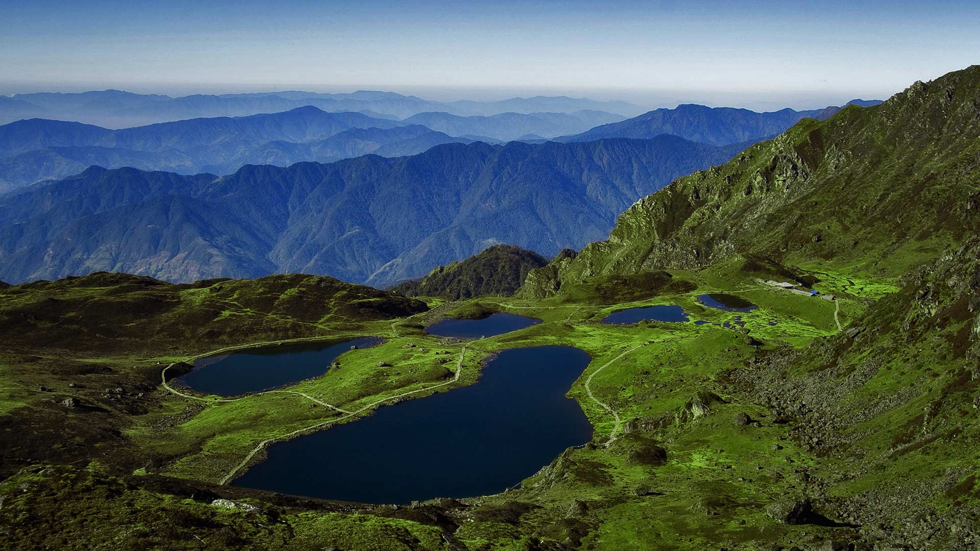
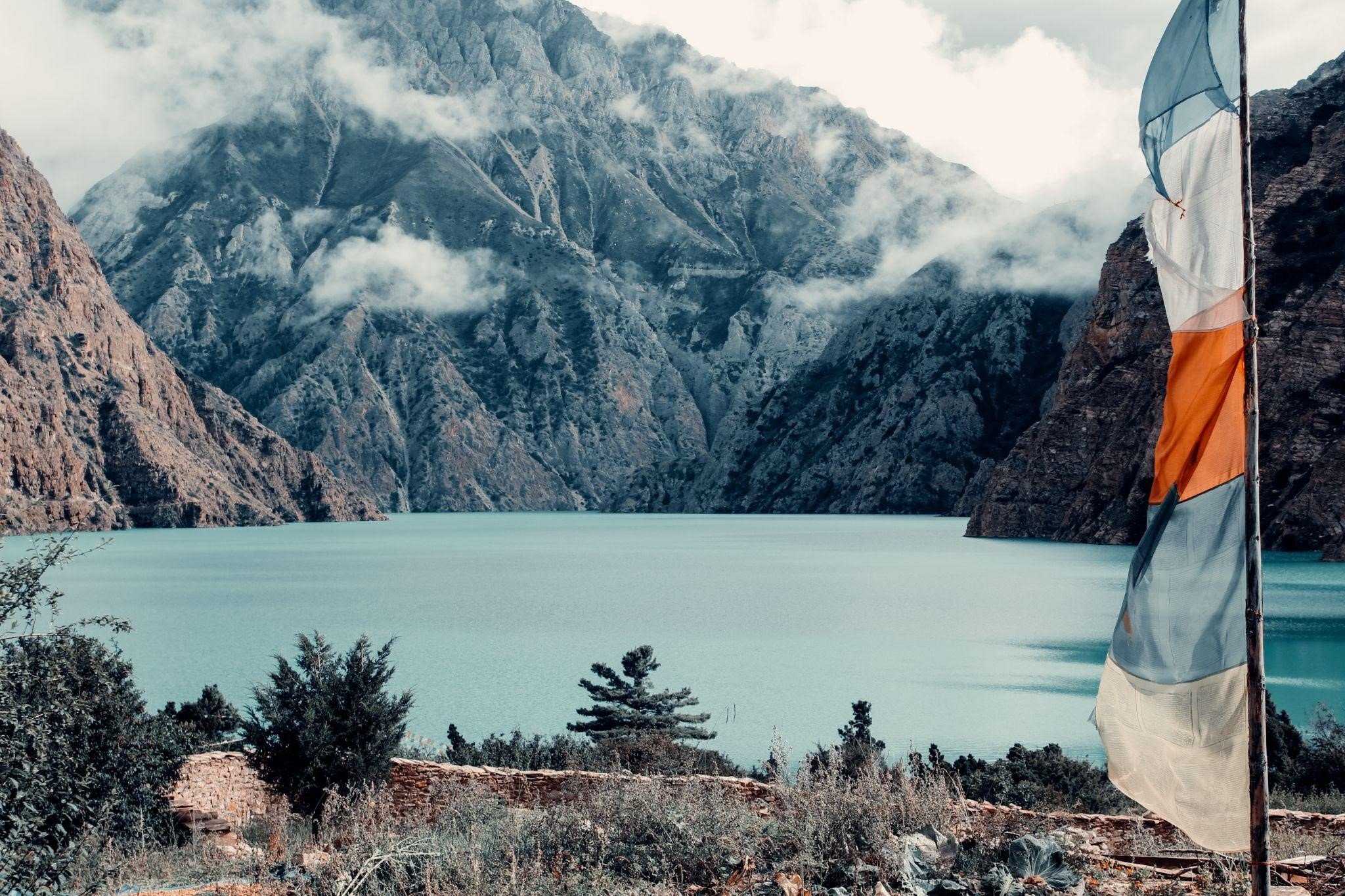
Panch Pokhari (4,100 m) is located to the capital’s northeast at the base of the Jugal Himal, a chain of peaks that includes Dorjee Lhakpa (6,966m), Phurbi Chhyachu (6,637m), and Madiya (6,257m) in Nepal, as well as Shishapangma (8,027 m) in south-central Tibet. This trekking route is a relatively new one, and the ideal time to do this trek is between October and May. Panch Pokhari means “Five Ponds”, and like most such sites, is important from both the cultural and religious aspects. Here, too, many devotees come in August during the Janai Purnima festival, when they change their janai (sacred thread worn by Brahmins around their bodies). Panch Pokhari, because of its altitude, also carried ecological significance. You’ll be mostly among Tamangs and Sherpas during this ten-day trek, which begins at Chautara (1,200 m). You drive there from Kathmandu, and around five hours later you’ll be there, the district headquarters of Sindhupalchok district, an area that was devastated by the 7.8 M earthquake in April 2015, followed by a 6.7 M aftershock that affected this district the most. As a result, more than 3,000 people lost their lives here, and in Chautara itself, more than ninety percent of the houses were destroyed. It is, of course, on its way to recovery now, and you’ll be halting for the night here. The following day, you start hiking to Phusre (2,045 m), reaching there in about six hours. It’s an uphill trek, and you’ll be glad to stop for the night. The next day’s hike continues gradually uphill to reach Kami Kharka (2,845 m) in six hours or so. On the way, the great views of Gaurishankar, Dorje Lakpa, and Jugal Himal range will uplift your spirit. The air is cool, and the scenery is splendid, this area being a grazing ground for livestock. You halt here in a trekking camp, and next morning, you hike for another six hours or so to arrive at Pauwa Bas (3,000 m). The fourth day sees you trekking to Hile Bhanjyang (3,400m), and similarly, the fifth day, you hike to Nasim Pati (3,700 m), passing Tangu village on the way. This is the final point before reaching your ultimate destination, that is, Panch Pokhari. Nasim Pati provides spectacular views, and you can stay the night in a rest house here. . Before reaching Panch Pokhari, however, you have to trek along some pretty difficult ridges. which will take around two hours, or thereabouts. Then, you’ll see a sign welcoming you to Panch Pokhari, and sometime later, you are there. The clear blue ponds are surrounded by green hills, and the scene is a very serene one. There are a number of rest houses, along with a temple. You should take a dip in the water, as it’s sure to refresh and rejuvenate you. Walking up to a hill top, you’ll be treated to a spectacular view of the Kanchenjunga, Rolwaling, Makalu, and of course, the Jugal Himal, ranges. Take a well-deserved rest here and have a peaceful night of deep sleep.
SIMILAR POSTS

Numbur Cheese Circuit Trek
Why Nepal is a Trekker’s Paradise
The Everest Base Camp and Annapurna Base Camp treks are so well-known around the world that they are often referred to as simply, EBS and ABC. However, Nepal is called a trekkers’ paradise not only for these two famous treks; there are numerous other trails that are as exciting. Here’s a series of lesser-known trails that are becoming more popular by the season.
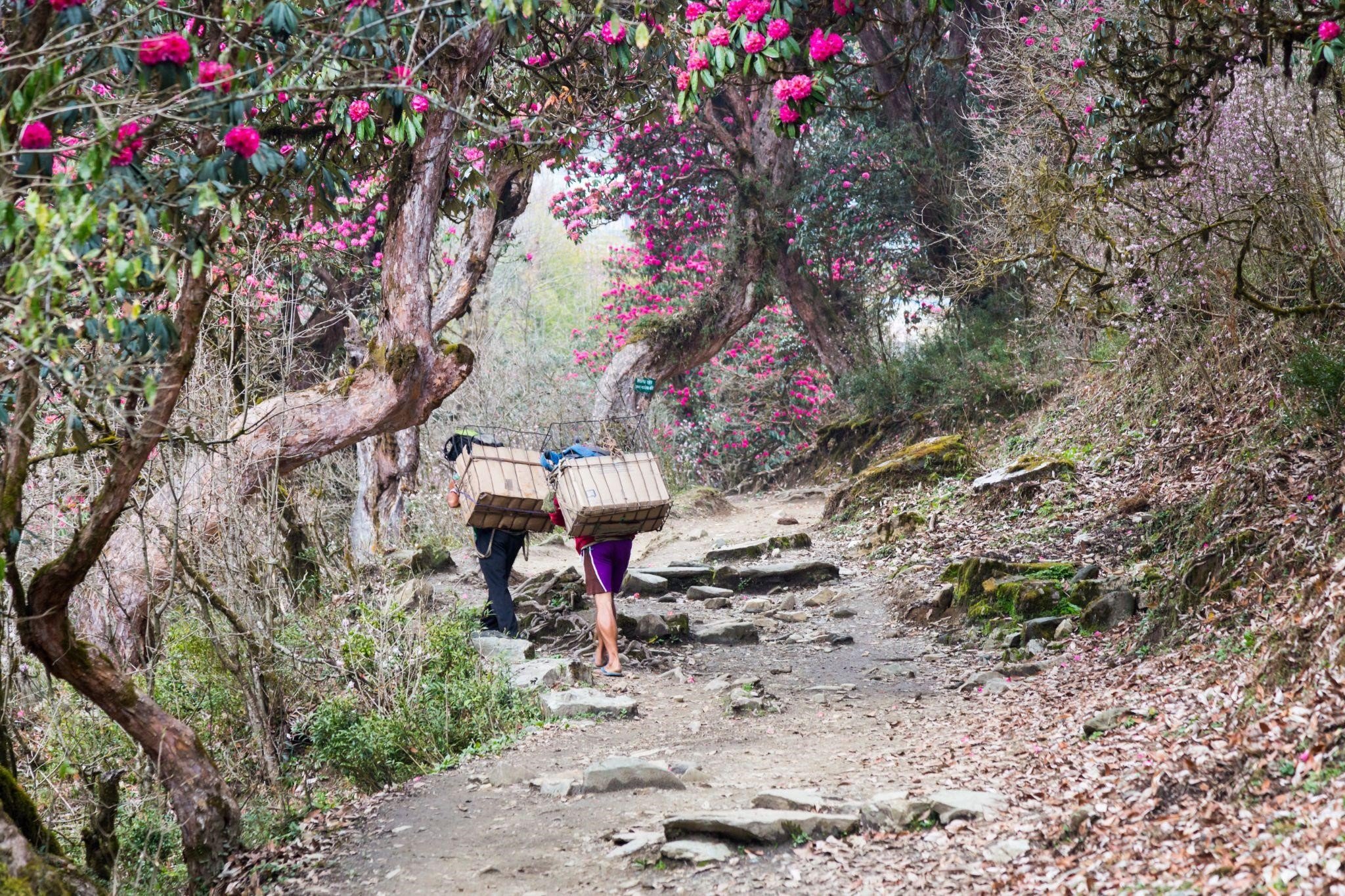
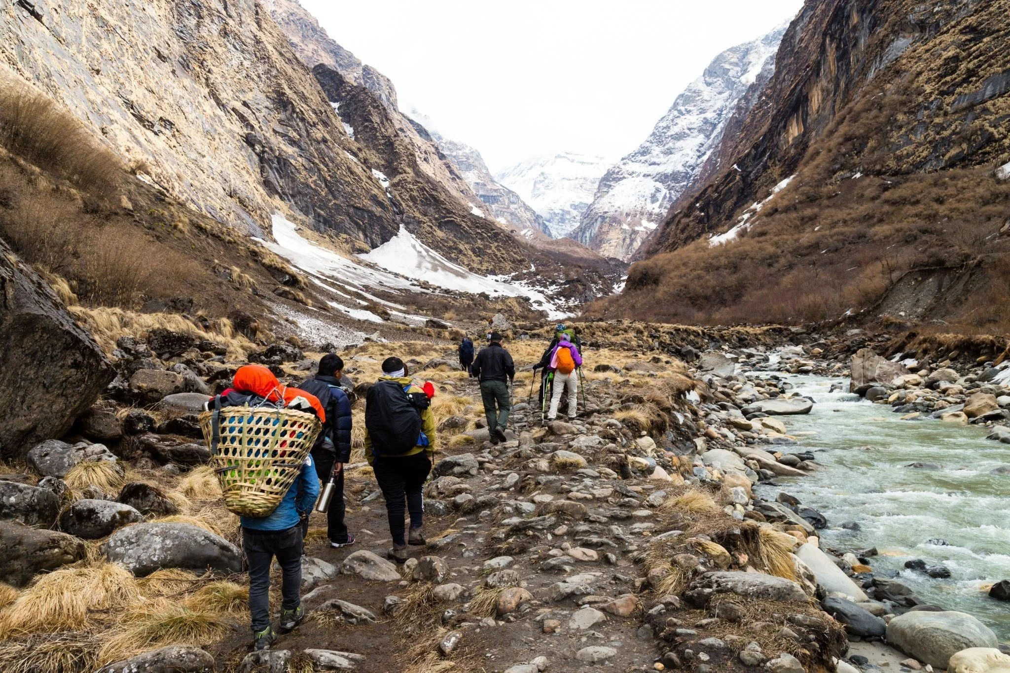
There’s a place called Ramechaap, east from Kathmandu some 184 km away that had once the unenviable reputation of being a place of largely ignorant folks, despite its proximity to the capital. Of course, times have changed, and it is not true anymore. What’s more, the region is now gaining fame for the increasing popularity of what’s known as the Numbur Cheese Circuit that goes through the area. It is a two-week trek that offers lovely scenes of the mountain landscape and splendid views of fantastic Himalayan peaks, along with pleasing sights of rhododendrons in bloom.
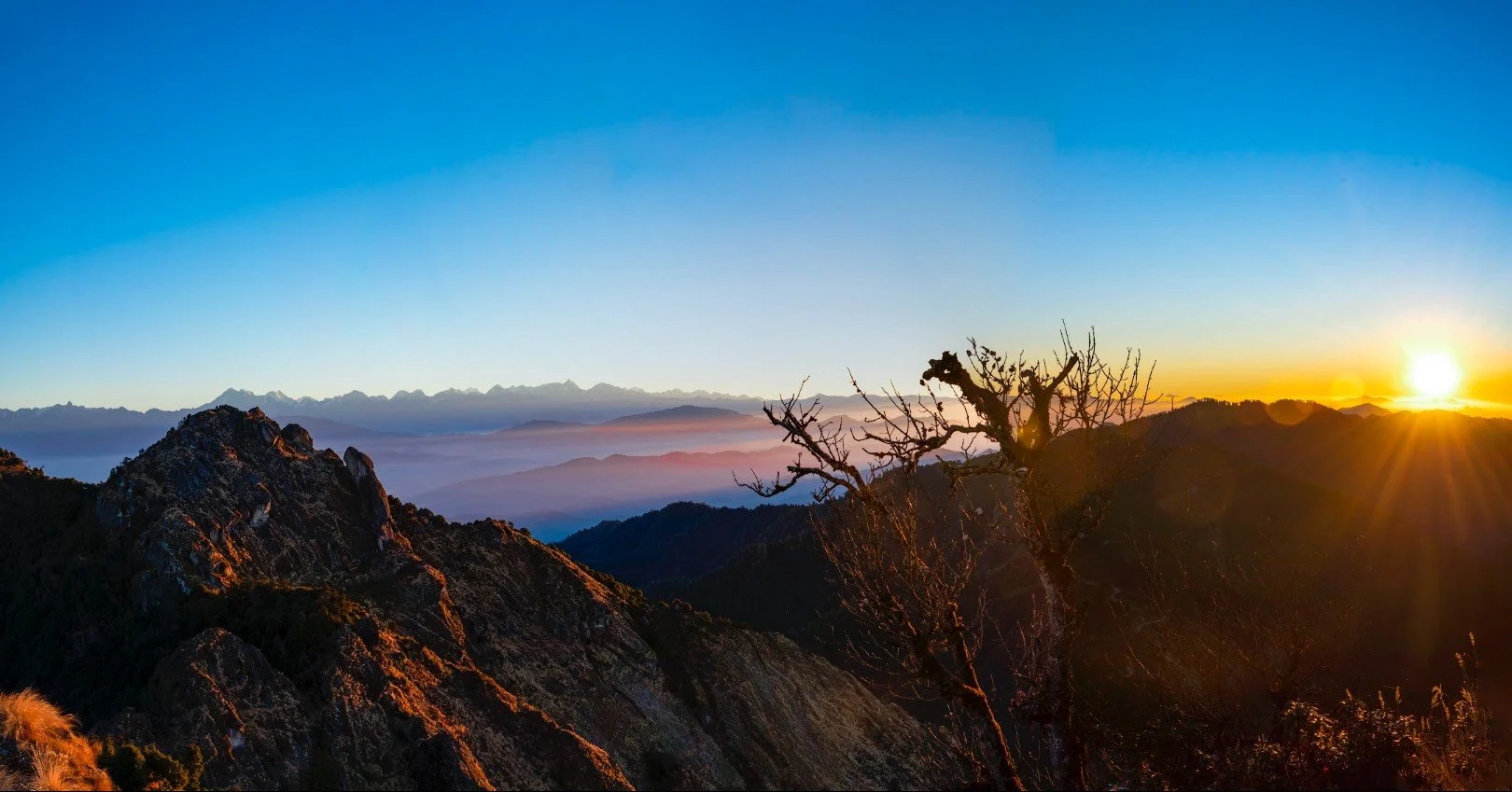
The Numbur Cheese Circuit, which links up the two picturesque valleys of Khimti and Likhu in the well-known Rolwaling region, is so named after the Numburchuli peak (6959 m), a virginal Himalayan peak, and the very first yak cheese factory in the country, which was founded way back in 1957. The topography is diverse, and the terrain is quite varied, with glacial lakes, alpine vegetation, river gorges, and terraced rice fields, besides quite a number of small villages. The trail goes along the shadows of the massive Numburchuli and Bigphera Go Nup peaks, and offers awesome views of the Langtang Himal range, along with Gaurishnaker and Jugal, especially more so from the Gyajo La (4880 m) and Panchpokhari (4605 m) passes, with the panorama extending into Tibet to the north and Pikey Peak to the south. The renowned Thodung Monastery lies on the way, as do some cheese factories, both of which are very much worth visiting. Now, here’s something that should be of special interest: visit the region around March/April for something really splendid, the sight of rolling hills of red due to the abundance of fully-bloomed rhododendron flowers. There’s wildlife, too; Himalayan tahr and musk deer being the prime ones, and snow leopard, as well, though they are highly elusive creatures. The population of the region consists of twenty-one different ethnicities, each with its own culture and lifestyle. Another distinct attraction of this popular trek is the opportunity to get up-close with Sherpa families by staying at one of their homestays and tasting Sherpa cuisine, which includes organic potatoes and high altitude tea. So, how do you start this interesting trek? Okay, first you take the nine-hour drive from the capital to a place called Shivalaya (1790 m), where you bed down for the night in a hotel. The next day, you hike for four hours to arrive at Khahare (2175 m), where you set up camp, and the following morning, you hike again for four hours to reach Panipakha (3105 m). It’s all uphill, so you’ll find the going pretty challenging. You carry on the next morning to Manedanda (3940 m), three hours away from Panipakha. In the coming days, your trek will take you to Panchpokhari (4515 m), a four-hour hike, and then Tare (5 h, 4140 m). You carry on downhill thenceforth to reach Ngeju (2665 m) in about four hours, followed by Lhachhewar (2665 m), Kyama (2380 m), and Gumdel (2255 m). It’s a flat trail till now, but you’ll be going uphill again, reaching Serding (3360 m) in three hours or so, then Lapchane (3150 m) in another five hours. The final part is a descent to Those (3 h, 1755 m), from where a bus takes you back to the capital (9 h).
The Kalinchowk Trek Part 2
Why Nepal is a Trekker’s Paradise
The Everest Base Camp and Annapurna Base Camp treks are so well-known that they are often referred to as simply, EBS and ABC. Nevertheless, Nepal is a trekkers’ paradise not only for these two popular treks; there are many other trails that are exciting and challenging,. Here’s a series of trails that are becoming more familiar by the season.
You, of course, carry on along the main trail, and two hours or so later, you’ll arrive at Thangsa, and then, another half hour takes you to Gairidanda (2,540 m), a ridge point that gives excellent views (danda means ridge). If the weather is clear, the northeastern Himalayan range offers a splendid sight for hungry eyes. However, one cannot expect everything to go as one wants, and the clouds up at these heights can be quite disturbing, so you have to be ready for anything, including disappointment at not seeing the magnificent Himalayan peaks. However, you’ll be somewhat compensated by the sight of Chayuris (cow and yak crossbreeds) grazing on the lusciously green hillsides, which is also a pretty picture. You may as well take a lengthy break at Gairidanda, because after that, for the next four-five hours, you’ll not come across any settlements. So, it wouldn’t be a bad idea to get adequately nourished with tough grilled yak meat and thick tea made of chyauri milk. Now, up ahead, the trek begins to be a back breaking one, with the trail climbing steeply uphill through thick forests of a variety of high altitude trees, as well as Rhododendron, the national flower. This part of the trek consists of a four-hour climb that will surely test your stamina, not to mention your back and legs. After reaching the top, where there is a stone deity image (as is usually is on most ridge tops), you are advised to make a longish halt, which will help to acclimatize you to the higher altitude. The trail then descends to a small valley, from where some distance ahead is Kuri Kharka (3,200 m), where you spend the night in one of the shack-like ‘guest houses’ around.
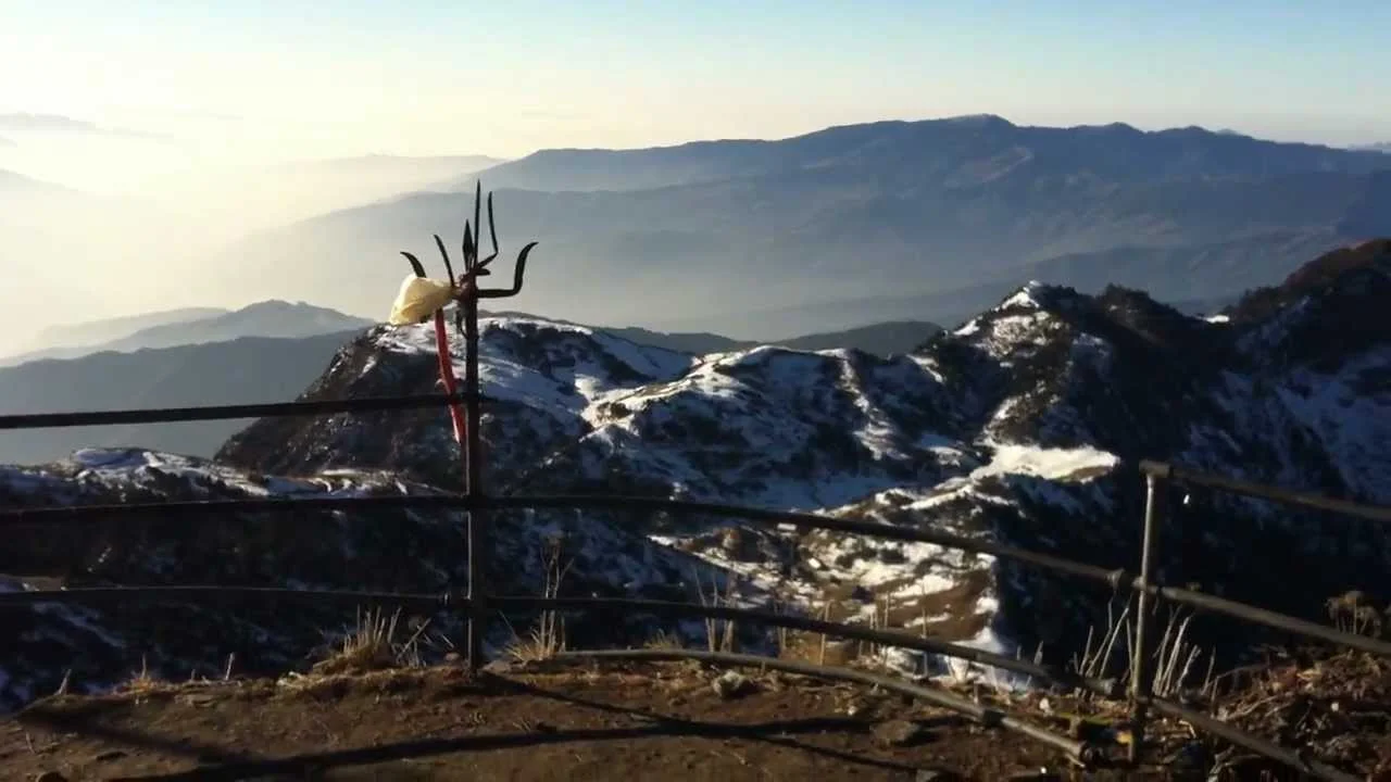
A good night’s sleep, hopefully, and a sunny morning, again hopefully, paints a more enthusiastic and inspiring picture of magnificent mountains all around. Nice sight, but not much fun to climb! The trail now carries straight up again, this time across a mountain face, which naturally results in pretty ragged breathing all around, and an extremely slow pace. But, when you reach the top, you get a fantastic view of Gaurishanker, the goddess mountain, which stands apart from the other peaks on the horizon, with Melungtse Himal (7,023 m) beside her. From here, it’s only 200 meters more to the Kalinchowk Temple, but is a slow climb, since the track is narrow, and then there’s that deep gully on one side, and the high mountain on the other. So, it is a scary sight, yes—looks quite dangerous, doesn’t it? So, it is no surprise that it can take you more than two hours to reach the temple. Before you arrive there, however, there’s one more bridge to cross. Literally! An iron stairway across a chasm between the two opposite crests is what awaits you, and you’ll have to somehow pick up the courage to crawl across it. Reminds you of Indiana Jones, does it? Anyway, having done so, you then climb to the very top, which is barely 200 or so square feet in area, and here is where stands Kalinchowk Temple, dedicated to Kalinchowk, another form of Goddess Bhagwati, that powerful Mother Goddess of the Hindu pantheon. She is symbolized by a natural spring arising in a small pit, and all around the site, you’ll find many tridents, that three-forked weapon of the goddess. It should all inspire you. Even if it doesn’t, the awesome panoramic views from here definitely should!
The Kalinchowk Trek Part 1
Why Nepal is a Trekker’s Paradise
The Everest Base Camp and Annapurna Base Camp treks are so well-known that they are often referred to as simply, EBC and ABC. Nevertheless, Nepal is a trekkers’ paradise not only for these two popular treks; there are many other trails that are exciting and challenging. Here’s a series of trails that are becoming more familiar by the season.
It is the Arniko Highway that most trekkers drive on to get to their respective take-off points for quite a few treks in regions north of the capital. It’s a good road, so that’s a good thing, because you reach your destination faster, saving you precious time. And so, that’s how you start your Kalinchowk trek, it’s a pleasant beginning. However, you might be less pleased to know that you’ll be trekking in an isolated area and hiking through some pretty dense forests on the way, one of which, especially, has seen its fair share of robberies. So, be warned!
Anyway, you first drive to Charikot, which should take around five hours. This picturesque town is 133 km northeast of Kathmandu, atop a hill at 1,733 meters. The trek to Kalinchowk from here mean you will be climbing to a height of 3,782 meters, and so it is bound to challenge your mettle, both physical and mental. At the same time , it need not be said that the scenery you encounter will be really lovely, the route passing across terraced fields of millet and mustard, forests of sweet smelling pine trees, hemlock, and what not, and thick droves of gracefully swaying bamboo. Soon after you start hiking, you’ll get splendid views of the Tamakosi River way down below, to the south, while to the north are of course, the mighty Himalayan peaks, Gaurishanker (7,134 m) being, without a shred of doubt, the most prominent and impressive.
As you near Chothang village, which is also called “Hotel Danda”, you will observe chortens with Nepali inscriptions and stone memorials with Tibetan inscriptions all along the trail. Such memorials to the dead is a common tradition for the largely Sherpa, Magar, Lama, and Tamang villagers who live around here. Carry on hiking, and now you’ll notice that there’s a clear change in the geography, with the rhododendron and pine forests becoming denser as you climb, and at some point, you’ll find the tall trees almost completely blocking out the light. This is where many robberies apparently have occurred, so you’ll be walking a bit faster through this part of the woods, right?
All going well, and no Robin Hoods having made their presence felt, you emerge onto a lovely setting that’s pretty enchanting. It has as its centerpiece, a heart-shaped, moss-covered pool of water, that’s known as Simpani. You can rest easier now, and take your time enjoying the beautiful scenery, since your next stop will be at a place only a half hour later; it’s called Deurali (2,350 m), and it has some very welcome teashops. And, hot tea is what’s most welcome, what with the chilly weather up here. A fork up ahead has tracks going down to some villages. Chhyamamwati and Makaibari have Tamang, Magar, and Sherpa inhabitants, while Shuspa village has an ethnic group called Thami.
Kathmandu is more than temples; it is a city of living legends.
From the mysterious Taleju Temple to the story of Kasthamandap and the Living Kumari, these ancient spaces carry myths that have shaped the Valley for centuries. Dates tell history, but stories give it meaning.
Discover the legends that still breathe through Kathmandu’s timeless temples.