
An Adventure In Upper Mustang | Part II
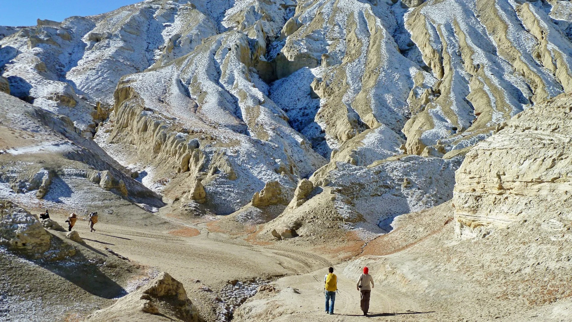
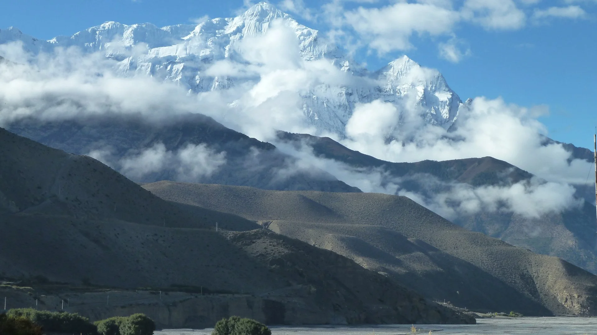
The Himalayas are a cure for every spiritual turmoil. The trails of upper mustang offer you an opportunity to experience the dessert terrain, scattered green pastures and the majesty of the stunning peaks such as Nilgiri, Annapurna and Dhaulagiri.
Trek Itinerary
Day 1: Arrival in Kathmandu and Flight/ Drive to Pokhara
Once you land in Kathmandu, our team shall transport you to our hotel. After checking in, you can rest for a while before pursuing further. A flight to Pokhara is at an average of 15 minutes, whereas a drive ranges between 6-8 hours. A flight to Pokhara allows you to visit a few sights in Kathmandu. It also exempts you from a long bus journey.
Day 2: Flight to Jomsom and Trek to Kagbeni
Trek time: 3 to 4 hours
The flight to Jomsom from Pokhara is approximately 20 minutes. The real journey begins here. After you land at the airport, you are greeted with a teaser of the trek and views ahead. Your first destination is the mystical town known as Kagbeni. Firstly, you shall cross a small bridge. After that, the trail is well marked and relatively easy compared to the road ahead. When at Kagbeni, walled passages greet you with an archaic feel. The walls feature clay effigies and decorations. The stone houses transport you to a different realm altogether.
Day 3: Kagbeni to Chele
Altitude: 3050m
Trek Time: 6 hours
After spending a beautiful night at Kagbeni, the trek to Chele begins after a hearty breakfast. The trail follows the winding Kali Gandaki river. You get to witness the absolute depth of the valley gorges during this hike. The village of Tanbe is an oasis on the trail. You can stop here to catch your breath and admire the white-washed houses and the beautiful fields of buckwheat and barley. This landscape also features splendid apple orchards.
Did you know the apples of this region are prized for their rich taste? The locals also create various drinks and snacks with the apples. You should definitely grab a few to indulge during your trip. Further in the hike, you follow a ridgeline which takes you to Chele village.
Day 4: Chele to Syangmoche
Altitude: 3475m
Trek Time: 6 hours
The previous hikes seem easy compared to the trail ahead. During your journey to Syangmoche, you shall cross your first big pass- Taklam pass. The pass stands tall at an altitude of 3624m. As soon as you’re done with Taklam La pass, you are greeted with Darjori La pass at 3737m. Every risk comes with its reward. The trail offers breathtaking mountain views and glimpses of peculiar caves. As you walk further, you decend into Samar Village. You need to follow a ridge and cross a narrow steep trail during the final mile of Syangmoche.
Day 5: Synagmoche to Ghami
Altitude: 3500m
Trek Time: 5 hours
After a hearty breakfast, you shall embark on another challenging trail. You shall cross two passes in this leg Yamada La at 3850m and Nyi Pass at 4010m. As you embark further stunning landscape views of stone villages with lush barley fields greet you. Before you descend down to Ghami, you need to cross the second pass- Nyi Pass at 4010m. The village of Ghami is a picture perfect village. After refreshing yourself, you can indulge in a brisk village walk.
To be continued in the next blog…
POPULAR ITINERARIES
SIMILAR POSTS
An Adventure In Upper Mustang | Part I
The allure of the vast yonder of Upper Mustang has been a true calling for numerous adventurers. Formerly known as the Kingdom of Lo, the reminiscences of a bygone era are still visible in the region. An adventure to this land is a lifetime of memories.
Up until 2008, the Government of Nepal officially recognised the Kingdom of Lo as a Kingdom. The last recorded king (raja or gyelpo) was Jigme Dorje Palbar Bista. His lineage is traced back to 1380 AD. He is a descendant of Ame Pal, the king who oversaw the foundation and construction of Lo Manthang, the walled capital of Lo and Mustang.
In terms of geography, Traditional Mustang ( Lo Kingdom) ranges from 2750m (9020ft) above sea level at its lowest point. The highest point is 7600m (22,00 ft) at Khamjung Himal, north of Kagbeni. Hydrographically, the main feature is Gandaki River. It runs southwards to the Terai bisecting Mustang. Traders used the route to travel between Tibet and India. The Kali Gandaki Gorge is regarded as the deepest gorge in the world.
Where do I get the permit and card? How much does it cost?
As per the department of immigration, a fee of USD 500 is charged for the first 10 days. Beyond which USD 50 is levied per person/day. A trekker needs to pay the ACAP Permit, $20 per person. The TIMS (Trekkers Information Management System) card is not required in Upper Mustang. Trekkers are required to present the RAP (Restricted Area Permit).
Can I trek to Upper Mustang alone?
No! You are not allowed to trek the Upper Mustang region alone. Neither you nor an individual guide can obtain the RAP. The permit can only be requested by a registered trekking company. However, you can acquire the TIMS and ACAP Permit at Nepal Tourism Board in Kathmandu and the Tourist Office in Pokhara.
How do I start?
Once you have landed at TIA (Tribhuvan International Airport), you can either experience a bit of the capital (Kathmandu) for a few days or get a connecting flight to Pokhara. The distance between Pokhara and Kathmandu is 200 KM. You can opt to take a bus instead of a flight as well. Your available options are either local or deluxe buses.
Deluxe buses leave at 7 AM from Sorakhute Bus Station in Kathmandu. You may either book a ticket beforehand or arrive an hour early, pay and embark directly at the terminal. We recommend these buses as they have air conditioning. The travel time ranges between 7-8 hours, with stops for lunch and snacks at good quality rest stops.
You can skip all of the hassles by contacting the front desk officer at the hotel. S/he shall do their best to arrange these services for you. They can also develop a proper itinerary to experience Lower Mustang at a reasonable rate.
When is the right time to trek?
In Nepal, Spring and Autumn is prime trekking season. The skies are clear with light to minimal rainfall. Autumn (Mid-September to Mid-November) is best for Lower Mustang Trek.
During other months such as December - February, the climate is colder and potential high snowfall may not allow you to trek above High Camp. Whereas during pre-monsoon ( Mid-May to Mid-July) and monsoon (Mid-July to Mid-September), chances of rain and clouding are high. The forest area shall be full of leeches and mosquito's.
Spring (Mid-March to Mid-May) is also a great time to trek this region. Temperature is nominal, and winds are light, allowing you to have a beautiful walk. The plant life will be blossoming: amplifying the atmosphere.
What should I wear and carry?
Proper clothing is vital while trekking to remote areas. In Spring and Autumn, you need summer/light clothing for the day hours and warmers for the night. If you’re travelling during the pre-winter and winter months, you need to wear your heavy jacket. During pre-winter and winter, warm clothes are essential. A heavily padded jacket, full sleeve t-shirt and fleece-lined pants are essential. During spring and autumn, a parka is mandatory. An umbrella and a raincoat should be carried as well.
Does the trek cost the same around the year?
No, the cost presented to you by your tour agent varies as per the season. The cost of accommodation is higher during peak season. Food costs rise during winter as transportation of goods becomes difficult. During peak season, you are bound to be over-charged. Off-season treks are usually less expensive due to slow business. You’ll get a sweet deal if you time your adventure off-season.
POPULAR ITINERARIES
SIMILAR POSTS
Mountaineering Adventure In Nepal
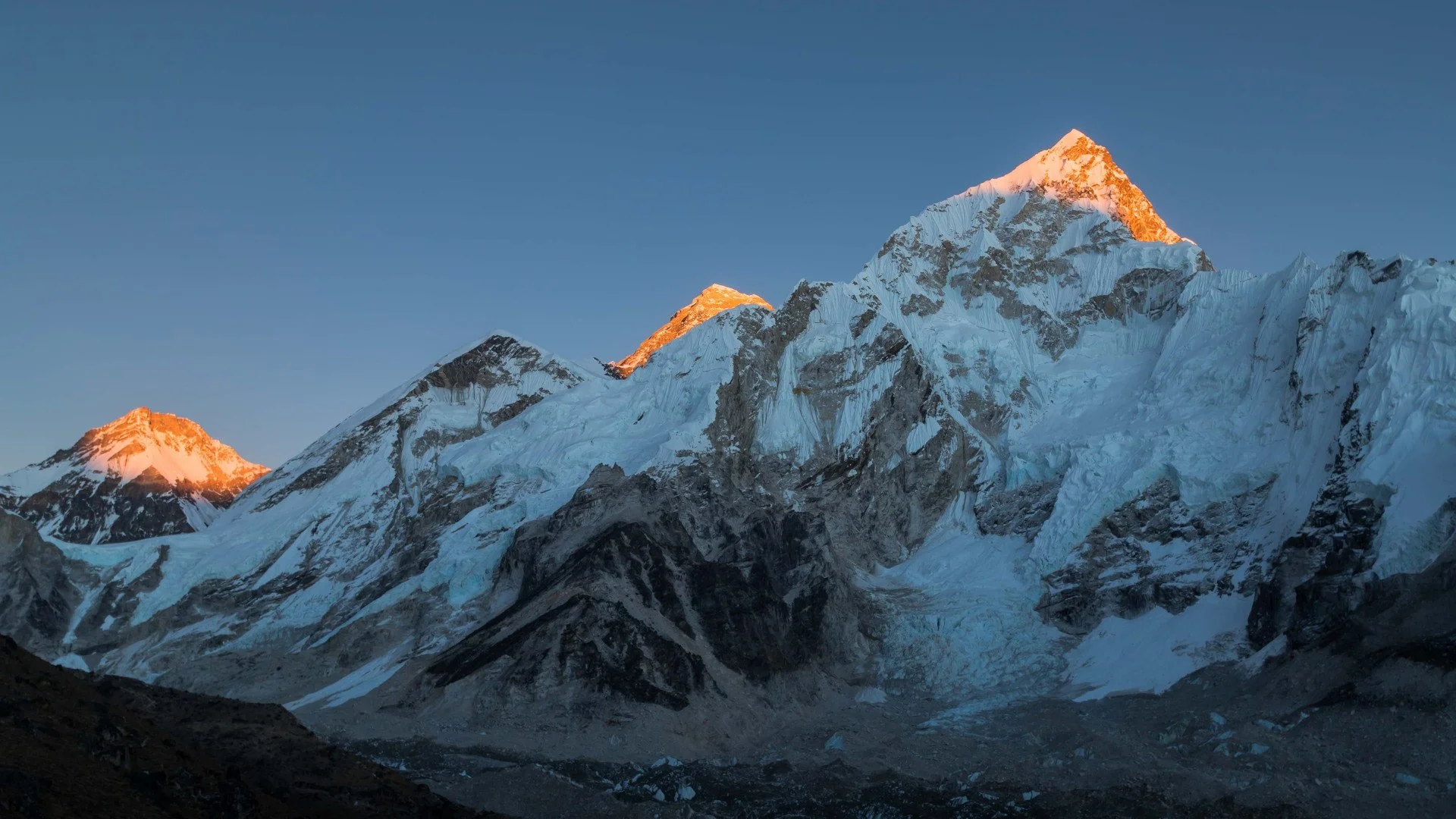
Many souls crave an adventure in the Himalayas. There are numerous snow-covered peaks in Nepal. They are open to national and international mountaineers to the summit. In this blog, we shall look into some of these majestic mountains.
The art of climbing a mountain is a hard-earned skill. It is a challenge and an adventure that takes you to one of the most remote regions of this nation and allows you great views that are unfathomable.After the first successful summit of Mt Everest by Tenzing Norgay and Edmund Hillary, mountaineering took great leaps. After this summit, the Nepalese authorities also took steps to develop mountaineering infrastructure and regulations.
When is Nepal’s climbing season?
Nepal has two main climbing seasons:
1. March to Early May: This period is considered the golden period for mountaineering adventures. The days and nights are typically warmer this time of the year. The visibility during this period is also nominal.
2. September to November: The nights during this period are more chilly than between March to Early May. The visibility is nominal with minimal weather disturbances.
How do I acquire a climbing permit?
Every climber must adhere to laws set by the Government of Nepal during their expedition. Please click on the following link to know more about the rules and regulations related to mountaineering expeditions: [Click Here]
Nepal Mountaineering Association issues the climbing permits. You are required to submit the following documents:
1. Bank Voucher from Nabil Bank of Permit Fee [Click here to find out the service charges for foreign climbers] and Garbage Deposit
2. Accidental insurance of 15 lakh
3. Medical insurance of 4 lakh and
4. Rescue insurance of Climbing Guide
(Documents 2,3&4 are required for Nepalese climbers as well)
Which peaks are open for climbers?
As per the tourism department of Nepal, 468 peaks are open and proposed to be open for climbing. You can [Click here] to view their profile.
How long is the permitted period?
The mountaineering permit is for a period of one month. The permission is open to an extension if required for two weeks. The period of permission relates to time spent climbing above base camp.
Will I also require a trekking permit on top of my climbing permit?
Yes, you need to acquire a TIMS card and trekking permit.
Where do I get mountaineering training?
The Nepal Mountaineering Association provides both basic and advanced mountaineering training in Nepal.
Top 2 beginner peaks in Nepal
1. Mera Peak
Elevation: 6470 M/ 21227 FT
Location: Province 1
District: Solukhumbu
Nearest Health Centre: Lukla 29.8 KM
Royalty Fees:
A. For Nepalese: Rs 4000(Spring) , 2000(Autumn), 1000 (Winter/Summer)
B. For Foreigners (USD): 250 (Spring), 125(Autumn), 70 (Winter/Summer)
Accessibility
From Kathmandu: Flight to Lukla
Caravan Route: Lukla-Chhatrala- Thanknak-Khare- Base Camp (BC)
Climbing Route Length: 4.2 KM
Duration: 17 Days
The Nepal Mountaineering Association provides both basic and advanced mountaineering training. Mera peak is the highest trekking peak in Nepal.
Nepal Mountaineering Association (NMA) manages the peak. Meera Peak is an expert recommendation for novice mountaineers due to its non-technical nature.
It is an eye-opener for enthusiasts of mountaineering. The summit of Mera offers a breathtaking of the world’s five highest mountains: Mount Everest, Lhotse, Kanchenjunga, Makalu and Cho Oyu.
2. Island Peak (Imja Tse)
Elevation: 6165 M/ 20226 FT
Location: Province 1
District: Solukhumbu
Nearest Health Centre: Namche 28.5 KM
Royalty Fees:
A.For Nepalese: Rs 4000(Spring) , 2000(Autumn), 1000 (Winter/Summer)
B.For Foreigners (USD): 250 (Spring), 125(Autumn), 70 (Winter/Summer)
Accessibility
From Kathmandu: Flight to Lukla
Caravan Route: Lukla- Namche- Khumjung- Dinboche- Chukung- Base Camp (BC)
Climbing Route Length: 2.4 KM
Duration: 18 Days
Imja Tse is also known as Island Peak. The peak got its nickname from a British Expedition en route to Mt Everest. As they looked towards Imja Tse, it seemed like an island in a sea of ice from Dingboche. The summit of Imja offers majestic views of Everest, Ama Dablam, Makalu, Nuptse, Baruntse, Lhotse and other famous summits. The climb to the summit is moreover straightforward. There are only a few sections that require technical manoeuvring.
POPULAR ITINERARIES
SIMILAR POSTS
An Adventure In Lower Mustang - Part III
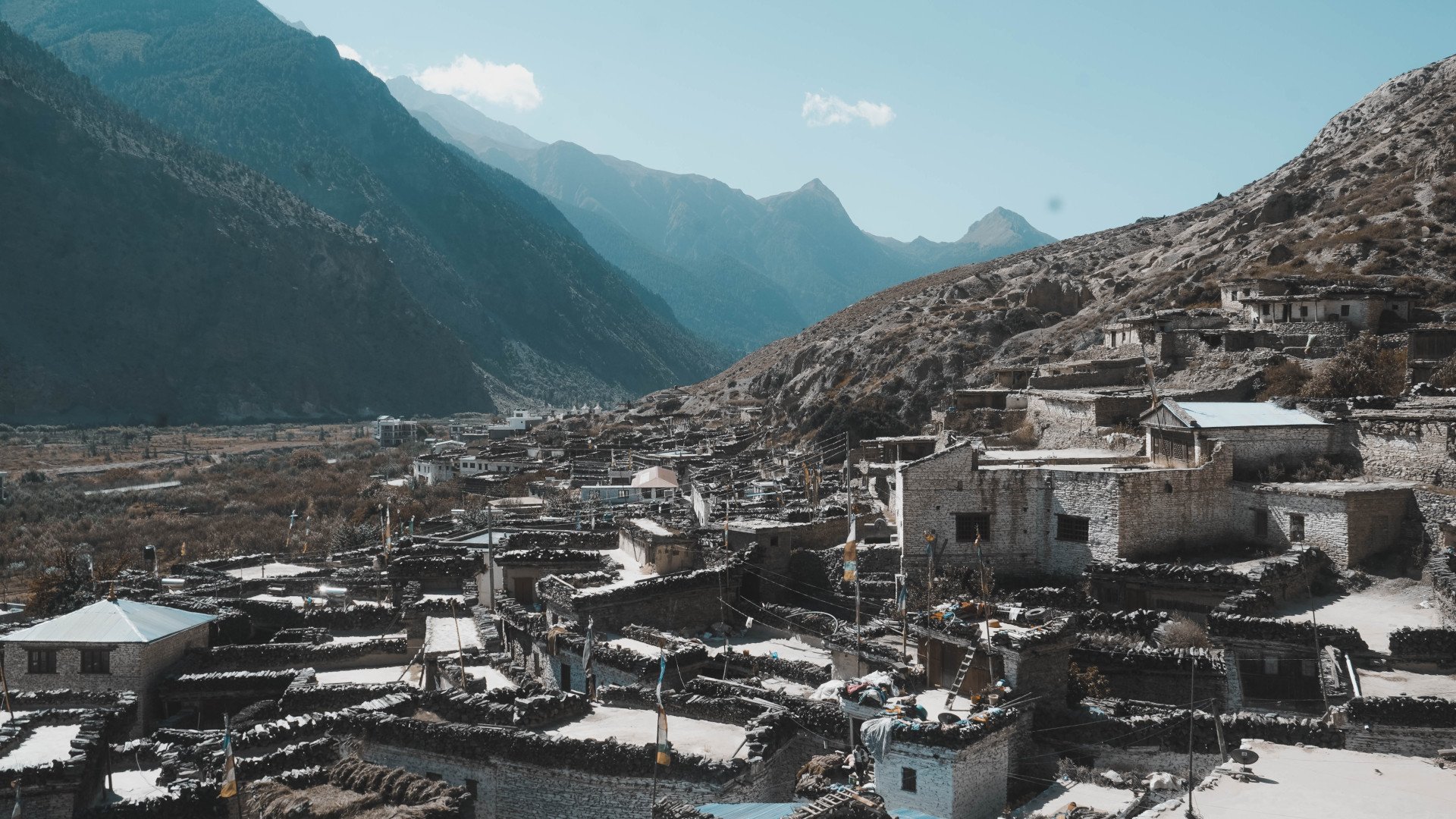
The region of Mustang is unique. Life in this part of Nepal is simple, peaceful and noteworthy. The people and their hospitality are memories that you can cherish for the rest of your life. This trek’s popularity comes from the opportunity to get a good glimpse of the Annapurna region in a short time duration.
Day 5: Trek to Jharkot
Total Trek Time: 3-4 hours
This segment of the trek is where you gain the most altitude. If you are in peak physical condition, you will be able to complete this leg of this journey in 3 hours. Trekkers leave after a good breakfast. If you start at dawn, then you shall reach Jharkot by noon. The village of Jarkot features a red Gompa (monastery) of the Shakya sect of Buddhism. The complex is approximately 500 years old. The Gompa also houses a school of Tibetan Medicine. In terms of the view, welcoming sites of the mountainscape are throughout the walk. Thorong La Pass, the highest point of the Annapurna Circuit, is visible from here.
Day 6: Trek to Muktinath
Total Trek Time: 3 hours
You may choose to either rest at Jharkot and walk to Muktinath the next day or continue forward to Muktinath on the same day. You can start in the morning after a full breakfast. In 2-3 hours, you shall reach Muktinath. This pilgrimage site is the crown jewel of the trek. Hundreds and thousands of devotees of Hindu and Buddhist fate visit this site for purification and salvation. The majority of devotees are from India, Tibet and Nepal.
Day 7: Trek to Jomsom
Total Trek Time: 5-6 hours
The trek back to Jomsom from Muktinath is relatively a breeze compared to the ascent. You shall be descending via Lupra Village, one of the few remaining Bonpo villages in the region. Bonpo is an ancient pre-Buddhist religion that flourished in this region. In this part of the trek, you see stunning views of the Himalayas. Once at Jomsom, you may visit the villages and sites missed previously and prepare yourself for your scheduled flight.
Day 8: Flight to Pokhara
Your day begins with an early breakfast post which you shall head towards the local airport to catch a flight to Pokhara.
The city of Pokhara is a famous tourist stop for trekkers and travellers who wish to venture to Annapurna or Western Nepal. The town features plenty of amenities and a stunning lake by which you may enjoy your favourite beverage.
Ten things one must do in Pokhara
1. Visit Phewa Tal (Fewa Lake)
2. Witness the sunrise from Sarangkot Hill Station
3. Visit the Peace Pogada
4. Check out the International Mountain Museum
5. Visit the Gurkha Memorial Museum
6. Get an adrenaline kick via Bungee Jumping
7. Explore the Butterfly Museum
8. Get a birds eye view of the city via Paragliding or Ultra Light
9. Experience Pokhara Skydiving
10. Explore the city and nearby villages
POPULAR ITINERARIES
SIMILAR POSTS
An Adventure In Lower Mustang - Part II
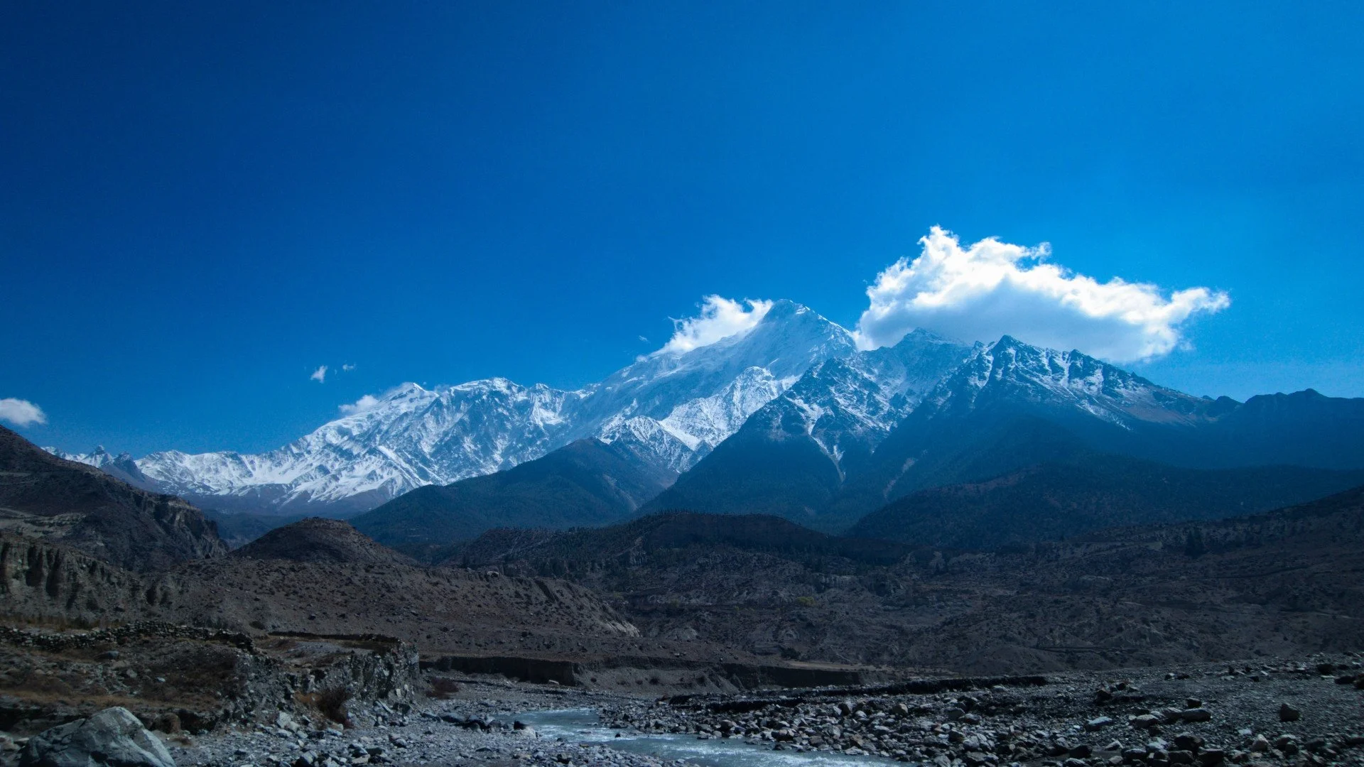
Lower Mustang is one of the most popular treks in the Annapurna Conservation Area. It gives you a chance to witness the Himalayas without bothering with proper acclimatization. It is an adventure beyond your imagination.
Day 1: Arrival & Exploration
Kathmandu is the capital of Nepal. It isn’t just the seat of the federal government but also the epicentre of culture and heritage. Once you’ve arrived, look out for our hotel delegation in the arrival hall. If you haven’t requested airport pick-up, you can hop on a cab and ask the driver to take you to Hotel Shanker. After reaching the hotel, our team shall check you in at the earliest. In the meantime, you can relax with a fresh towel and sip on the seasonal welcome drink.
If you’ve booked a city tour pre-hand from our travel desk, our staff shall hand you an itinerary for the following. If you wish to book a city tour, please visit the travel desk in the lobby.
You may choose to explore the city on your own. While doing so, please be careful of street hawkers and scams in tourist areas.
Checkout these blogs:
B. 7 Things to do in Kathmandu
C. 7 Things to do in Bhaktapur
Day 2: A Morning Tour of Kathmandu & Flight to Pokhara
The morning hours are the best time to experience this ancient city. If you wish to experience the sunrise, you may visit the following spots:
1. Chandragiri Hill Station (Best all around the year)
2. Chovar Hill (Best all around the year)
3. Phulchowki Hill (Best during spring, requires a short hike)
If sunrise isn’t your thing, then these destinations are quick and a must:
1. Bouddhanath Stupa (18 minute drive from the hotel)
2. Swyambhu Stupa (15 minute drive from the hotel)
3. Patan Durbar Square (19-25 minute drive from the hotel)
4. Pashupatinath Temple (14 minute drive from the hotel)
An insightful morning tour of Kathmandu can be arranged as per your flight schedule. A regular flight to Pokhara is at an average of 15-18 minutes. Upon arrival in Pokhara, you may proceed towards your accommodation, have a beautiful day in Pokhara and prepare for your next flight to Jomsom. You can also get a direct connecting flight and skip exploring Pokhara.
The most popular choice is to explore Pokhara on day 2 and fly to Jomsom the next day.
Are you sure you’ve taken everything? Check this blog to see if you’ve prepared well for your trek: Click here
Day 3: Connecting Flight From Pokhara to Jomsom
If you choose the latter, you can enjoy your breakfast and embark upon a 25-minute flight to Jomsom. During the flight, you shall fly over Kali Gandaki- the deepest gorge in the world. If the weather is a view of Mt Dhaulagiri, Annapurna and more, greet you.
Arrival at Jomsom might take you back in time. The village is at 8900 feet (2700 m). Just the view from the airport is breathtaking, imagine how gorgeous the rest of your trip shall be. Jomsom, over the years, has served as a hub/ gateway to two prime destinations:
1. Upper Mustang and,
2. Muktinath (A very important Hindu & Buddhist site)
The population of Jomsom is merely 1370 as per the 2011 census. The village lies south of Kagbeni, which is your next destination. The landscape around Jomsom is rocky cliffs and high Himalayan peaks. It has sparse greenery, mostly rhododendron forests. The culture of this village is a mix of Hinduism and Tibetan Buddhism.
Do you want to know more about trekking in Nepal? Click here to read an article on various treks and activities.
Day 4: Trek to Kagbeni
Total Trek Time: 3 to 4 hours
Your main trek begins from Jomsom. The first destination is to your north- Kagbeni. If you start your walk in the morning, you shall arrive at Kagbeni for lunch. The trails are wide and allow you to witness splendid views of the Annapurna Massif, Dhaulagiri, Nilgiri and Tukuche.
The village of Kagbeni lies atop a cliff that overlooks the junction of Kali Gandaki and Jong Khola (river). This village is also known as the entrance to Upper Mustang. You are requested to not head north end of the village. There is a clear sign that reads. “Restricted area! Tourists, please do not go beyond this point.” Tourists who have acquired a special permit for Upper Mustang are only allowed past the police check-point.
POPULAR ITINERARIES
SIMILAR POSTS
An Adventure In Lower Mustang - Part 1
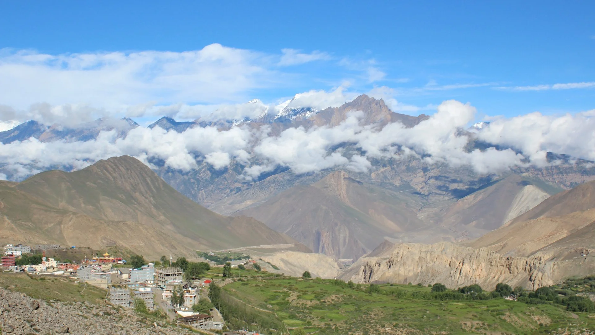
Mustang is a wonder, its semi arid deserts at times seem endless and magical. This valley was once a glorious kingdom known as Lo with its capital Lo Mangthang. The word ‘Mustang’ is Tibetan and means plain of aspiration.
Eroded canyons, panoramic view of the Himalayas, high-altitude deserts and stratified rock formations are the identity of Mustang. The demarcation of Upper and Lower Mustang was done by the national government to restrict foreign movement in the upper region. Even today, the Upper Mustang region is classified as a restricted area. Foreigners who wish to venture into this wonderous region are required to obtain a restricted area permit along with their TIMS Card and ACAP entry permit.
However, Lower Mustang doesn’t feature any of these restrictions.
Foreigners require only the basics: TIMS Card and ACAP entry permit to venture into this region.
Cost of TIMS Card & Permit:
1. Organized TIMS Card (Blue): $10
2. Individual TIMS Card (Green): $20
3. SAARC Country TIMS Card (Red): $3
4. ACAP Permit: $20
Where do I get the permit and card?
The TIMS card and permits are obtained from the Nepal Tourism Board (NTB) office. They are located in Bhrikuti Mandap of Kathmandu and Lakeside Road of Pokhara.
What are the basics of Lower Mustang Trek?
Basic Itinerary Days: 9 Days
Route: KTM- PKR- Jomsom ( Flight) - Kagbeni (Trek) - Jharkot (Trek) - Muktinath (Trek) - Lupra (Trek) - Jomsom - PKR (Flight)
Trek Style: Tea House
Max Elevation: 3795 M
Attractions: Red Gompa, Apple Orchids, Muktinath Temple, Panoramic Peaks View, Thak Kola, Bonpo Monastery, Sayka Gompa
How do I start?
Once you have landed at TIA (Tribhuvan International Airport), you can either experience a bit of the capital (Kathmandu) for a few days or get a connecting flight to Pokhara. The distance between Pokhara and Kathmandu is 200 KM. You can opt to take a bus instead of a flight as well. Your available options are either local or deluxe buses.
Deluxe buses leave at 7 AM from Sorakhute Bus Station in Kathmandu. You may either book a ticket beforehand or arrive an hour early, pay and embark directly at the terminal. We recommend these buses as they have air conditioning. The travel time ranges between 7-8 hours, with stops for lunch and snacks at good quality rest stops.
You can skip all of the hassles by contacting the front desk officer at the hotel. S/he shall do their best to arrange these services for you. They can also develop a proper itinerary to experience Lower Mustang at a reasonable rate.
When is the right time to trek?
In Nepal, Spring and Autumn is prime trekking season. The skies are clear with light to minimal rainfall. Autumn (Mid-September to Mid-November) is best for Lower Mustang Trek.
During other months such as December - February, the climate is colder and potential high snowfall may not allow you to trek above High Camp. Whereas during pre-monsoon ( Mid-May to Mid-July) and monsoon (Mid-July to Mid-September), chances of rain and clouding are high. The forest area shall be full of leeches and mosquito's.
Spring (Mid-March to Mid-May) is also a great time to trek this region. Temperature is nominal, and winds are light, allowing you to have a beautiful walk. The plant life will be blossoming: amplifying the atmosphere.
What should I wear and carry?
Proper clothing is vital while trekking to remote areas. In Spring and Autumn, you need summer/light clothing for the day hours and warmers for the night. If you’re travelling during the pre-winter and winter months, you need to wear your heavy jacket. During pre-winter and winter, warm clothes are essential. A heavily padded jacket, full sleeve t-shirt and fleece-lined pants are essential. During spring and autumn, a parka is mandatory. An umbrella and a raincoat should be carried as well.
Does the trek cost the same around the year?
No, the cost presented to you by your tour agent varies as per the season. The cost of accommodation is higher during peak season. Food costs rise during winter as transportation of goods becomes difficult. During peak season, you are bound to be over-charged. Off-season treks are usually less expensive due to slow business. You’ll get a sweet deal if you time your adventure off-season.
In the next part of this article, we shall look into the itinerary.
POPULAR ITINERARIES
SIMILAR POSTS
Adrenaline Adventure In Nepal - Part II
Nepal is viewed as a natural or cultural destination. Through efforts from various sectors, Nepal is slowly climbing the ranks of being known as an adventurous destination as well. Over the years, the inception of various adrenaline thrills in Nepal has opened a new genre of tourism altogether in this small but humble nation.
In part one of this article, we looked into 5 adrenaline activities that one must try during their visit to Nepal. Continuing further, we look into 5 more adventurous activities in this part of the article.
Rafting
Did you know that Nepal has approximately 6000 rivers? Each river is an opportunity for adrenaline seekers to indulge in the pure serenity of water. The strength of rivers are classified into 6 classes:
a. Class 1: Easy
b. Class 2: Novice
c. Class 3: Beginner/ (intermediate) level
d. Class 4: Advanced Level
e. Class 5: Expert Level
f. Class 6: Extreme
Amongst the rivers currently open to rafting the grading is as follows:
I. Karnali River: Class IV-V (180 Km in length)
II. Tamur River: Class IV (120 Km in length)
III. Sunkoshi River: Class III-IV (270 Km in length)
IV. Kali Gandaki River: Class IV- V (90 Km in length)
V. Seti River: Class III-IV
VI. Bhotekoshi River: Class III to V (22 km in length)
VII. Marshyandgdi River: Class IV-V (27 km in length)
VIII. Trisuli River: Class III-IV
IX. Bheri River: Class III (105 Km in length)
Many potential sites exist, but dams and weirs are hindering the growth of rafting. The rafting season in Nepal spans from March-May and September to November. The months from June to mid-September features massive flooding due to the monsoon.
Mountain Biking
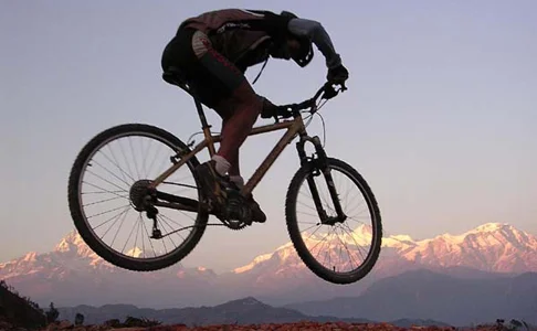
The thrill of experiencing the rugged terrain of Nepal on a mountain bike is an opportunity like no other. Nepal's potential in this sport is immense due to our nation's geography that provides the rider with the chance to experience the world in an oyster. The current go to destinations are Mustang and the epic Annapurna circuit in the Himalayas; Manjushri Trail in Kathmandu; Lakure via Surya Binayak in Bhaktapur and Sunpandali- Thulakot Loop in western Nepal.
1.Trekking
As they say, while on foot, an individual gets to truly take in the beauty of the surrounding. Nepal is an acclaimed trekking destination with multiple trails and circuits that allow a trekker to truly breathe in the beauty of nature. Nepal's geological diversity is both a blessing and a curse, but the rise in trekking has allowed remote households the opportunity to expand their income.
The landscape of Nepal offers trails of every grade and class. It doesn't matter if you're a novice or an adrenaline junkie who wishes to conquer the Himalayas on foot. Nepal offers a prospect for all. Various private and governmental interventions such as community tourism projects and the national conservation act has ensured the sustainability of tourism and trekking in Nepal.
Some of the major trekking routes of Nepal are as follows:
1. Annapurna Circuit Trek
2. Everest Base Camp Trek
3. The newly mapped Sisne Upper and Lower Trek in Western Nepal
4. Mardi Himal Trek
5. Ghorepani- Poon Hill Trek
6. Upper Mustang Trek
7. Shey Phoksundo Lake Trek
8. Manslu Trek
9. Langtang Trek
10. Kanchenjunga Region Trek
11. Limi Valley Trek in Humla
12. Rolwaling Valley Trek
13. Tsum Valley Trek
14. Kapuche Lake Trek
Trekking in Nepal is seasonal. The best time of the year is Spring, Autumn and Pre-Winter. But, trekking routes that fall under the shadow of the Trans-Himalaya can trek during the monsoon. The major hurdle during the monsoon is the disruption in the road and air networks of the country due to heavy rainfall.
Ultralight
Ultralight aircraft allow the adventurer to discover the majesty of the land from an eagle-eye perspective. Currently, micro-flights are run in the valley of Pokhara. Ultralight flights were introduced in the year 1997 AD. With the first successful professional flight in Pokara, the sport gained rapid popularity.
Ultralight Flight Facts
Best Season: From September to May
Take off and Landing Location: Pokhara Airport
Maximum Body Weight: Up to 100 KG
Flight Durations: 15, 30, 60 and 90 minutes
POPULAR ITINERARIES
SIMILAR POSTS
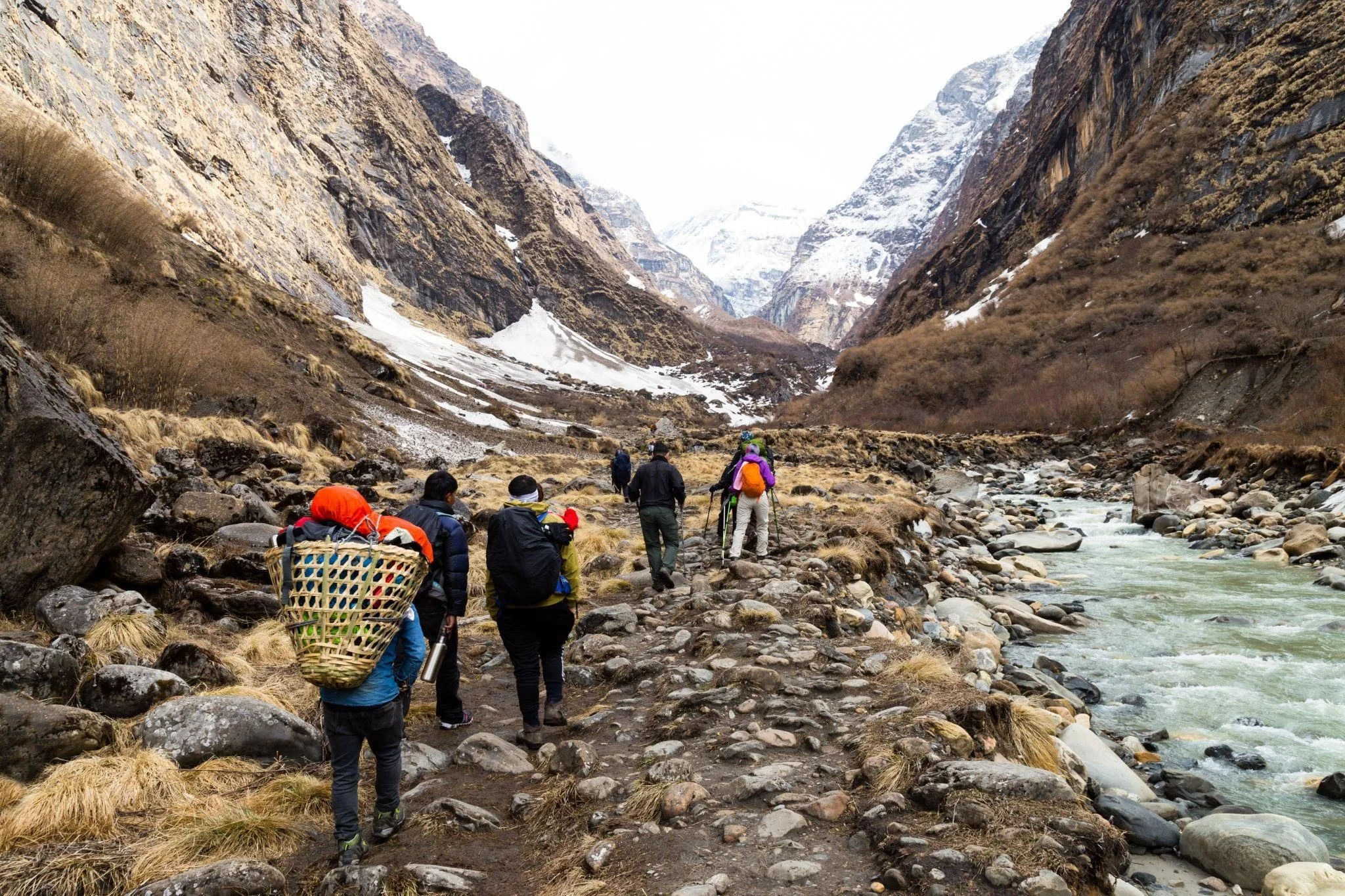
Adrenaline Adventure In Nepal
Nepal’s potential as an adventurous destination is immense. Over the years, various sectors tapped into this growing segment of adrenaline seekers by understanding their nation. Nepal is climbing the ranks quickly as a go-to adventure destination. Adrenaline seekers see Nepal as a great holiday to satisfy their kick. Nepal offers so much in a minimal footprint, and there is still more room to grow.
Ice Climbing
The first on our list is the newest addition to an adrenaline escapade in Nepal. Even though it falls under mountaineering, it is being simplified for adventure seekers who want to experience ice like never before. To date, there are two sites where one can indulge in this chilling sport, Humde in Manang and Thame in Khumbu. The sport is being facilitated by Nepal Mountaineering Association (NMA) and Nepal National Mountain Guide Association (NNMGA). The Visit Nepal Year 2020, which unfortunately couldn’t be executed due to the pandemic, featured a plan to accelerate the growth of this activity.
Paragliding
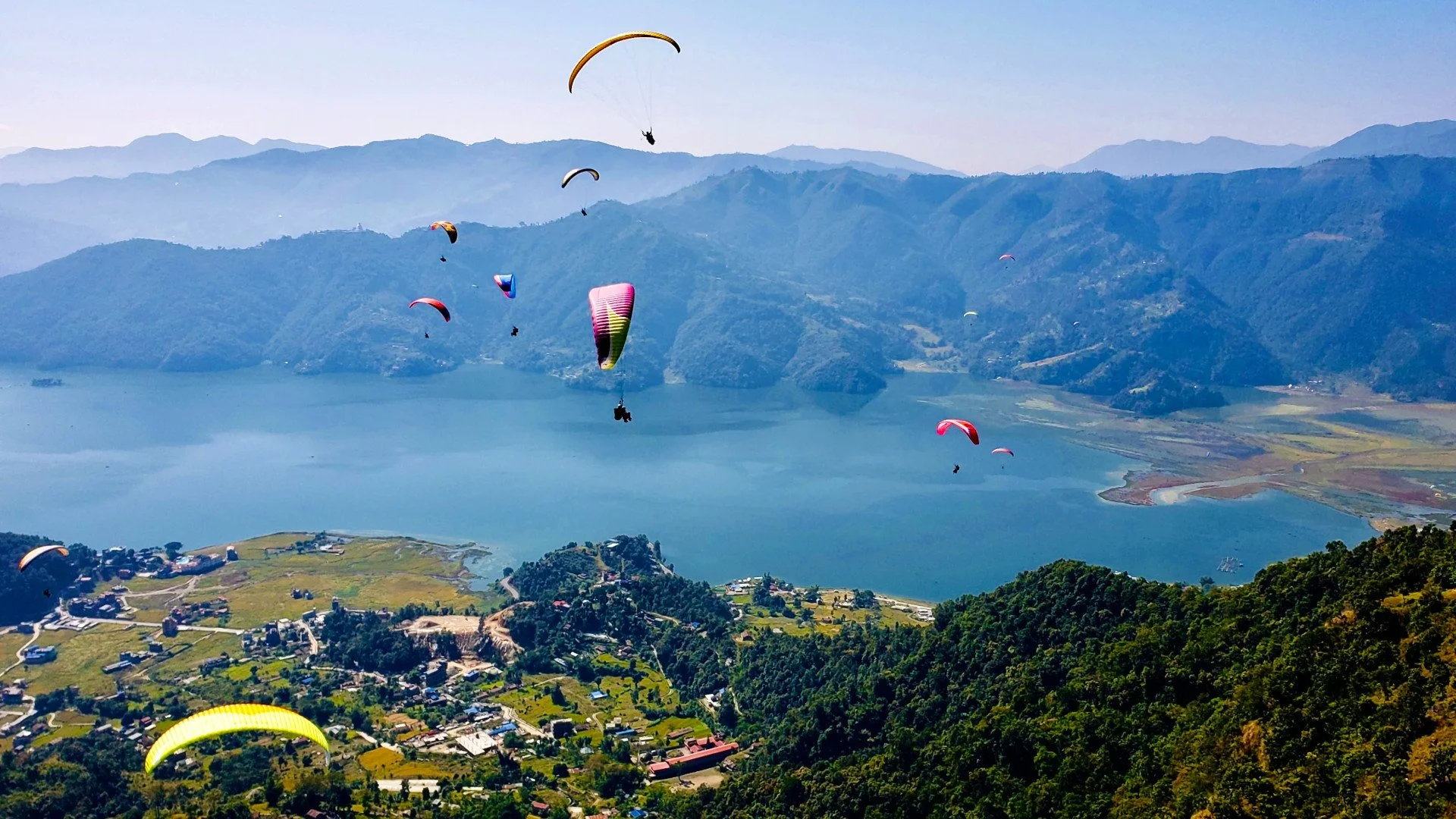
When it comes to feeling the wind, paragliding is the adventure of choice. The most popular destination for this sport is non-other than Pokhara. Sarangkot Hill is the take-off point for paragliders in this scenic valley.
Bandipur is also rising in the ranks as a go-to destination for this sport.
Both sites offer a great view of the Himalayas, along with an unobstructed view of the endless hills and farms. Flights last anywhere between 15, 30 or 45 minutes. If you plan on soaring high in the sky, please ensure you wear a good windproof jacket and light but comfortable shoes. Please make sure you are physically sound and communicate with your pilot. If you want the complete experience, let your pilot know you are up for acrobatic tumblings.
Ziplining
Where there is a hill, there is a zipline!
When zipline was introduced in Nepal, it was dubbed a crazy sport. The first adventurers shared their experience, and the sport went viral. Today, this sport is available in multiple destinations in Nepal. Ziplining can be experienced in Sarangkot of Pokhara, Makawanpur, Dhulikhel, Bhedetar, Kusma of Parbat, Kurintar of Chitwan, Chandragiri of Kathmandu, Nuwakot and Bhaktapur. It can be experienced by two individuals at the very same time or done solo.
The first zipline service in Nepal was established in 2010 AD in Sarangkot of Pokhara. The facility is 1,850 meters long and features international safety standards. American zip veteran company Zipflyer assisted Highground Adventures facility development.
The most popular destination for this experience is Pokhara. Dhulikhel Zipline takes second place. The unique selling point of Dhulikhel Zipline is your chance to become superman. The facility can give you a one in a lifetime opportunity to be superman unless you choose to zip again. You move in a horizontal position facing towards your destination. The harness is attached to the line at 90 degrees.
Canyoning
During canyoning, an enthusiast travels down a river tucked inside a canyon. S/he uses various techniques such as scrambling, abseiling, floating and swimming. Nepal is home to numerous exotic canyoning destinations for enthusiasts of all experiences. In terms of risk, it ranges from mild to high-risk depending upon the canyon.
The first canyon that gained popularity in this genre is situated in Jalbire. The Lamo Jharana (Long Waterfall) became a viral sensation due to its sheer natural beauty and canyoning prospect. It is located inside Chitwan National Park. To reach the waterfall, one must hike 20 minutes from Jalbire Temple situated on Muglin- Narayangarh Highway. The waterfall is 60 meters tall and is surrounded by lush green greenery.
Sky Diving
Sky diving in Nepal a few decades ago felt like an impossible dream, but today it is as real as it gets. On the scale of adrenaline-seeking, it ranks at the top of the scale. Merging two greats, ‘The Everest Skydive’ is a chance to witness Mt. Everest from a perspective like never before. The dive gives you a birds-eye view of the breathtaking Himalayas over the Khumbu region. From one Himalayan view to another, Pokhara Skydive gives you the chance to witness the beauty of the Annapurna range and a never seen view of Pokhara. It is a seasonal activity occurring only during autumn at Pame Lauruk dropzone, 11 km north of Phewa lake. The drop is from 11000-13000 ft above sea level from an AS 350 B3/B2 helicopter
POPULAR ITINERARIES
SIMILAR POSTS
The Making of ACA
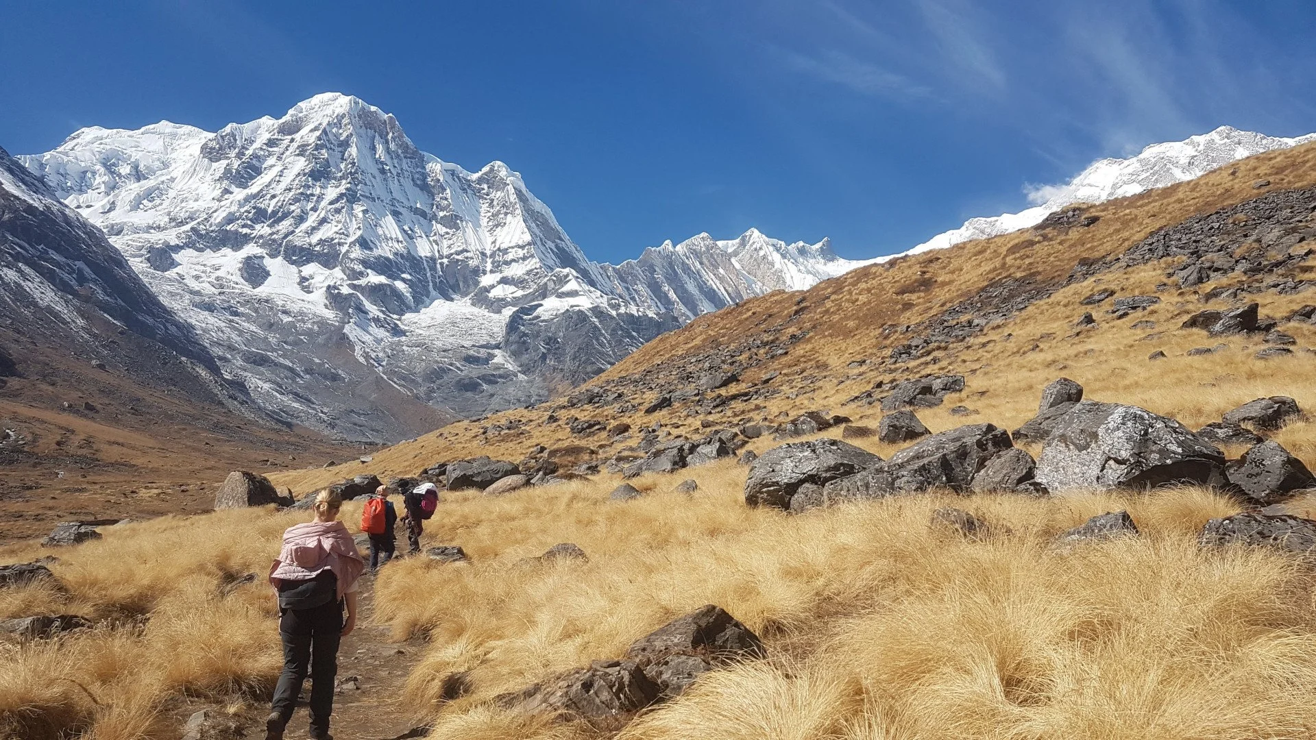
In 1986 AD, The NTNC (National Trust for Nature Conservation) launched a visionary project. The aim was to convert 7,629 sq. km of land in the Annapurna region home to 1,226 species of flowering plants, 105 mammals, 40 reptiles and 23 amphibians to a conservation area. This project was called Annapurna Conservation Area Project (ACAP), commonly known as Annapurna Conservation Area (ACA).
The Annapurna Conservation Area was established in 1992 AD. The project headed by National Trust for Nature Conservation (NTNC) began in 1986 AD. The boundary of this project to its north is the border to Tibet (China) and the Kali Gandaki river to its west. TO its east lies the Marsyandi Valley and the Pokhara valley in the south. The NTNC, formally King Mahendra Trust for Nature Conservation, began the pilot project from one single VDC, Ghandruk, in 1986 AD. The project area during that time was just 200 sq. km. In the year 1990 AD, the project area expanded to 16 VDC. In 1992 AD, 39 VDCs more VDCs were incorporated. The size of the project remains the same to date, with 55 VDCs in total.
The region features two climatic zones within a span of 120 km. The altitude within the conservation area ranges from 1000 to 8000 (3,300 ft to 26,200 ft). The lower parts of Annapurna receive higher rainfall than the higher as regions fall under the shadow of trans-Himalaya.
Annapurna Conservation Area is a culturally and naturally diverse scape. It is home to the deepest river gorge in the world- Kali Gandaki Gorge, which is 3 miles long and 1.5 miles wide. The valley is home to fossils from the Tethys Sea dating back 60 million years ago. Tilicho lake, north of Annapurna massif, is the highest altitude freshwater lake in the world. The world’s largest Rhododendron forest is located in Ghorepani. In terms of cultural diversity, the region features residents of Hindu Buddhist and pre-Buddhist religions. The dominant groups in the south are Gurung and Magar, whereas Loba, Manage and Thakali ethnicities dominate the north. These ethnicities have their dialect, cultural heritage and traditions.
Amongst the various conservation projects in Nepal, ACA was the first protected area to refrain from using the National Army for assistance. The locals reside within the protected area and also own private land. The project is directly operated by the NTNC with no funding from the government. The entry fees are used for the management of the area. NTNC uses a circular approach where the funds collected is invested into the region and its communities. NTNC also relies on various national and international donors.
The project utilises a community-based conservation and development approach. In this model, the community members are made aware of their habitat, duty towards conservation and protection of the environment. This instils ownership amongst all the community members, and each is a vanguard of the area.
ACA features 7 unit conservation offices.
Jomson
Manang
Lo-Manthang
Bhujung
Sikles
Ghandruk and
Lwang
This decentralised approach was devised to smoothen the operation and management of the area. In terms of the focus of offices, Jomsom, Manang, and Ghandruk work on integrating tourism management and other development activities. In Bhujung, Sikles and Lwang, the mission is poverty alleviation, integrated agriculture development and agro-forestry. In Lo-Manthang, the focus is on promoting heritage conservation and controlled tourism.
ACA over the years has gained national and international recognition. The biodiversity of the region under the leadership of the community members is flourishing. Multiple trekking routes were created in this region. Amongst them, some are voted as the best natural trails in Nepal.
Here are the top 10 trails in the region
Annapurna Circuit Trek
Poon Hill Trek
Mardi Himal Trek
Annapurna Base Camp Trek
Annapurna Trek (Manag to Tilicho)
Manaslu- Tsum Valley Trek
Kapuche Lake Trek
Sikles Eco Trek
Nar Phu Trek
Upper Mustang Trek
The best time of the year to embark on these trails is during spring, autumn and pre-winter. Trekkers can receive their permit (TIMS) from the NTB (Nepal Tourism Board) office located in Kathmandu and Pokhara.
POPULAR ITINERARIES
SIMILAR POSTS
The Jewels of Province 1
When it comes to natural wonders, province 1 boasts a good stock. It also features multiple religious sites. The province is also home to Nepal's crown jewel and the forehead of the world, Mt Everest.
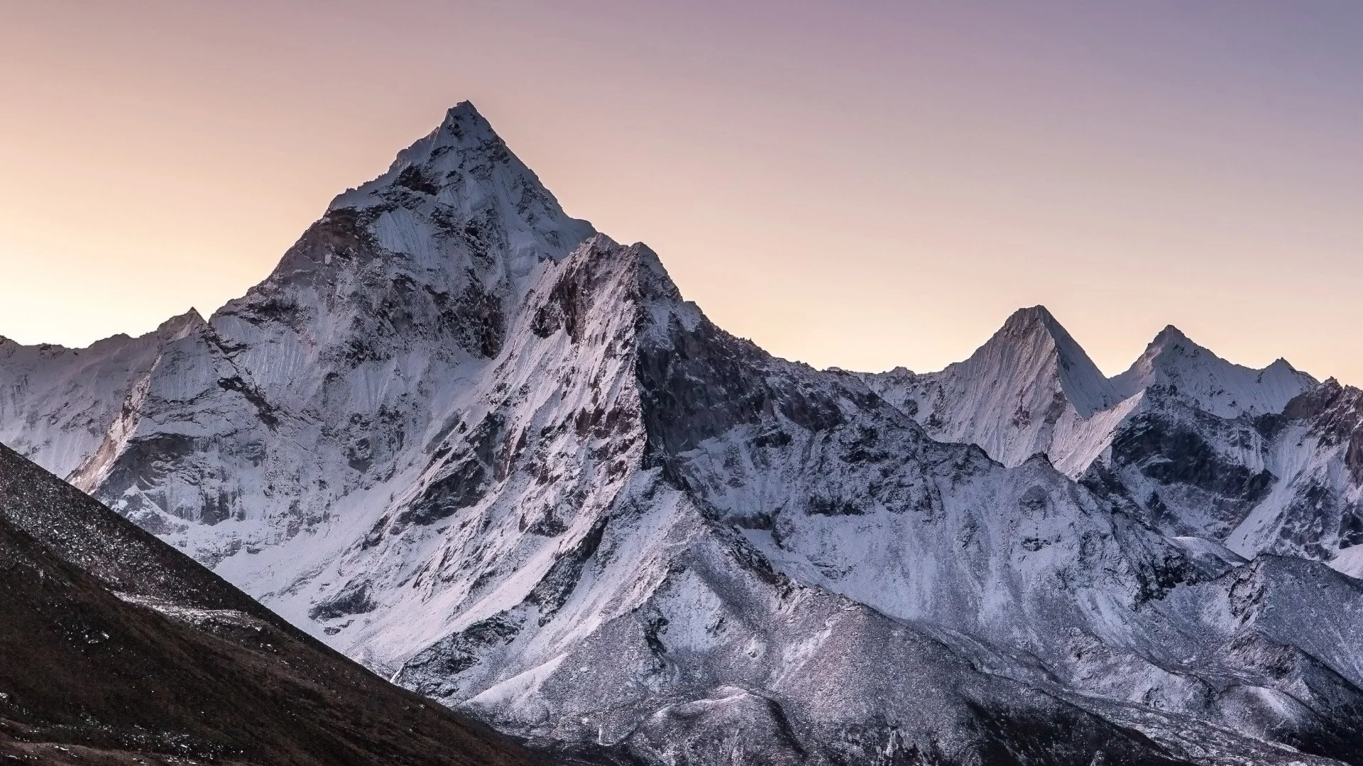
The new constitution of Nepal was established in 2015 AD. It featured the provincial system. As part of this, Nepal was divided into seven provinces. Province 1 is the easternmost of these seven. It covers 17.5% of the landmass of the nation. A total area of 25,905 km2. It is home to numerous great mountain peaks such as Everest (8848 m), Kanchenjunga (8586 m), Ama Dablam (6812 m) and others. Everest is the highest mountain in the world. Kanchenjunga is ranked third in the highest peaks index. Other peaks in this region are Cho Oyu (8188 m), Gokyo Ri (5357 m), Imja Tse (6160 m and Mera Peak (6476 m). These world giants help create Koshi- the largest river in the nation.
The province features multiple protected areas such as:
Sagarmatha National Park
Makalu Barun National Park
Koshi Tappu Wildlife Reserve (Also a Ramsar Site)
Kanchenjunga Conservation Area
Gokyo Lake Complex (Ramsar Site)
Mai Pokhari (Ramsar Site)
Amongst the proposed new destinations, Province 1 features sites such as Okhaldhunga and Tehrathum. Okhaldunga is famous for its scenic hills and cultural diversity. The place is also popular due to the famous poem by Siddicharan Shrestha titled 'Mero Pyaro Okhaldhunga' (My Lovely Okhaldhunga). It was converted into a song by famous Nepali singer Narayan Gopal.
Therathum is a site proposed by the Tourism Board of Nepal as a new destination years ago. Therathum is now a popular stopover location for trekking enthusiasts on the way to Kanchenjunga Base Camp.
This site is also home to 28 species of Rhododendron flowers. Rhododendron is also the national flower of Nepal. During spring, the hills become picturesque with full blossom and bloom of these flowers.
Another facet of tourism in Nepal is religious tourism. In this sector province, 1 features prominent shrines such as Haleshi Mahadev Temple, Pathivara Temple and Barachachhetra. Some of these shrines are worshipped by Hindus, Buddhists and Kirat's. The temple of Haleshi Mahadev is an example of multiple faiths intertwining. The cave is associated with Mahadeva (Shiva) by the Hindus. The Buddhists view it as Pashupati (Lord of the Animals). Buddhists of the Tibetan sect connect the cave to the legend of Padmasambhava. Halesi is worshipped as an ancestral deity by the Kirati Rai community of this region. Citations of this cave can be found in ancient texts as far as the 12th century. This cave was referred to as Halesi- Maratika in a biography of Padmasambhava.
As per Hindu legends, Mahadeva hid in this cave from the monster Bhasmasur for 6000 years. The cave is nicknamed 'Pashupati of the East' due to its close association with Mahadev and Pasupati. Devotees embark on a religious pilgrimage from both Nepal and India to this location in the month of Shrawan. Festivals are also held during the holidays of Rama Navami and Ganesh Chaturthi.
Pathibhara Devi, also known as Pathibhara Mai of Taplejung, is also a holy site. It is located on Pathibhara Hill. Trekking enthusiasts can embark on the Limbu Cultural Trek or take a side route from the Kanchenjunga Base Camp Trek to visit this temple. The hill is also famous for its panoramic natural views. Mountains such as Everest, Lhotse and Makalu are visible on a clear day. The lookout tower view also features most of Panchthar and Illam. Sikkim and the West Bengal of India are also visible.
Barahachhetra is a renowned Hindu and Kirat Pilgrimage site located in Sunsari. The shrine of this temple is the oldest mentioned in the Puranas. The epic Mahabharata also mentions and glorifies this shrine. It is one of the Char Dham (Four Great Religious Sites) in Nepal.
POPULAR ITINERARIES
SIMILAR POSTS
The Trails of Poonhill - Part 2
Poonhill is a destination that one must experience in a lifetime. The view is spectacular, the journey is beautiful, and the hospitality is the cherry on top.
I am not a notorious trekker but I cannot help resist experiencing Nepal through its riveting trails. When I decided to trek the Annapurna region, Poonhill trek was the obvious choice for me. The route I choose is as follows:
1. Pokhara to Nayapul
2. Nayapul to Tikhedhunga (Overnight)
3. Tikhedhunga to Ghorepani (Overnight)
4. Ghorepani to Ghandruk (Overnight)
5. Ghandruk to Pokhara (Overnight)
The most alluring factor for me was the diverse ecosystem of this trial. It would take me on a mini adventure of the Annapurna region. 5 beautiful nights would be spent inside cosy tea houses, which I always choose over camping. It's not because camping reminds me of the primitive days but, I wouldn't be able to share great memories with the innkeepers and their families. Plus, the added equipment is always a hassle.
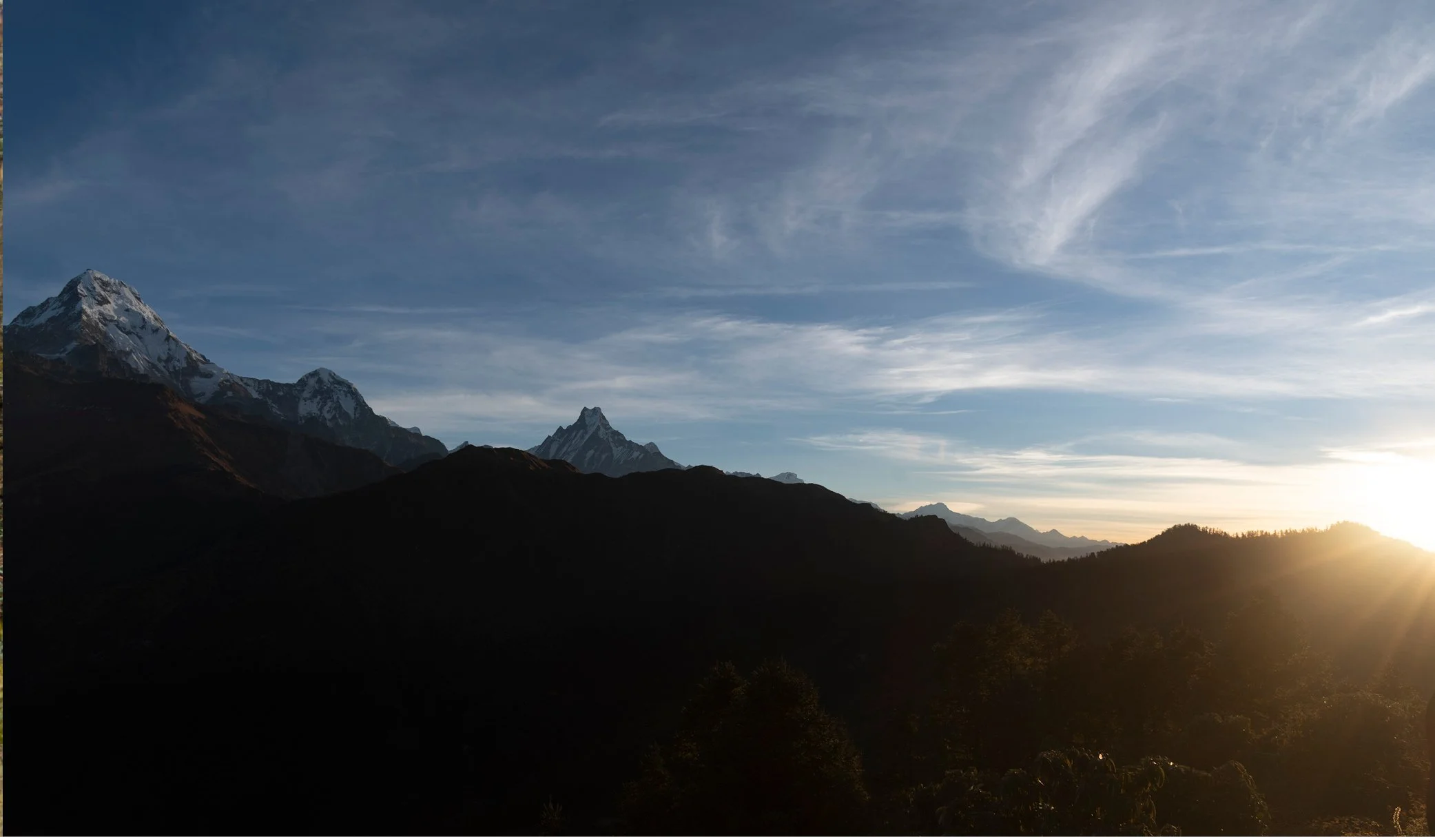
The famed sunrise view from Poonhill was like a wanted poster inside of my head. It motivated me during the strenuous inclines, which felt never-ending.
As I was travelling in a group, our driver was kind enough to take us a bit higher than Nayapul. As it was growing dark, he was concerned for our safety, thus ensuring us that he'd take the bus as close to Tikhedhunga as possible.
We thanked him for his help and began our trek to Tikhedunga. As it was already getting dark, visibility was minimal. The power of the Himalayan river could be felt in its thunderous sound. When I arrived in Tikhedunga, the village was already asleep. However, our innkeeper and his family were patiently waiting for our arrival.
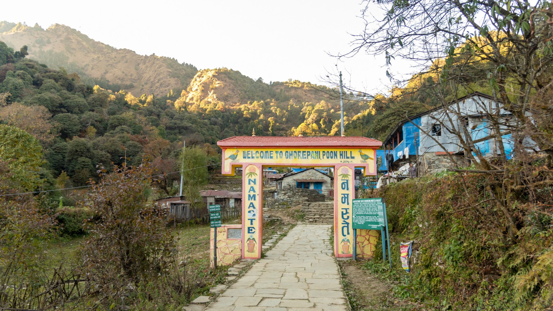
They couldn't offer us a traditional welcome because it was very late. The hot water had already been exhausted by my friends, who finished their meal quick and bolted. Tikhedhunga is a lovely village, and I couldn't explore it much. Early morning we had breakfast and began our trek for Ghorepani. This is the longest part of the journey. We left at around 7 in the morning and reached at 5 in the evening. Once our beds were decided, we explored the beautiful village.
The Poonhill and its breathtaking view brought the villagers ample fortune. They talked about how before this route was established, there was nothing much here. But now, it looks similar to a bustling semi-urban community during peak season.
We came back to our lodge and gathered in the commons. We indulged ourselves in the radiation of the boiler. Once dinner was complete, we slept early. As we would be leaving for Poonhill before the break of dawn.
The hike to Poonhill felt a bit difficult because I woke up late. I reached the viewpoint before sunrise and readied by equipment to photograph the moment. With the break of dawn, the grey mountains slowly turned to gold. The view was riveting, and I was in total awe.
We then made a break for the lodge. Breakfast and check-out later, we marched towards Ghandruk. I was the last guy in the pack because I took too many pauses taking pictures of beautiful waterfalls. I then ramped my pace to catch up with the lot. I was hungry and tired. Thus the incline of Tadapani felt like ages.
When I reached the Tadapani viewpoint, I couldn't help but sit on the bench for 5 minutes and marvel at the sheer beauty that laid ahead of me. I wanted to spend the night, but we were already booked at Ghandruk. Post lunch, I began my hike. I reached Ghandruk late because of my photographic stops. Dinner and a warm cup of tea later, I called it a night. Exploring Ghandruk never gets old. A trip to the museum, walking along tight alleys paved with stone and just staring at the beautiful mountains.
The majority of my trip was now over, and given the bus stand is just a few hours walk from Ghandruk, I too it slow. We boarded the bus and made our way to Pokhara.
POPULAR ITINERARIES
SIMILAR POSTS
The Trails of Poonhill - Part 1
Witnessing the sunrise from Poonhill is something hard to explain. It's an experience that shoots a bolt down your spine, and with the first rays of light, you learn to see the good in your bad. The journey to this hill is a challenge, but it is not impossible.
The Annapurna region for years has been the picturesque image of Nepal. Its villages and lifestyle have been the inspiration for numerous paintings. Over the years, it became one of the most trekked regions along with Everest. Amongst the trails in the region, the trek to Ghorepani- Poonhill became widely popular because of its accessibility and varied eco-systems it covers during the journey. The highlight of this trip is a magnificent panoramic view of the Himalayan range from Poonhill at 3210m.
The trek falls under the category of medium difficulty because it doesn't feature extreme walking periods. The average walking time per day is 8 hours. During peak season, this trail is jam-packed with trekkers. During the off-season, the tea houses and paths are normally empty. It falls under three major trekking routes:
A. Ghorepani - Ghandruk Trek
B. Khayar Barah Trek and,
C. Annapurna Circuit Trek
Apart from which, customs itineraries can be drawn to end the trek at various other points at Annapurna Conservation Area as well.
Where can I get my TIMS card?
Nepal Tourism Board provides the TIMS card. You may acquire your permit either at the central office in Kathmandu or at their regional office in Pokhara.
How long is the trek?
Ghorepani- Poonhill Trek can be completed in 3-4 days, excluding travel time to Pokhara from Kathmandu.
How do I start?
Once you have landed at TIA (Tribhuvan International Airport), you can either choose to experience a bit of the capital (Kathmandu) for a few days or get a connecting flight to Pokhara. The distance between Pokhara and Kathmandu is 200 KM. You can opt to take a bus instead of a flight as well. Your available options are either local or deluxe buses.
Deluxe buses leave every morning at 7 AM from Sorakhute Bus Station in Kathmandu. You may either book a ticket beforehand or arrive an hour early, pay and embark directly at the terminal. We recommend these buses as they have air conditioning. The travel time ranges between 7-8 hours, with stops for lunch and snacks at good quality rest stops.
You can skip all of the hassles by contacting the front desk officer at the hotel. S/he shall do their best to arrange these services for you. They can also develop a proper itinerary to experience Ghorepani-Poonhill at a reasonable rate.
When is the right time to visit this region?
The season of spring and autumn are optimum to visit this region. Pre- winter is a preferred time to visit the region. Nepal is open throughout the year, apart from peak winter season this trek is possible in any other months.
What is the highest altitude during this trek?
The highest elevation is at Poon Hill, which is at 3210m.
Do I need camping equipment for this trek?
No, the Ghorepani- Poonhill trek is a tea house trek, meaning ample tea houses which double as lodges exist along the route to accommodate the trekkers.
Do I require added payments to enter certain areas?
The total cost in permits during the trip includes TIMS Trekkers Permit and Annapurna Conservation Permit. Apart from which, you will require a minimal amount to enter Poonhill viewpoint.
What is the most popular route?
Nayapul- Tikhedunga- Ghorepani- Tadapani- Ghandruk is the most popular route
Do I need acclimatization days ?
No, as this trek features gentle gains, an extra day for acclimatization is not required. Trekkers are however, recommended to not fast track the itinerary and enjoy the extra time exploring the area.
The next part of this article shall feature a review of the destination.